

Updates are taking place to our mailing system v2
Test Headline
2019-05-05 09:06:44
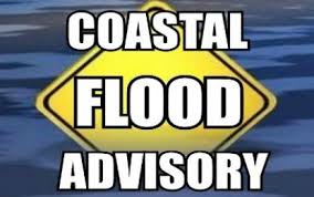
The National Weather Service has issued a Coastal Flood Advisory for the Borough effective Sunday evening, May 5th. The Advisory remains in effect from 7:00pm until Monday, May 6th, at 1:00am.
A storm is expected to bring additional rainfall to our region this morning, tapering off in the afternoon. During high tide, there is anticipated to be minor tidal flooding in low lying areas. High tide will occur at the Townsend’s Inlet Bridge Sunday at 9:20pm. Exercise caution while driving this evening. Never attempt to drive on any flooded street as this puts you and your vehicle at risk. Windy conditions are expected late this afternoon and this evening, with sunshine returning on Monday.
Here is the text of the Coastal Flood Advisory issued by the National Weather Service:
Coastal Flood Advisory
Coastal Hazard Message National Weather Service Mount Holly NJ 550 AM EDT Sun May 5 2019
Cumberland-Atlantic-Cape May-Atlantic Coastal Cape May- Coastal Atlantic-Southeastern Burlington- 550 AM EDT Sun May 5 2019
…COASTAL FLOOD ADVISORY IN EFFECT FROM 7 PM THIS EVENING TO 1 AM EDT MONDAY…
The National Weather Service in Mount Holly has issued a Coastal Flood Advisory, which is in effect from 7 PM this evening to 1 AM EDT Monday.
* LOCATIONS…Coastal areas of Atlantic, Cape May, Cumberland, and southeastern Burlington County.
* TIMING…High tide on the New Jersey oceanfront occurs between 8:30 and 9:30 PM this evening. High tide on the back bays occurs later than the high tide on the oceanfront.
* COASTAL FLOOD IMPACTS…Up to one foot of saltwater inundation above ground level is possible in low-lying areas near shorelines and tidal waterways. In Atlantic County, minor roadway flooding is possible in Atlantic City, Absecon, Ventnor, and nearby communities. In Cape May County, minor roadway flooding is possible in Wildwood, Cape May, Avalon, and other locations along the shore and the Delaware Bay shoreline. Minor roadway flooding is possible on the barrier islands and along the back bays of Ocean County, and in tidal areas of southeastern Burlington County.
..Wave heights on the ocean waters off the coast are forecast to be 4 to 7 feet.
PRECAUTIONARY/PREPAREDNESS ACTIONS… A Coastal Flood Advisory means that minor tidal flooding is expected. Minor tidal flooding often results in some road closures. Usually, the most vulnerable roadways will flood. Do not leave your vehicle at a location that is prone to tidal flooding. Do not drive your vehicle through flood waters. The water may be deeper than you think it is. You will be putting yourself in danger and your vehicle may be damaged, leading to costly repairs.
