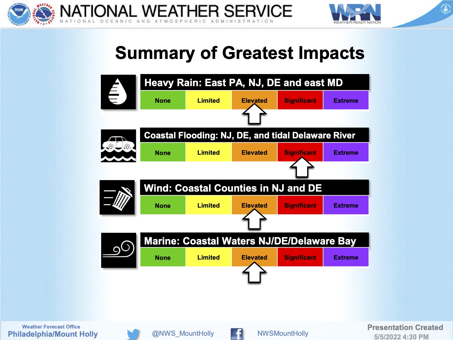
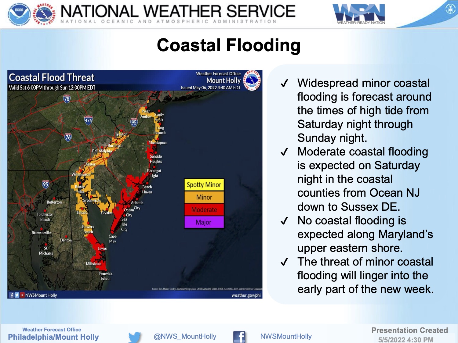
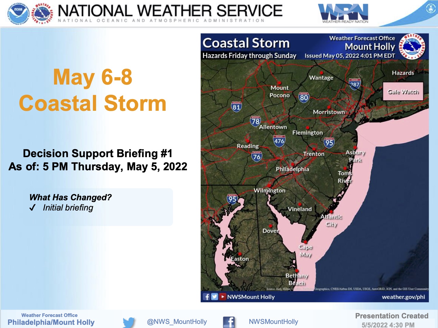
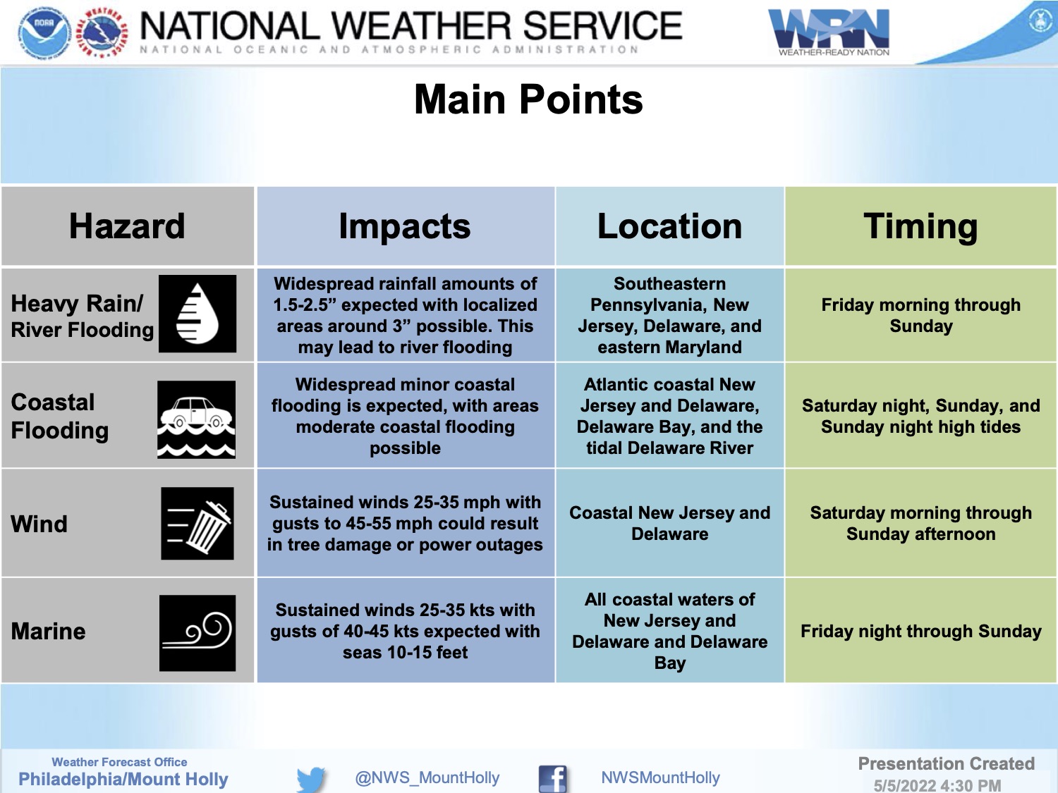
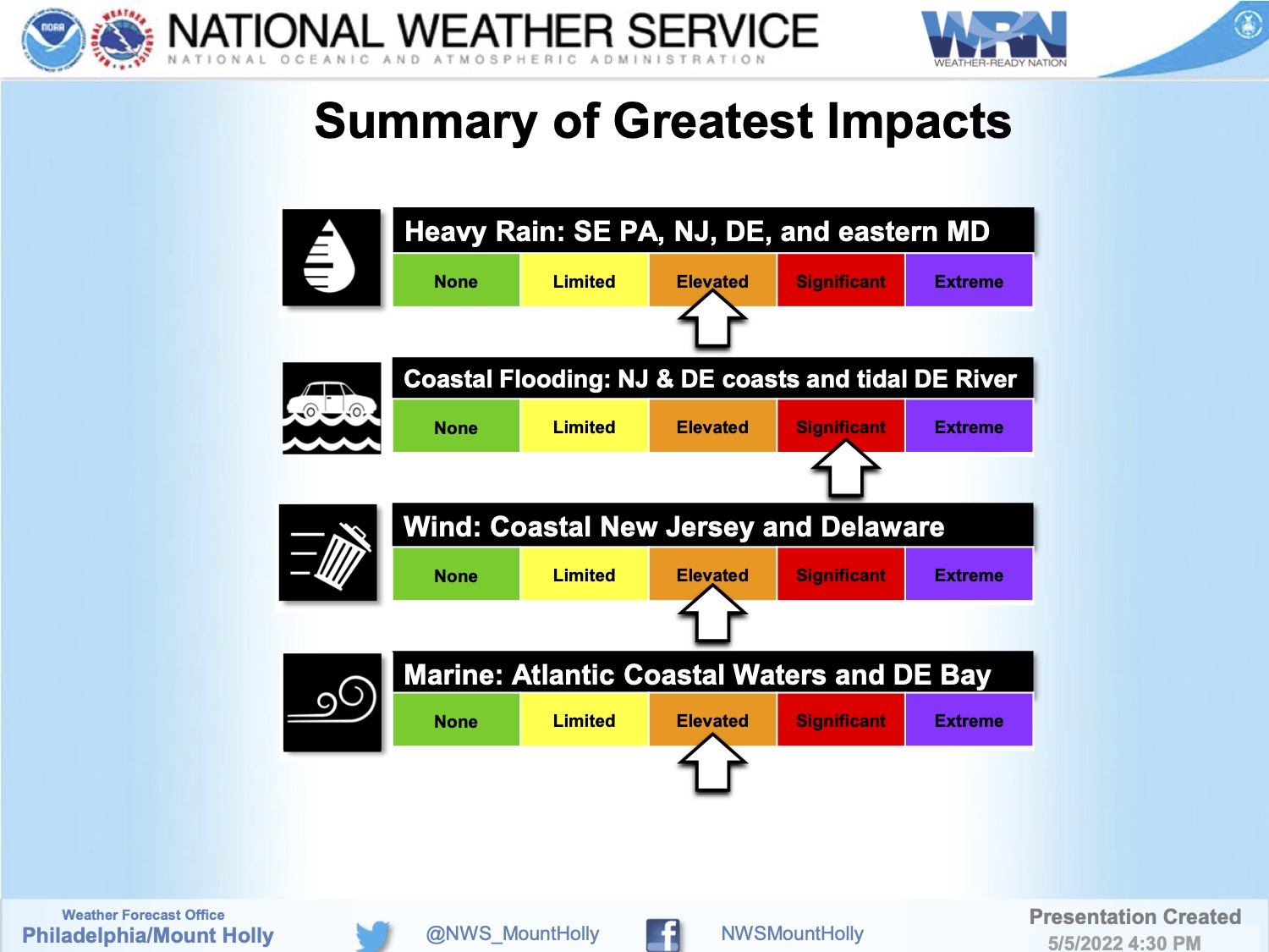
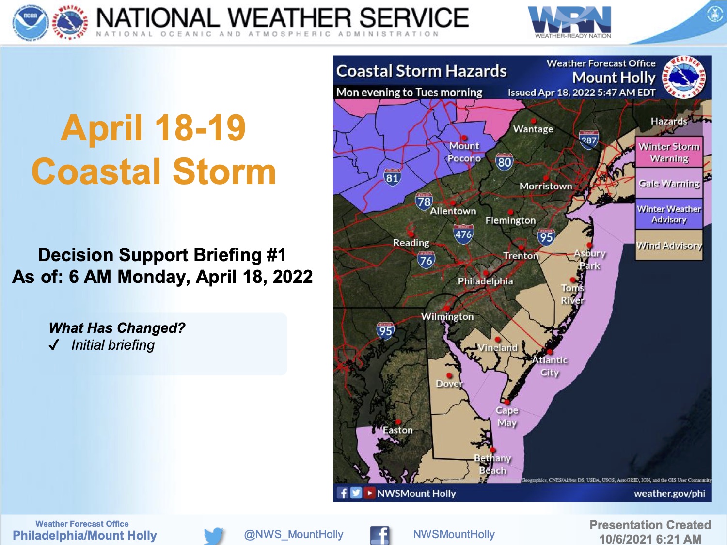
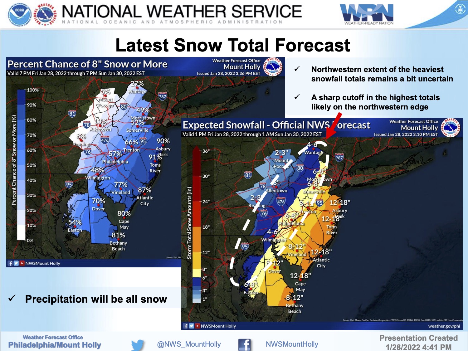
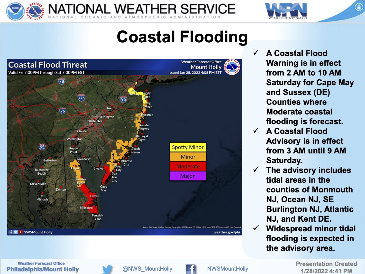
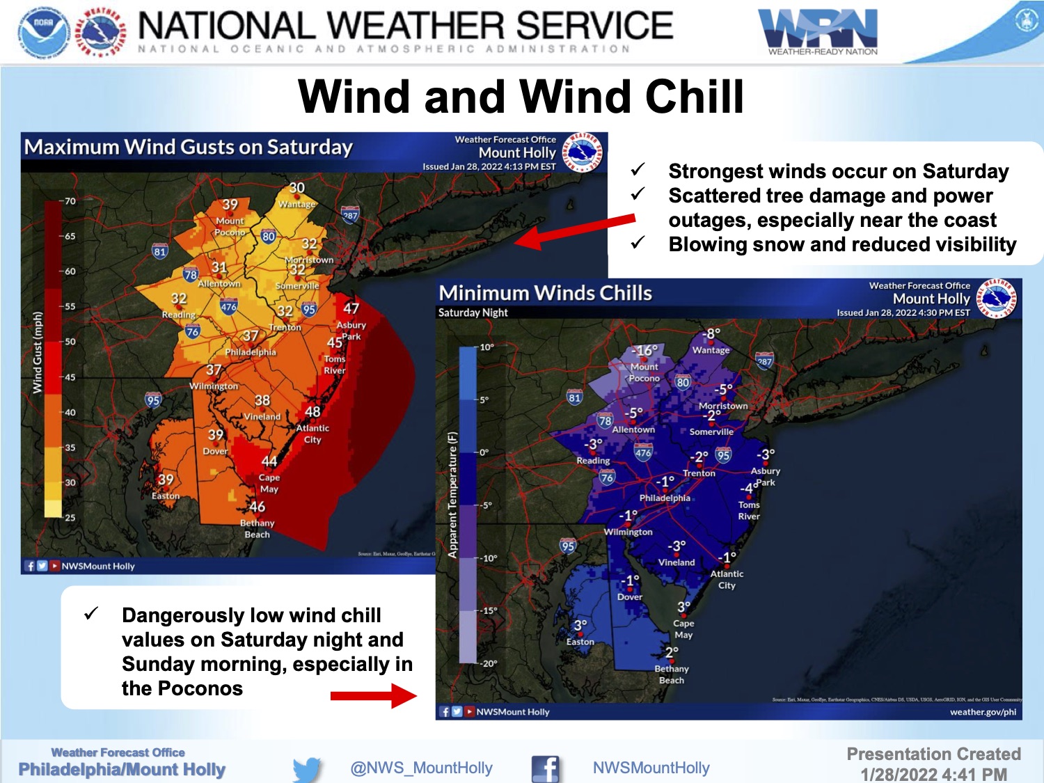
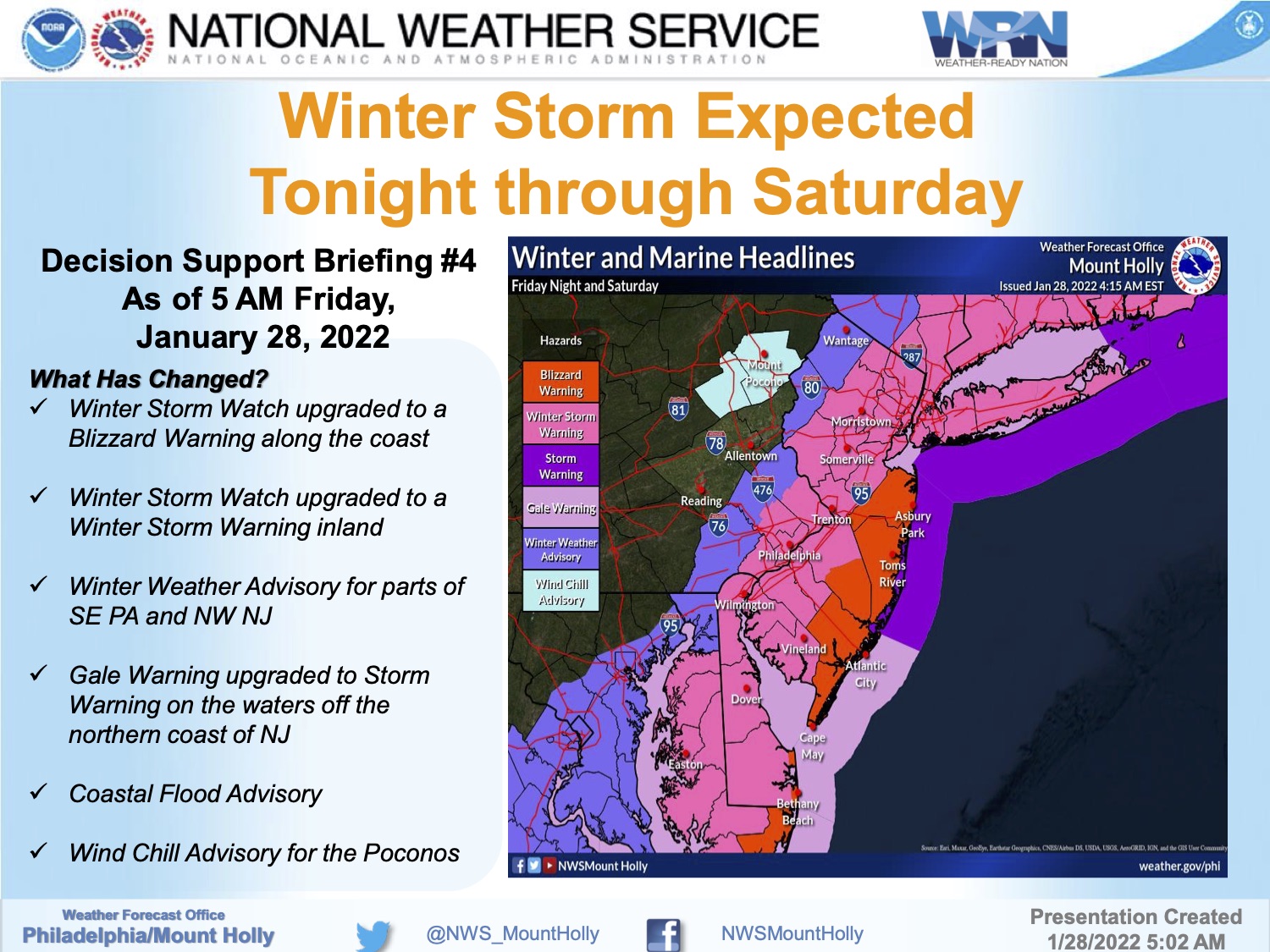
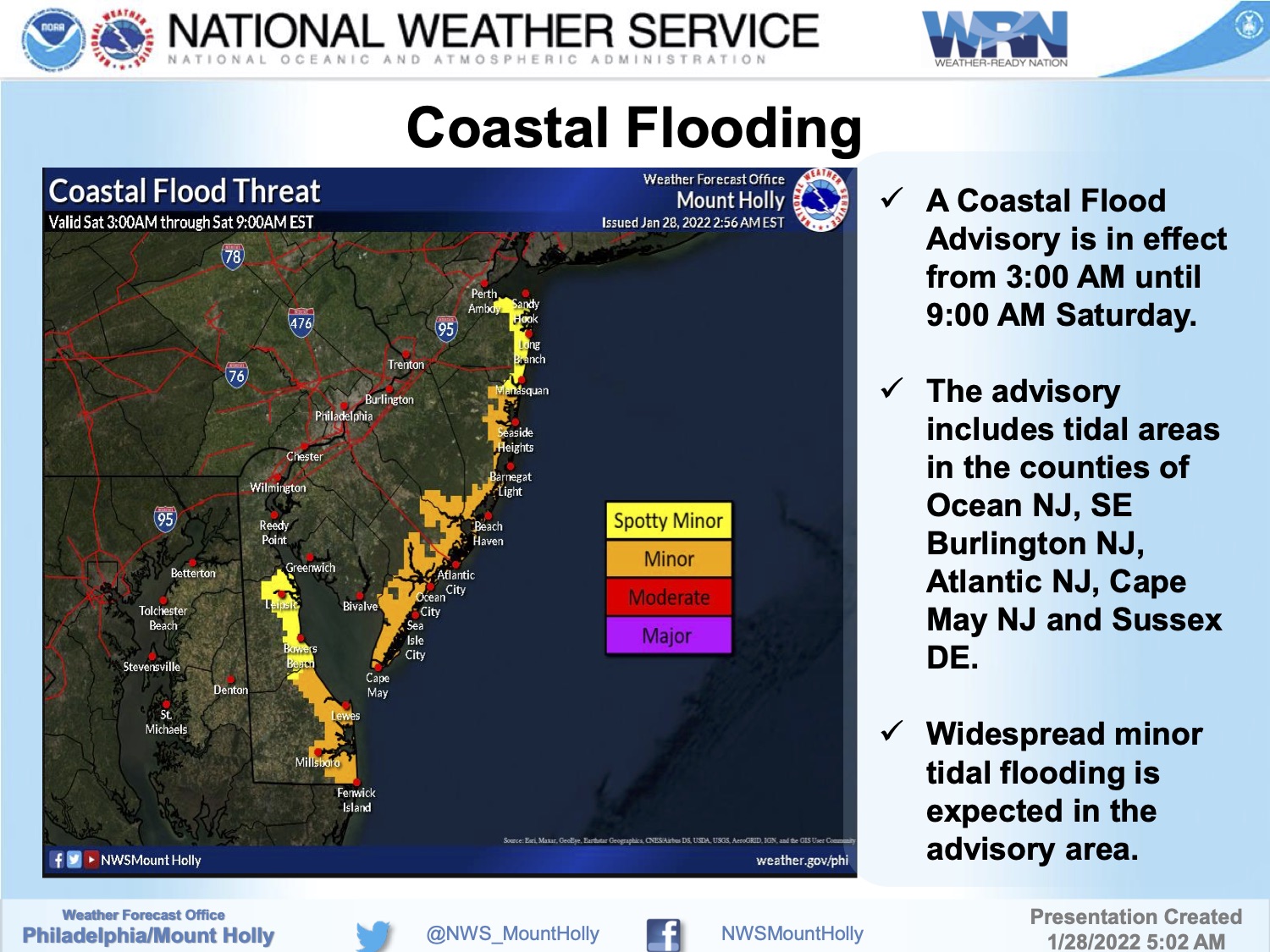
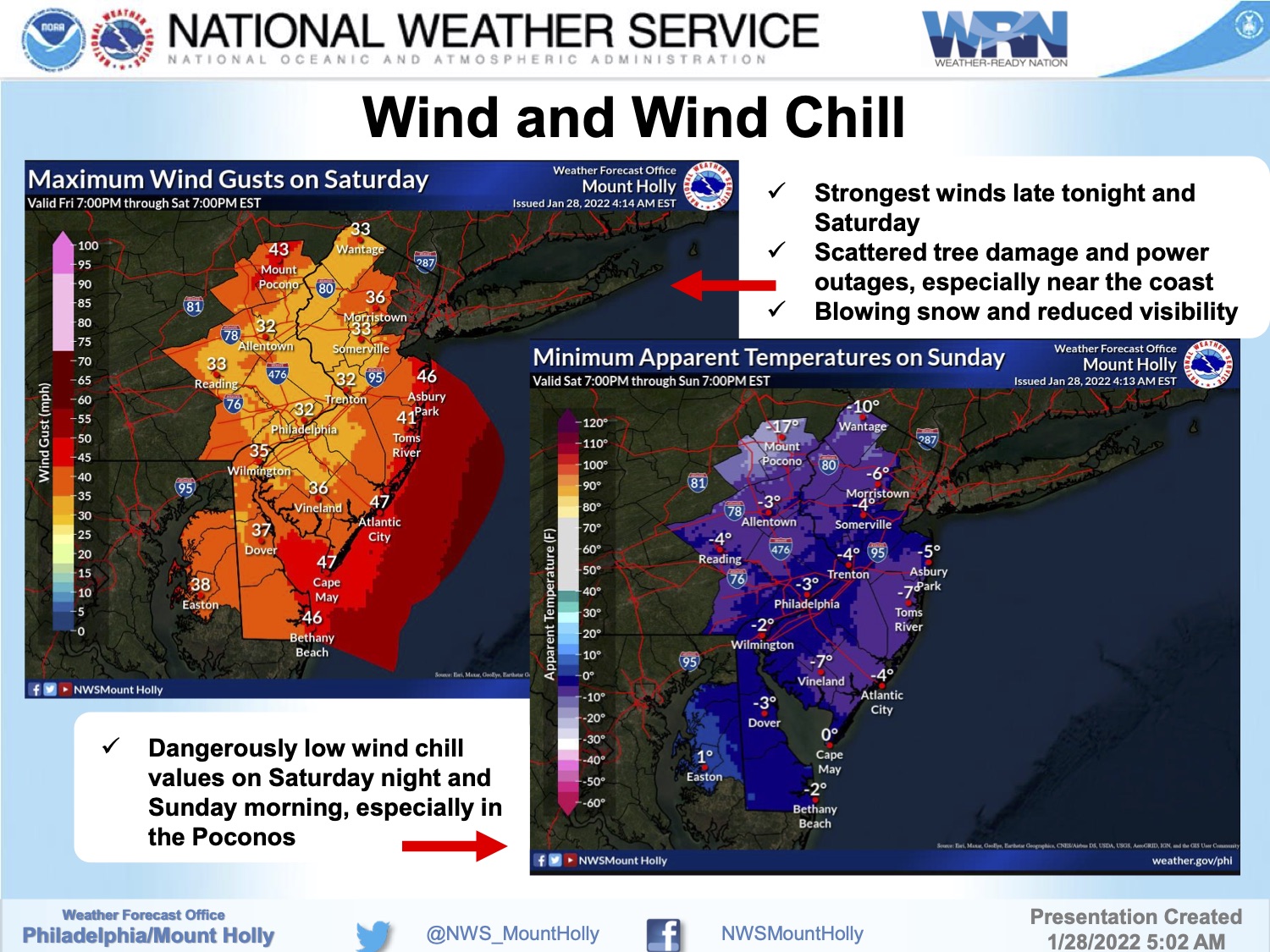
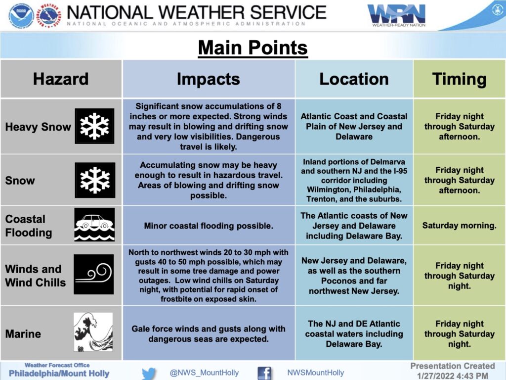
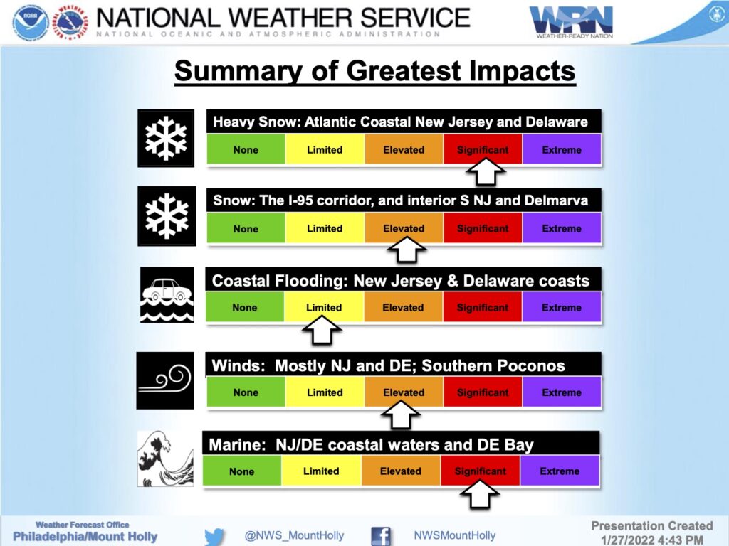
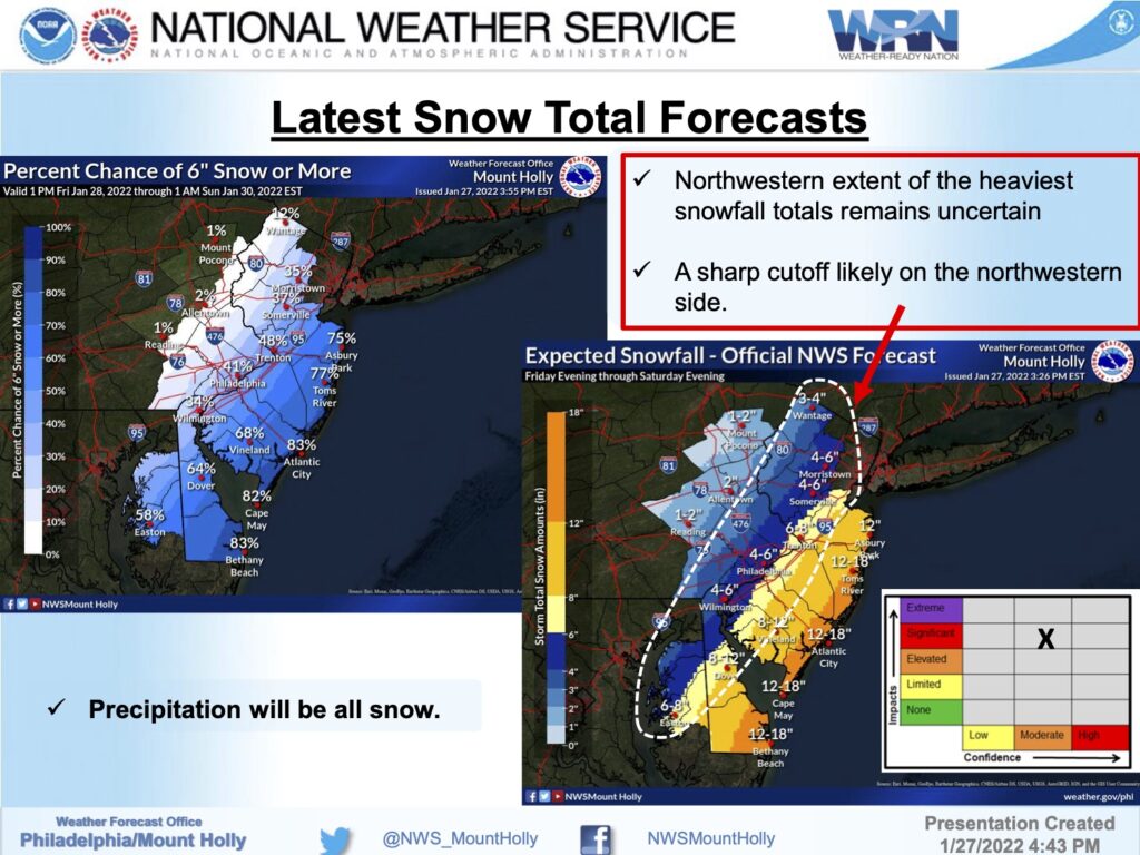
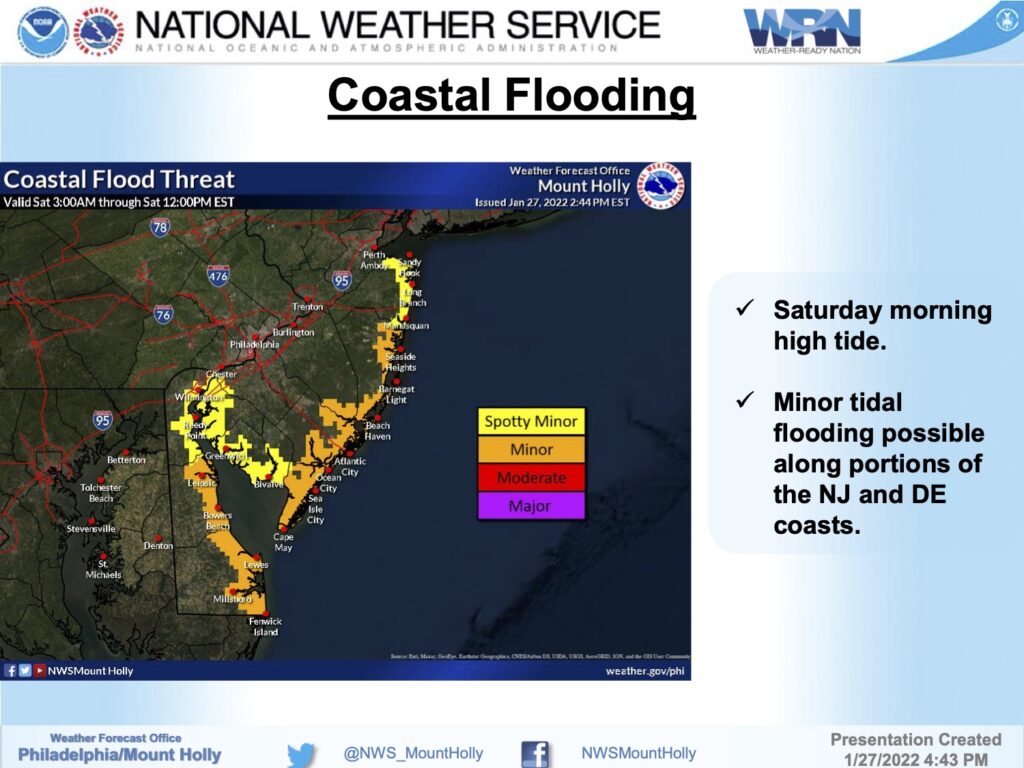
Tuesday, September 6th: Avalon Under Flood Watch for Potential of Heavy Rainfall
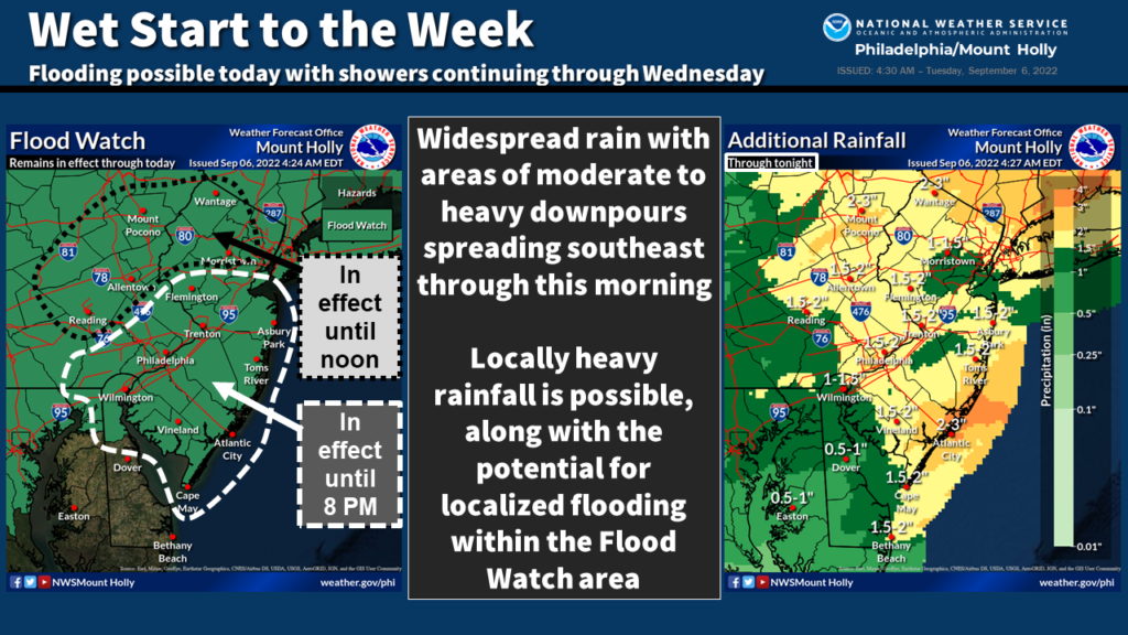
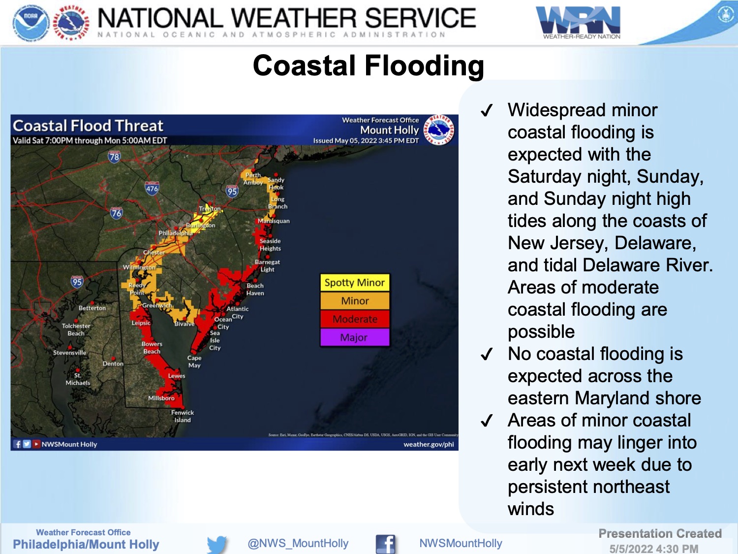
Here are the key messages for the heavy rain expected through today. The only change is to the Flood Watch, which was expanded to include Atlantic, Cape May, and Cumberland Counties in New Jersey.
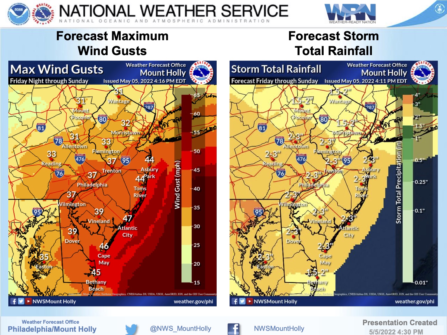
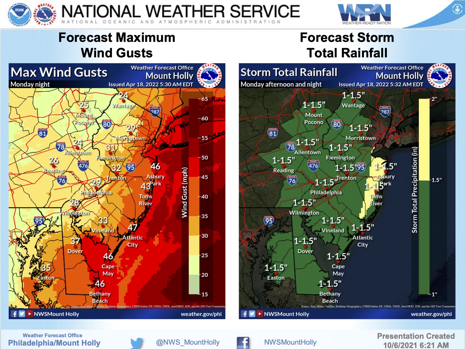
- Rain will spread from eastern PA and northern NJ into the I-95 corridor and toward the coast through this morning. The rain may be moderate to heavy at times. The heavier rainfall rates will diminish this afternoon near and north of I-78. Heavier rainfall rates are expected this afternoon across the coastal plain of New Jersey.
- Rainfall rates of 1 to 2 inches per hour on dry soils may initially enhance runoff leading to flash flooding of urbanized and low lying areas.
- Event total rainfall amounts through tonight are forecast to be 1 to 3 inches, but locally higher amounts are possible.