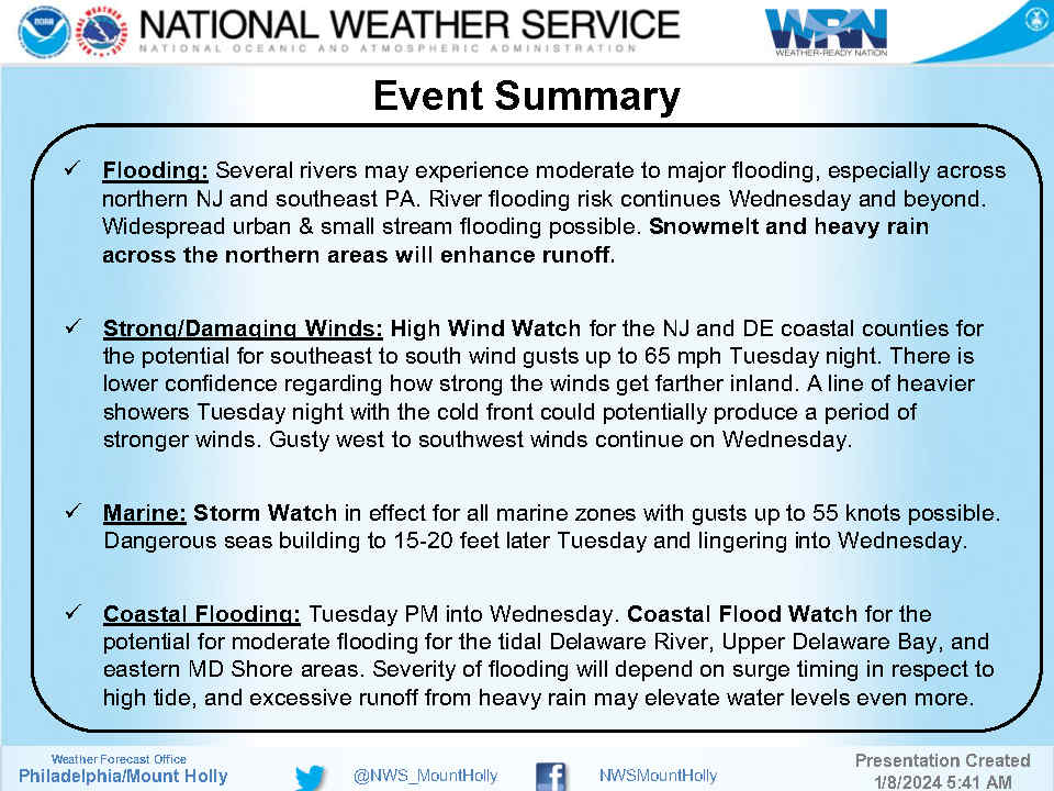
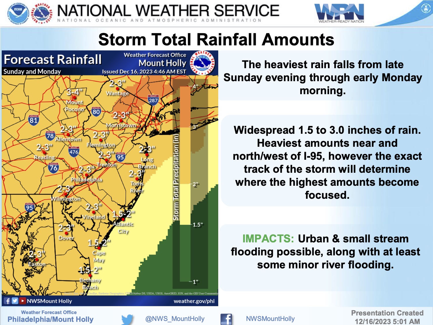
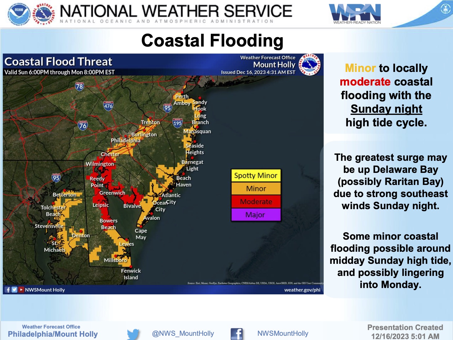
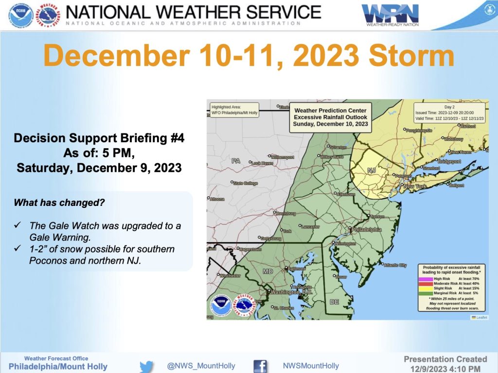
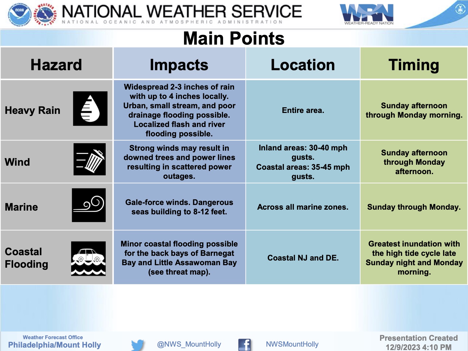
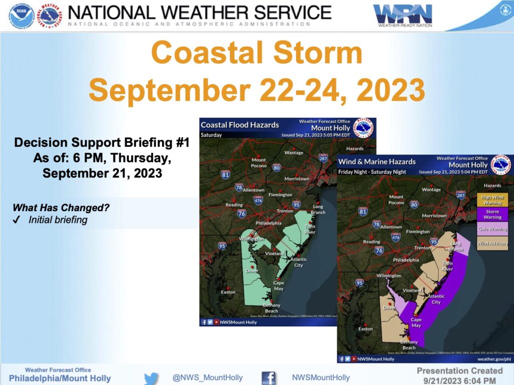
Sunday, March 24th, 3:46pm: Coastal Flood Warning for Monday-Tuesday, March 25-26th

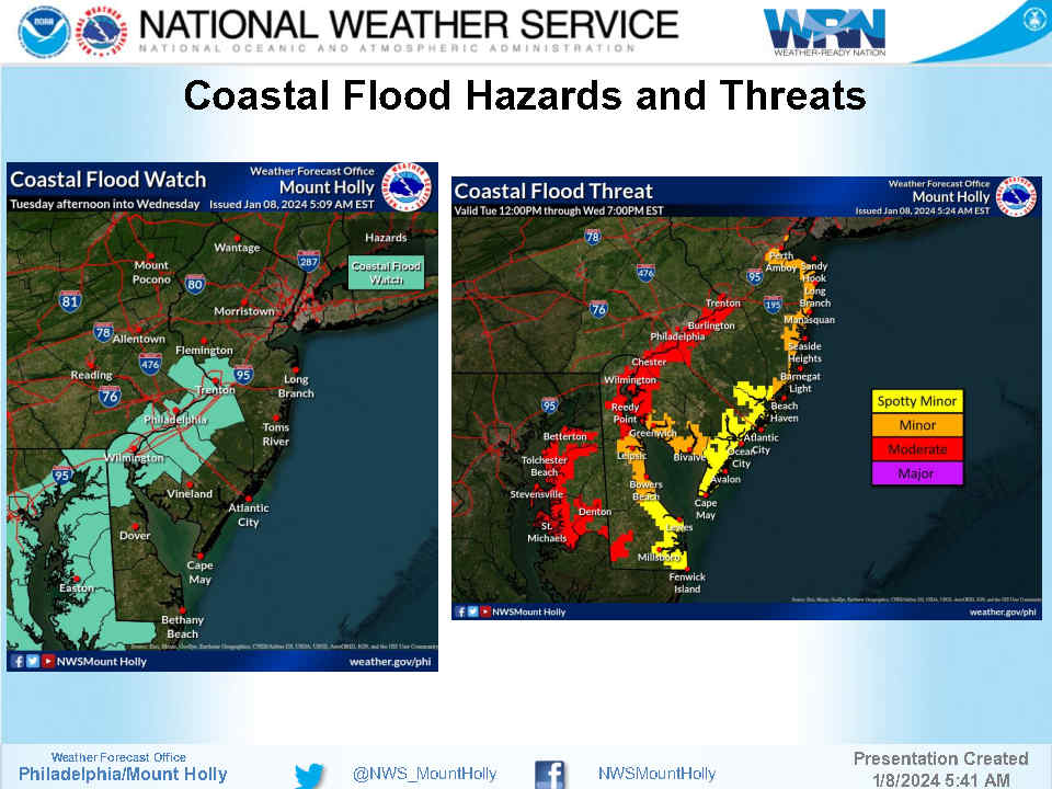
The National Weather Service has issued a Coastal Flood Warning for Avalon and the southern coastal region of New Jersey. The warning is in effect from Monday, March 25th at 6:00am through Tuesday, March 26th, at 2:00pm. Minor tidal flooding is likely at time of high tide Monday morning. The highest water levels are expected during the Monday evening and Tuesday morning high tide events.
High tide will occur at the Townsend’s Inlet Bridge Monday at 2:52am and again at 9:20pm. High tide will occur Tuesday at 3:28pm and again at 9:51pm.
Please exercise caution while driving during times of high tide during the Coastal Flood Warning. Never drive on any street that is covered in tidal water as this puts you and your vehicle at risk and may flood other vehicles and properties. Avalon has developed a flood risk map for our community. Please use this map as a guide in the event you want to move your vehicle to another part of the community that is not prone to tidal flooding. The weather forecast will be dry and breezy during this flooding event.
![]()
Here is the text of the Coastal Flood Warning issued by the National Weather Service:
Coastal Flood Warning
Coastal Hazard Message
National Weather Service Mount Holly NJ
329 PM EDT Sun Mar 24 2024
…COASTAL FLOOD WARNING IN EFFECT FROM 6 AM MONDAY TO 2 PM EDT
TUESDAY…
* WHAT…One to two feet of inundation above ground level
expected in low-lying areas near shorelines and tidal
waterways.
* WHERE…Ocean, Atlantic, Cape May, Atlantic Coastal Cape May,
Coastal Atlantic, Coastal Ocean and Southeastern Burlington.
* WHEN…From 6 AM Monday to 2 PM EDT Tuesday.
* IMPACTS…At this level, widespread roadway flooding occurs in
coastal and bayside communities and along inland tidal
waterways. Many roads become impassable. Some damage to
vulnerable structures may begin to occur.
* ADDITIONAL DETAILS…Widespread minor flooding is likely with
the Monday morning high tide, but the highest water levels are
expected with the Monday evening and Tuesday morning high tides.
PRECAUTIONARY/PREPAREDNESS ACTIONS…
Take the necessary actions to protect flood-prone property. If
travel is required, do not drive around barricades or through
water of unknown depth.