

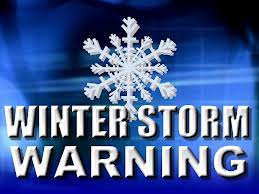
The National Weather Service has continued both the Winter Storm Warning and the Coastal Flood Warning for the Borough. The Winter Storm Warning remains in effect until Thursday, March 22nd at 2:00am while the Coastal Flood Warning remains in effect until Thursday, March 22nd at 5:00am.
The snowfall totals for the Jersey Shore have been reduced by the National Weather Service. Heavy mixed precipitation is expected with an accumulation of between two to five inches of snow, with local ice and a light glaze expected on streets and sidewalks. The wintry mix is expected to change to all snow during the mid afternoon hours on Wednesday. Driving conditions are anticipated to be difficult Wednesday evening.
Minor coastal flooding is expected at time of high tide this morning, with the potential for moderate coastal flooding at time of high tide this evening. High tide will occur Wednesday at the Townsend’s Inlet Bridge at 11:25am, and again at 11:47pm. Please exercise caution while driving and never drive on a flooded street. The Townsend’s Inlet Bridge has been closed during this storm event due to unsafe conditions on the approach road.
![]()
If you have an emergency, dial 911. If you have a power outage, call Atlantic City Electric at 1-800-833-7476. We continue to be in contact with the National Weather Service and with the Cape May County Office of Emergency Management regarding this storm event. Continue to monitor this forecast on traditional media outlets.
There will be no trash/recycling collection in Avalon on Wednesday; collection will be held instead on Thursday.
Winter_Storm_Briefing_Mar21_5am
Here is the text of the Winter Storm Warning and the Coastal Flood Warning from the National Weather Service:
Winter Storm Warning
URGENT – WINTER WEATHER MESSAGE National Weather Service Mount Holly NJ 410 AM EDT Wed Mar 21 2018 …Major Coastal Storm to Impact the Region Through Tonight… .Low pressure will consolidate into an intense Nor`easter just east of the Mid-Atlantic coast today, then track southeast of Nantucket Island late tonight. Unnecessary travel especially in most of New Jersey and eastern Pennsylvania this afternoon and evening is strongly discouraged!
WINTER STORM WARNING REMAINS IN EFFECT UNTIL 2 AM EDT THURSDAY…
* WHAT…Heavy mixed precipitation expected. Total snow accumulations of 2 to 5 inches and local ice accumulations of a light glaze are expected.
* WHERE…Far southeast New Jersey, and southern Delaware. * WHEN…Until 2 AM EDT Thursday. A wintry mix and areas of plain rain changes to snow late this morning and this afternoon, with a period of heavy snow expected during this afternoon when snowfall rates of an inch per hour is anticipated. The snow then tapers off later this evening.
* ADDITIONAL DETAILS…Plan on difficult travel conditions, especially during this evenings commute. Tree branches could fall due to wind gusts up to 40 mph, potentially leading to power outages. Be prepared for significant reductions in visibility at times. Once snowfall rates reach or exceed one inch per hour, it becomes difficult for road crews to keep up due to rapid accumulations.
Coastal Flood Warning
COASTAL FLOOD WARNING REMAINS IN EFFECT UNTIL 5 AM EDT THURSDAY…
* LOCATIONS…Coastal areas of Cape May County and Cumberland County in New Jersey, and Sussex County and Kent County in Delaware.
* COASTAL FLOODING…Minor to moderate flooding is forecast with today`s high tide. Moderate flooding is expected with the high tide tonight.
* TIMING…Flooding may occur for a few hours around the time of high tide. High tide on the New Jersey and Delaware oceanfront occurs between 10:30 AM and 11:30 AM today, and between 11:00 PM and midnight tonight. High tide on the back bays and on Delaware Bay occurs later than the high tide on the oceanfront.
* SURGE…Around 2.5 to 3.0 feet today and tonight.
* WAVES…Around 10 to 16 feet off the coast today, and around 6 to 12 feet tonight. * IMPACTS…Numerous roadways will flood and minor to moderate property damage is possible along tidal waterways. The tide and wave action is expected to result in moderate beach erosion.
PRECAUTIONARY/PREPAREDNESS ACTIONS… This Coastal Flood Warning means that moderate tidal flooding is expected. Be prepared for rising water levels and take appropriate action to protect life and property. Follow the recommendations of local emergency management officials. Do not drive your vehicle through flood waters. The water may be deeper than you think it is. You will be putting yourself in danger and your vehicle may be damaged, leading to costly repairs. Visit the Advanced Hydrologic Prediction Service at water.weather.gov/ahps for additional water level and flood impact information for your local tide gauge.
