

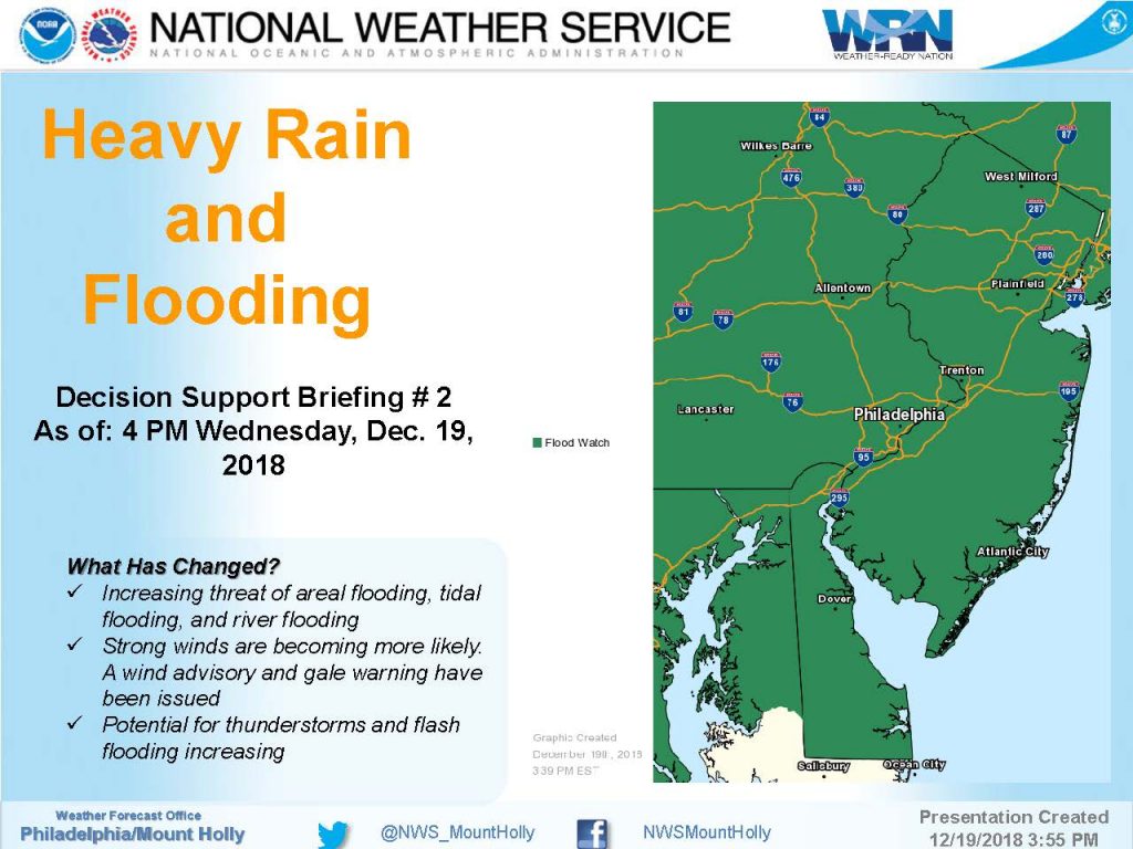
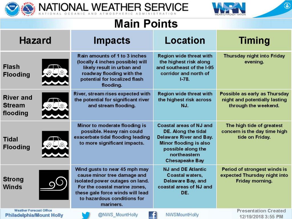
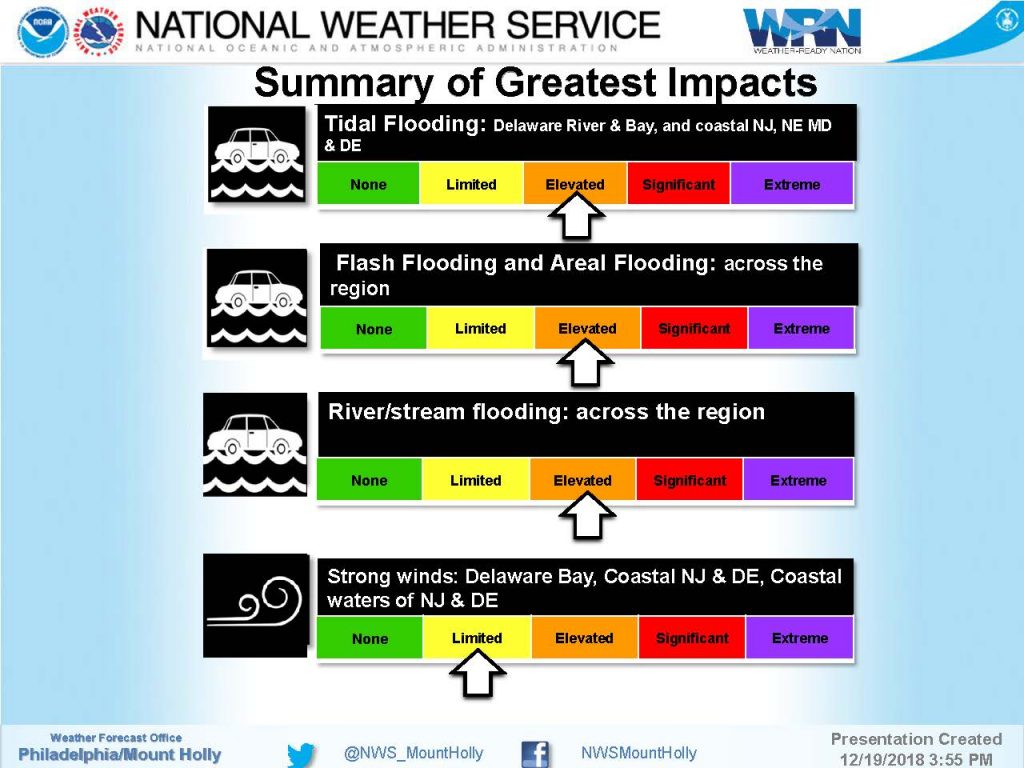
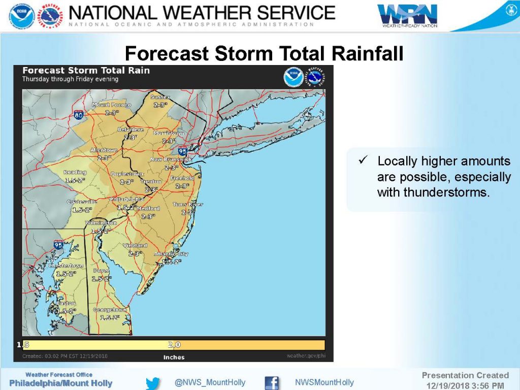
The National Weather Service has continued the Flood Watch for the region, and has added a Wind Advisory for an approaching storm that will bring heavy rain and gusty winds to our region from a period from Thursday evening through Friday night. Up to three inches of rain are expected in most areas in southern New Jersey (higher amounts in some locations), and wind gusts will approach 50mph. There is also the potential for minor to moderate tidal flooding at times of high tide on Friday.
The storm is expected to move into our region Thursday afternoon, beginning as rain showers. The storm will intensify during the overnight hours Thursday night into Friday morning. Periods of heavy rain and strong winds are possible Friday. The storm is expected to depart our region Friday night.
The Friday high tides bring the most concern for the potential for minor to moderate coastal flooding. High tide will occur Thursday evening at the Townsend’s Inlet Bridge at 5:56pm. High tide occurs Friday at 6:22am, and again at 6:46pm. Street flooding may occur due the compounding factor of tidal flooding with heavy rainfall.
Turn around, don’t drown. Never attempt to drive on any flooded street as this puts you and your vehicle at risk, and causes an unnecessary wake that can damage property. Driving on a flooded street adjacent to businesses may push water under doors causing damage that can easily be avoided by taking a different route to your destination.
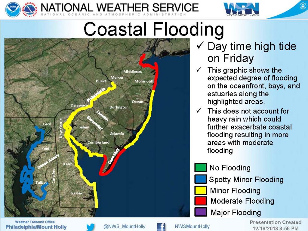
The Borough of Avalon has developed a flood risk map for heavy rainfall and tidal flooding events. Please review the map and make best decisions to secure your property and potentially move vehicles to areas of our community that are not subject to flooding.
![]()
If you have any emergency, dial 911. Continue to follow traditional media outlets for updates to the forecast as current weather alerts may be upgraded. The Borough continues to be in contact with our partners at the Cape May County Office of Emergency Management for updated information from weather and state agencies.
Here is the text of the Flood Watch and the Wind Advisory issued by the National Weather Service on Thursday morning:
Flood Watch
Flood Watch
National Weather Service Mount Holly NJ
356 AM EST Thu Dec 20 2018
…Significant Flooding Possible Tonight and Friday…
356 AM EST Thu Dec 20 2018
…FLOOD WATCH REMAINS IN EFFECT FROM THIS EVENING THROUGH LATE
FRIDAY NIGHT…
The Flood Watch continues for
* Portions of Delaware, northeast Maryland, New Jersey, and
southeast Pennsylvania, including the following areas, in
Delaware, Delaware Beaches, Inland Sussex, Kent, and New
Castle. In northeast Maryland, Caroline, Cecil, Kent MD, Queen
Annes, and Talbot. In New Jersey, Atlantic, Atlantic Coastal
Cape May, Camden, Cape May, Coastal Atlantic, Coastal Ocean,
Cumberland, Eastern Monmouth, Gloucester, Mercer, Middlesex,
Northwestern Burlington, Ocean, Salem, Somerset, Southeastern
Burlington, and Western Monmouth. In southeast Pennsylvania,
Delaware, Lower Bucks, and Philadelphia.
* From this evening through late Friday night.
* Widespread rainfall of 1.5 to 2.5 inches, with locally higher
amounts possible.
* Heavy rain will result in flooding of roadways and areas of poor
drainage. There is also the potential for significant river
flooding. The flood risk will increase where heavy rain and
embedded thunderstorms move over the same area, even potentially
leading to localized flash flooding.
* In addition to the freshwater flooding, the combination of heavy
rain and increased tide levels during the times of high tide
Friday morning will result in minor to locally moderate coastal
flooding along the Atlantic, Delaware Bay, the tidal Delaware
River, and the eastern shores of the Chesapeake Bay.
PRECAUTIONARY/PREPAREDNESS ACTIONS…
A Flood Watch means there is a potential for flooding based on
current forecasts.
You should monitor later forecasts and be alert for possible
Flood Warnings. Those living in areas prone to flooding should be
prepared to take action should flooding develop.
Wind Advisory
URGENT – WEATHER MESSAGE
National Weather Service Mount Holly NJ
335 AM EST Thu Dec 20 2018
…WIND ADVISORY REMAINS IN EFFECT FROM MIDNIGHT TONIGHT TO 10 AM
EST FRIDAY…
* WINDS…Becoming southeast 20 to 30 mph with gusts up to 50
mph.
* TIMING…Late Thursday night through Friday morning.
* IMPACTS…Gusty winds will blow around unsecured objects. Tree
limbs could be blown down and a few power outages may result.
PRECAUTIONARY/PREPAREDNESS ACTIONS…
A Wind Advisory means that very windy conditions are expected.
Winds this strong can make driving difficult, especially for high
profile vehicles. Use extra caution. Light-weight outdoor objects
such as patio furniture and garbage cans should be secured.
