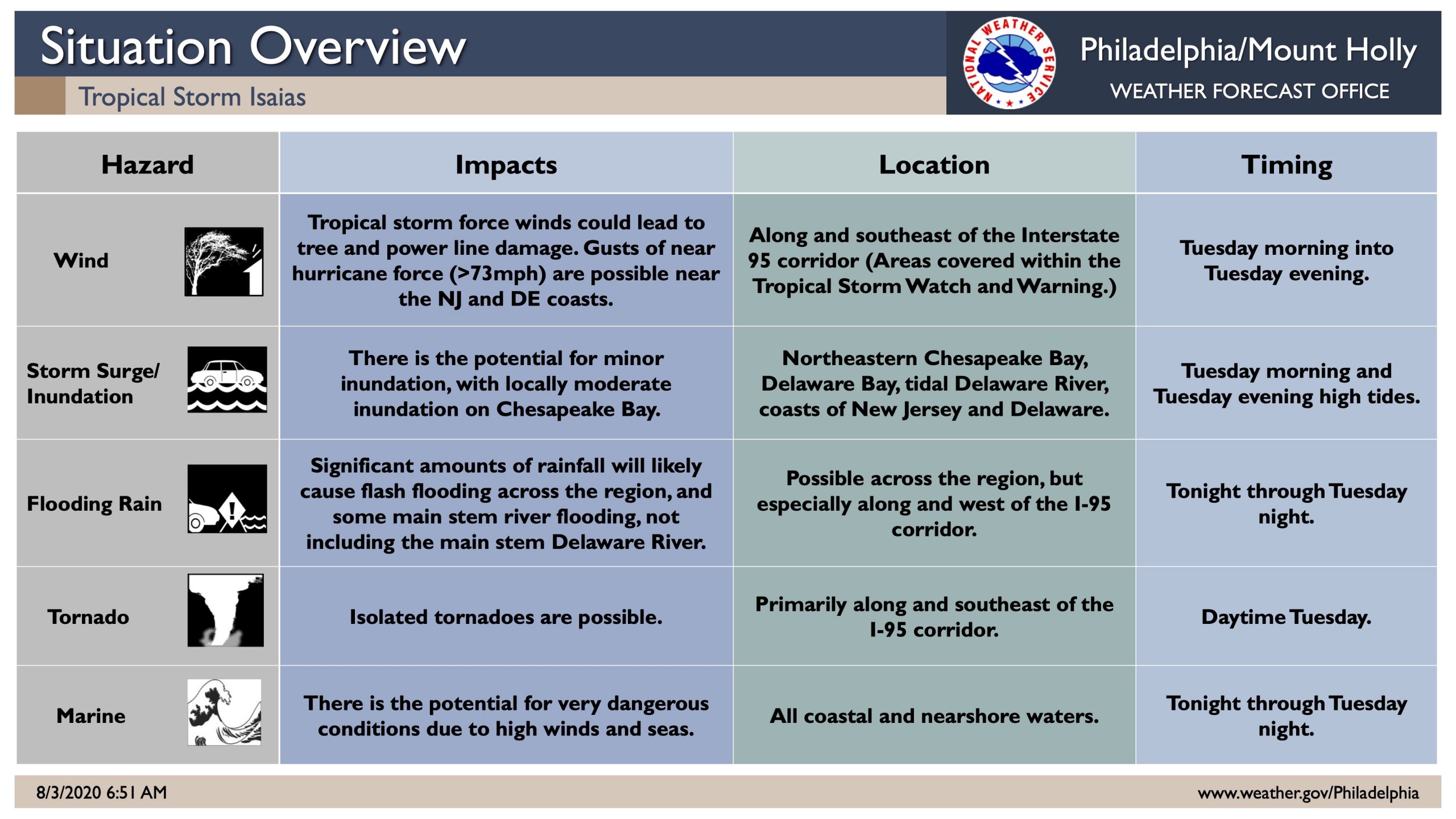
The National Weather Service has issued a Tropical Storm Warning and a Flash Flood Watch for Avalon. The Tropical Storm Warning is in effect until Tuesday evening, and the Flash Flood Watch is in effect from Monday evening through Tuesday evening, August 3-4th.
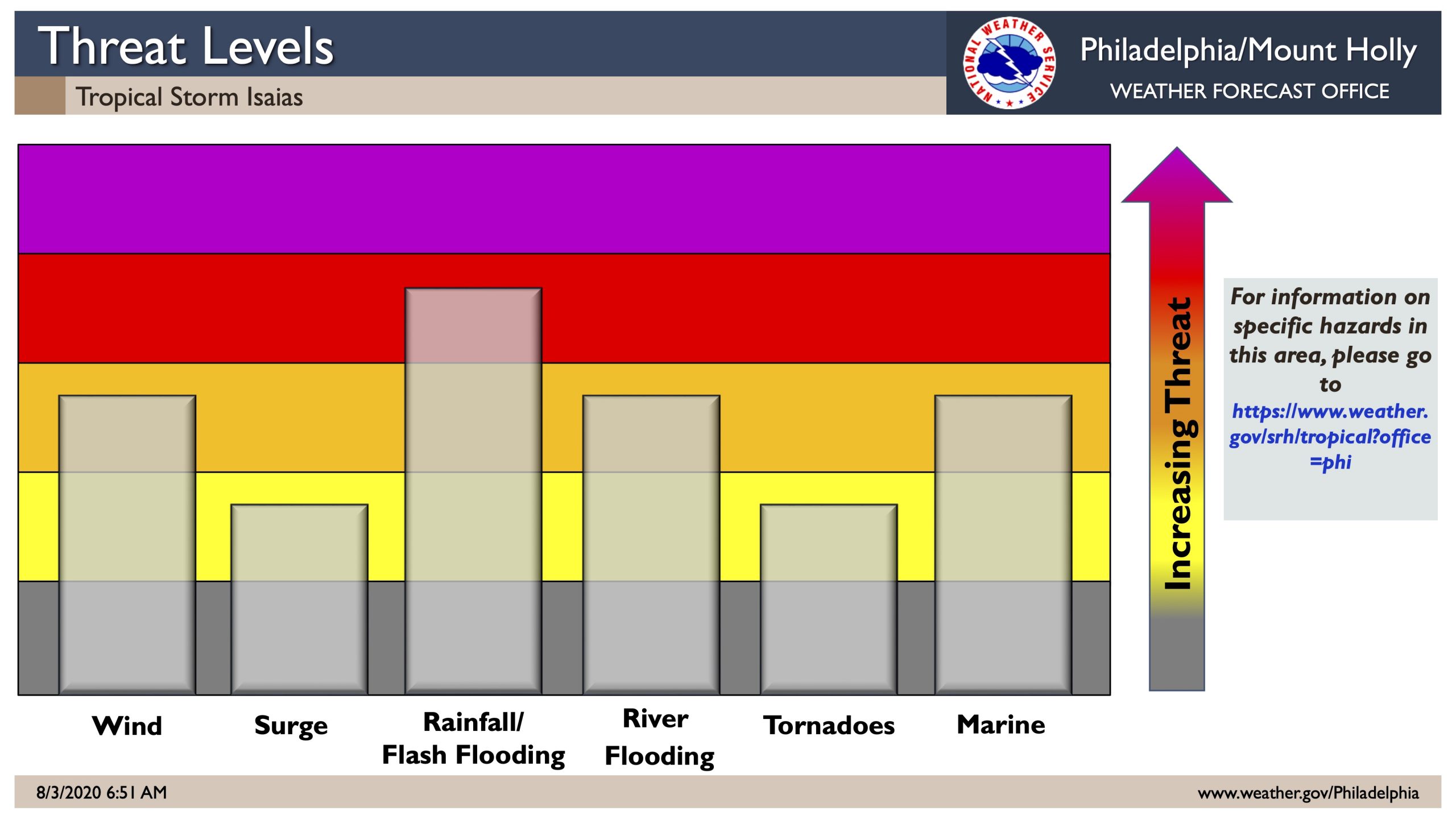
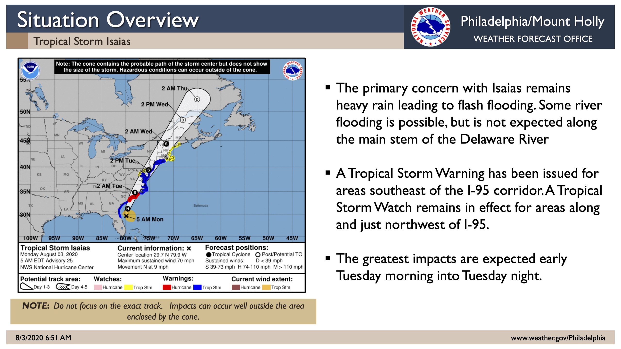
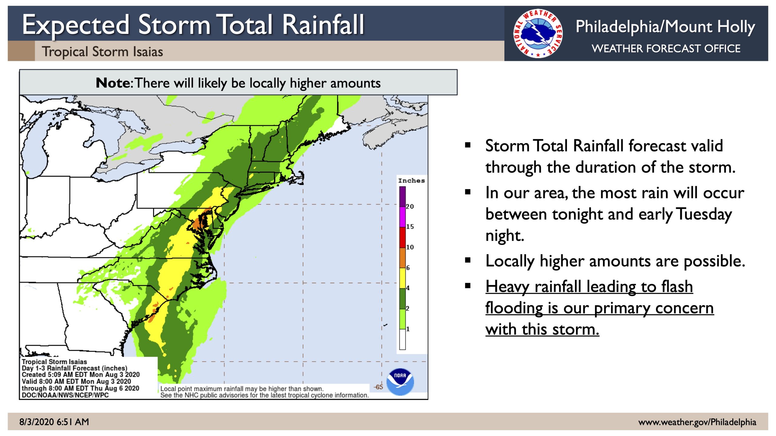
Tropical Storm Isaias is forecasted to bring windy conditions with heavy rainfall from late Monday night through Tuesday evening. This storm is anticipated to have wind gusts approaching 75mph, with the potential for three inches of rain, with locally higher amounts. The storm is expected to produce street flooding in poor drainage areas.
Do not attempt to drive on any street that is flooded as this puts you and your vehicle at risk, and causes a wake that damages private property. Turn around, don’t drown. There is the potential for power outages during this storm event. If you experience an outage, call Atlantic City Electric at 1-800-833-7476. If you have any emergency, dial 911.
Follow all instructions provided by the Avalon Beach Patrol. There is a Rip Current Risk and a High Surf Advisory in effect with ten foot waves and rip currents likely.
By Monday evening, please secure any items that could be prone to strong winds including trash cans, patio furniture, awnings, and umbrellas. Contractors should secure their job sites Monday evening
Avalon has produced a flood risk map that shows where streets may flood during extreme rainfall events. They include, but are not limited to, the north end beach blocks; the Dune Drive business district; and portions of Ocean Drive. If you live on a street that floods during heavy rain events, move your vehicle to another section of Avalon that does not flood during heavy rain.

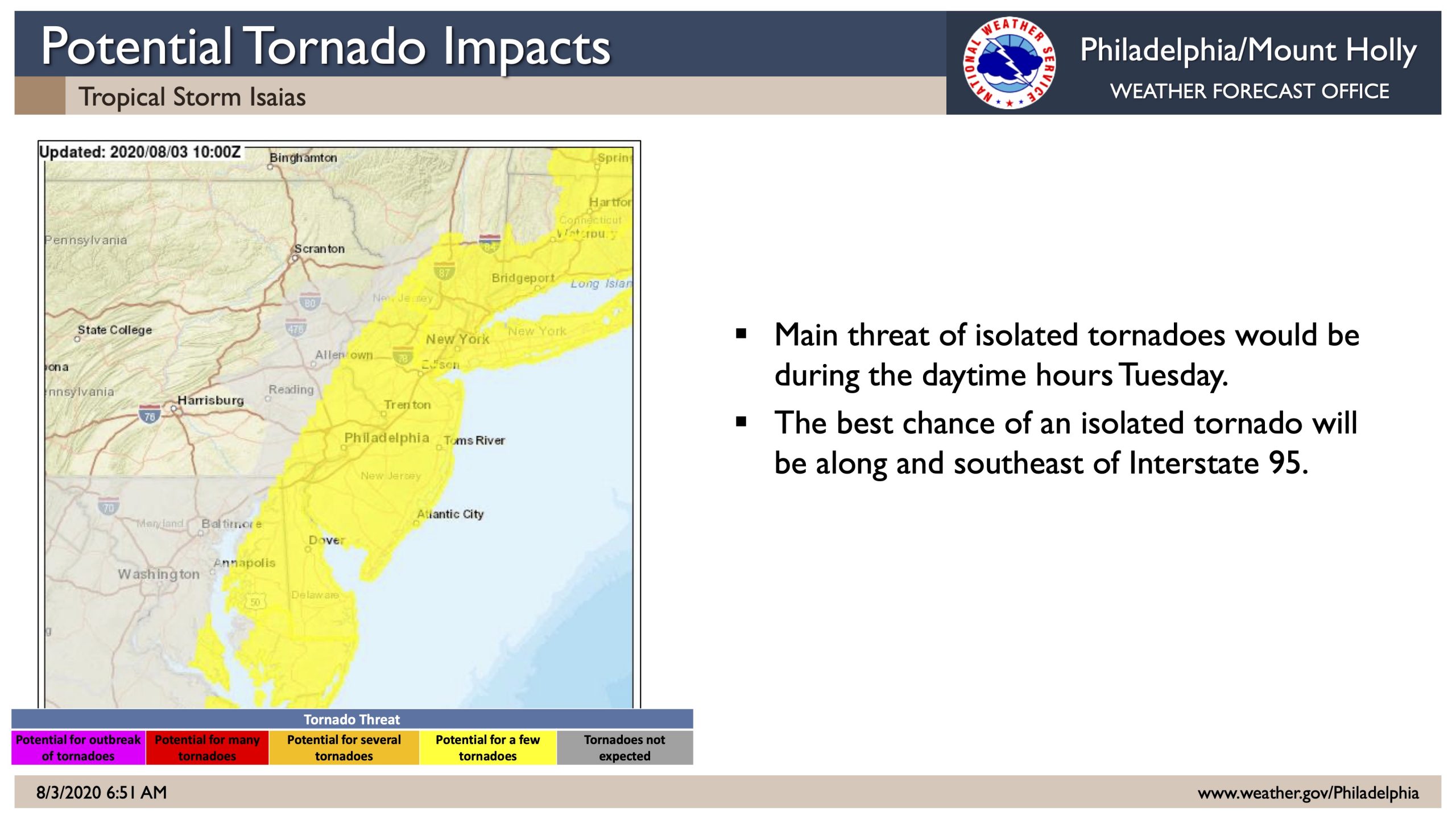
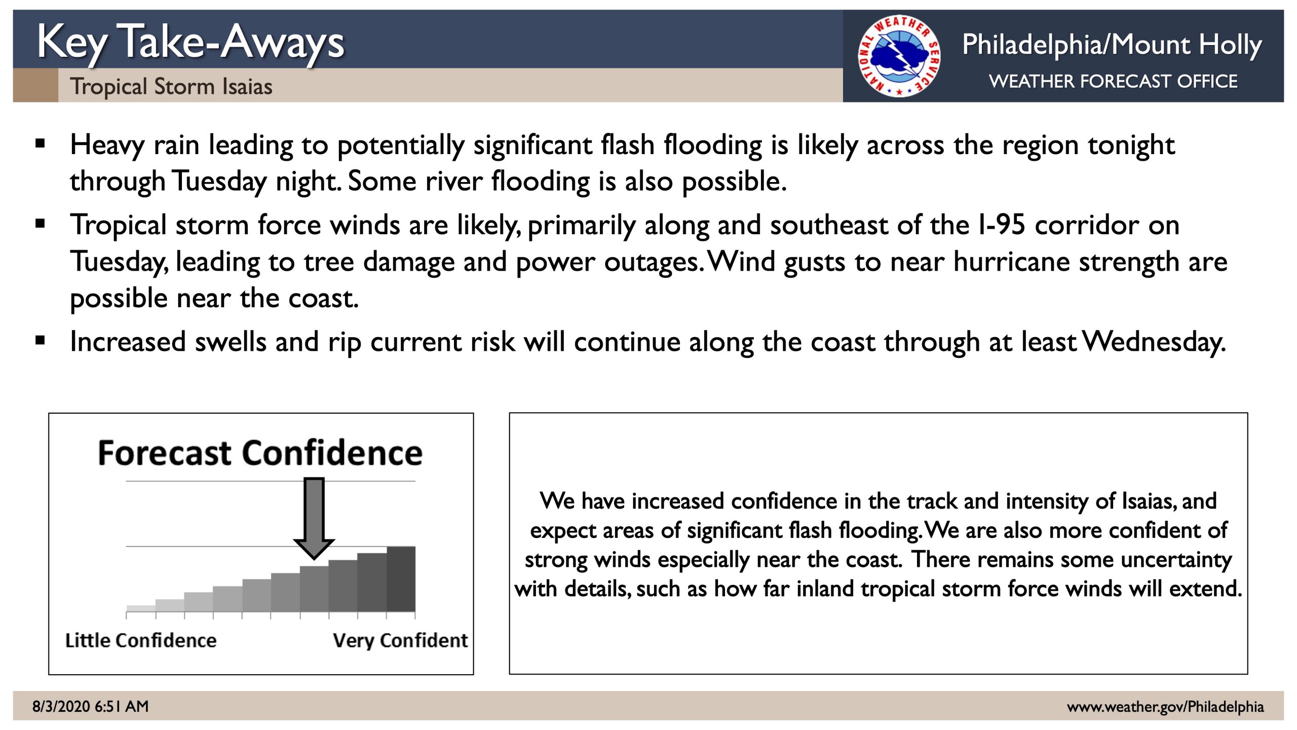
Here is the latest graphics package from the National Weather Service. We remain in contact with the New Jersey and Cape May County offices of emergency management during this event.