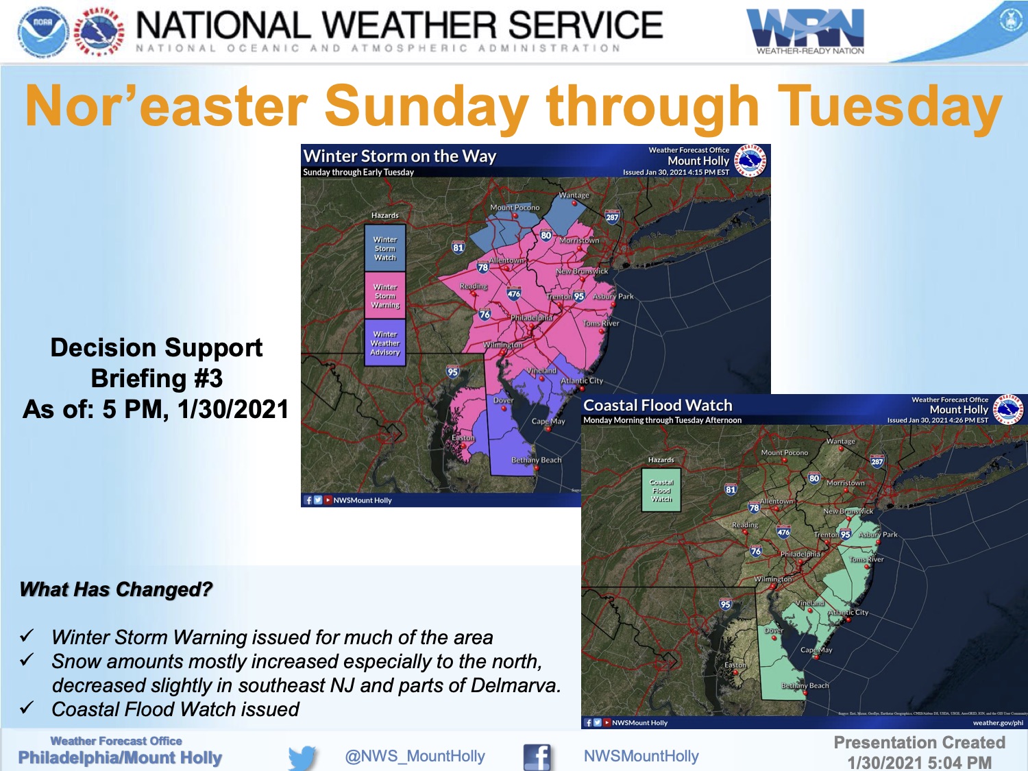
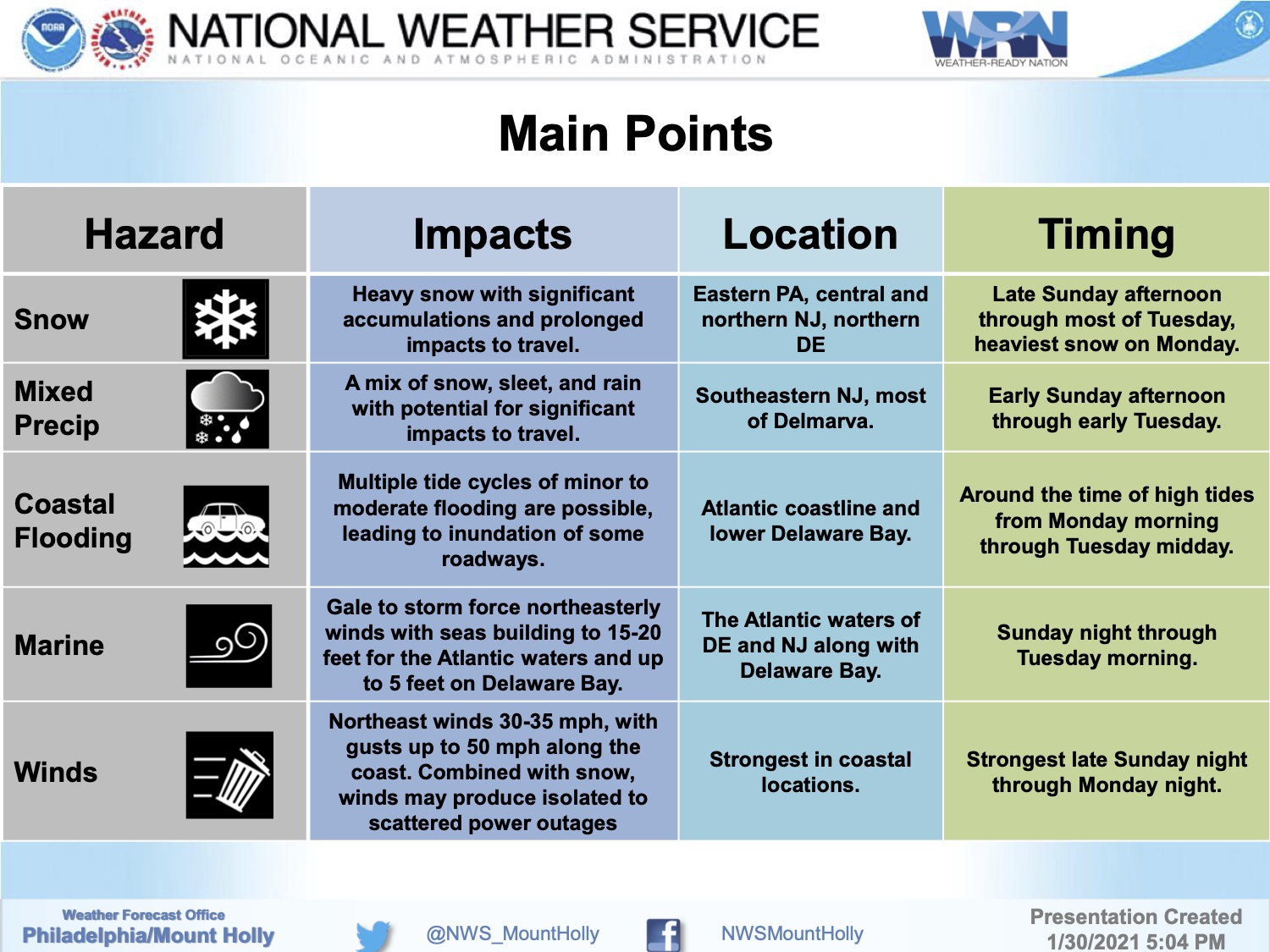
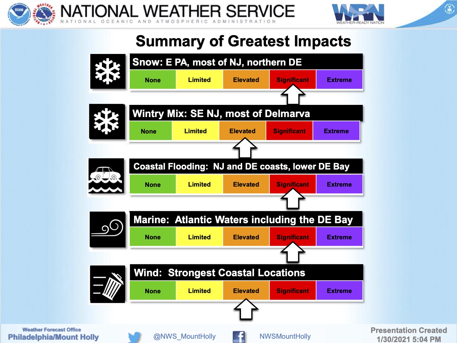
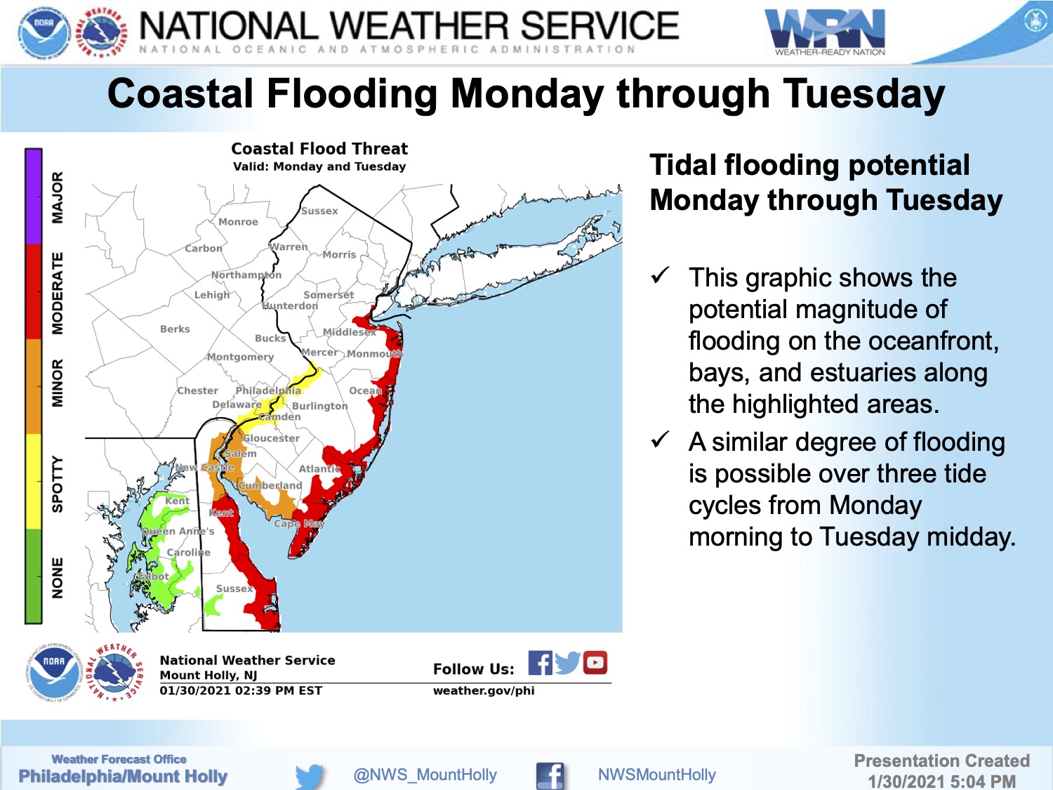
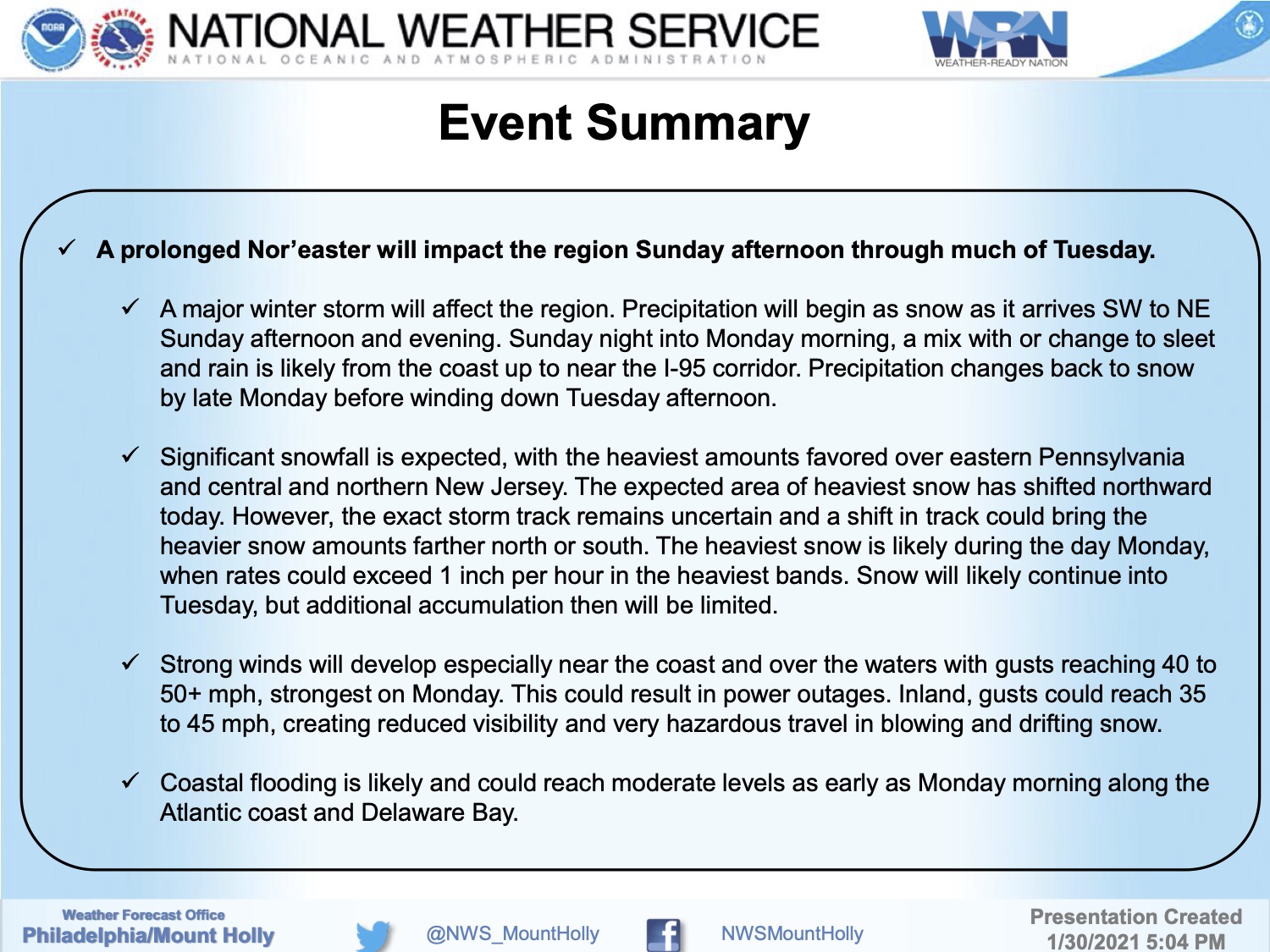
The National Weather Service has issued a package of advisories for coastal Cape May County in advance of a nor’easter-type winter storm that will impact our region Sunday afternoon through Tuesday morning. A Coastal Flood Watch is in effect from Monday morning through Tuesday afternoon; and a Wind Advisory is in effect late Monday morning through Monday evening.
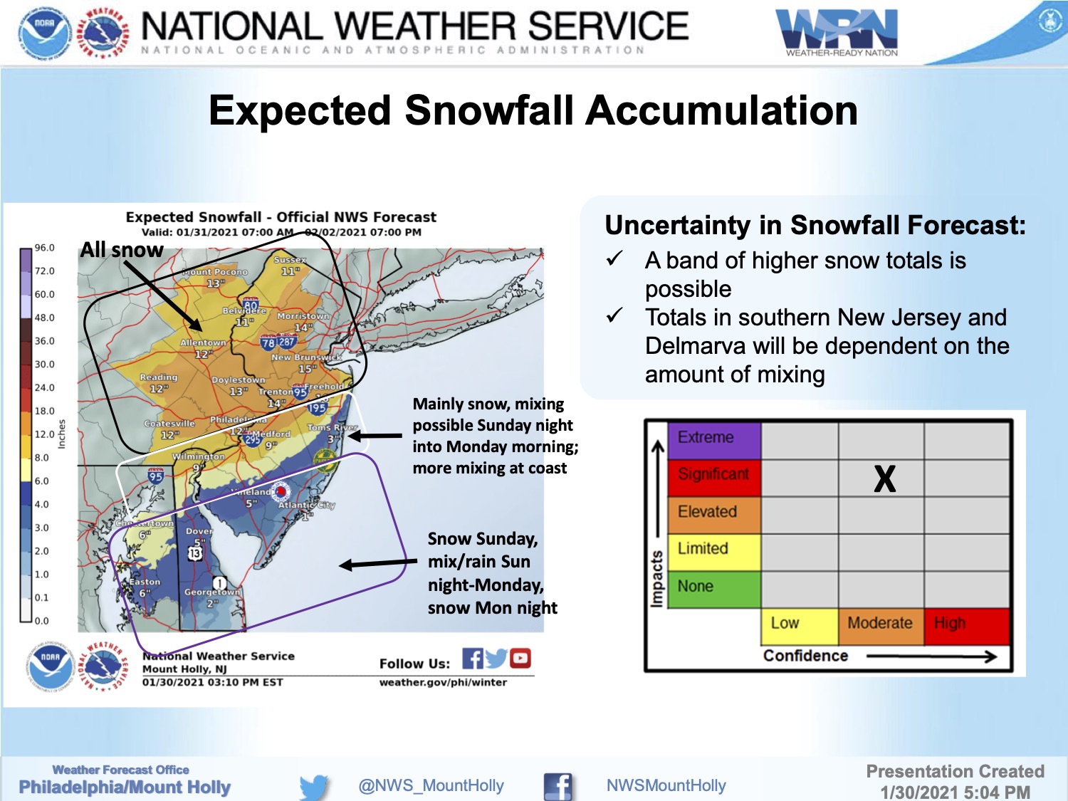
Snow is expected to begin Sunday afternoon, and transition to snow, rain, and sleet during the overnight hours into Monday morning. Monday will produce rainy, windy conditions along the coast with wind gusts over 40mph possible. The storm is expected to end with a snow/rain/sleet mix through Tuesday around midday.
Moderate coastal flooding is possible at time of high tide Monday and Tuesday. Some streets may be impassable due to tidal flooding. Never drive on a flooded street; turn around, don’t drown. If you live on a street that typically floods during storm events, consider moving your vehicle by Sunday morning. Secure any objects at your home that may be subject to strong winds, including trash cans and lawn furniture.
High tide will occur Monday at the Townsend’s Inlet Bridge at 10-:17am, and again at 10:54pm. Tuesday’s first high tide occurs at 11:05am.
If you have a power outage, contact Atlantic City Electric directly at 1-800-833-7476. If you have an emergency, dial 911.
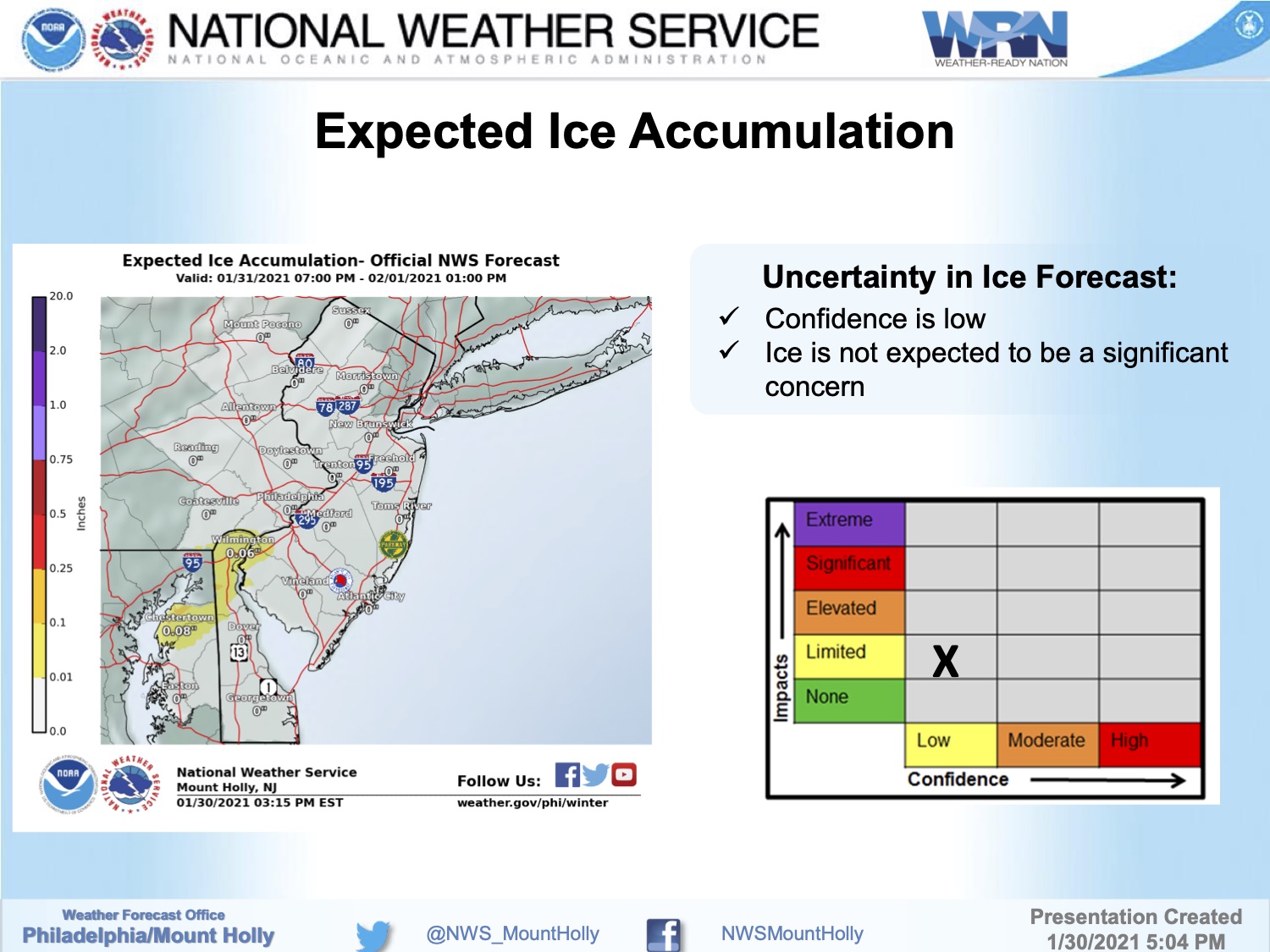
Here is the briefing package provided by the National Weather Service on Saturday evening, January 30th: