The remnants of former Hurricane Ida will spread over our region Wednesday afternoon into Thursday morning. The National Weather Service has reduced the amount of potential rainfall for Avalon. However, drenching thunderstorms are still possible that may cause temporary street flooding. Never drive on a flooded street as this puts you and your vehicle in danger. The Flash Flood Watch remains in effect until Thursday morning.
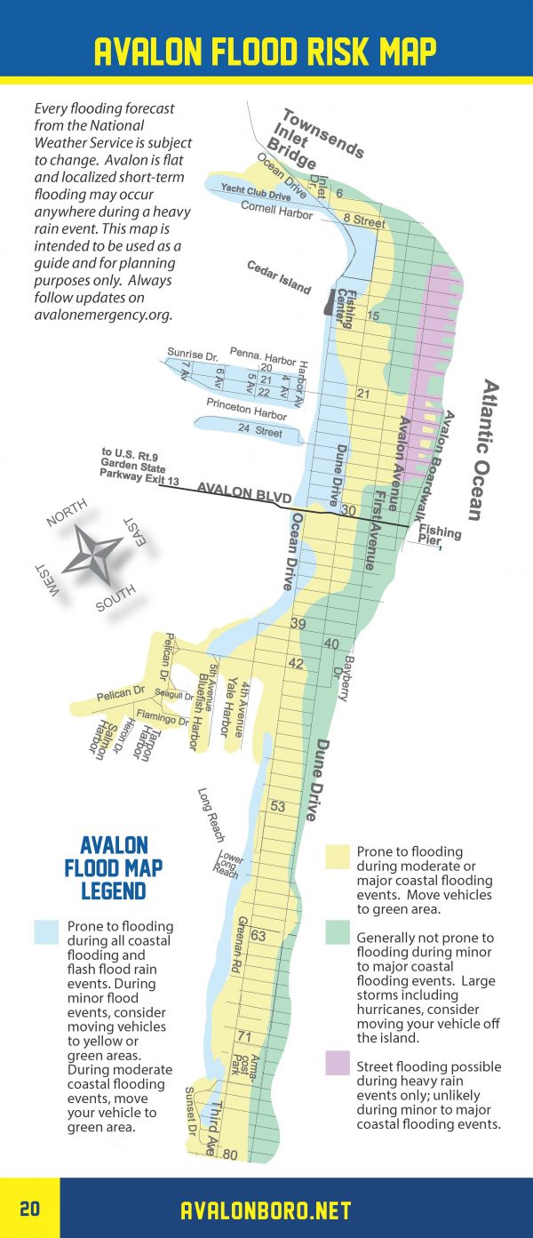
Please be aware that portions of Avalon are subject to temporary street flooding during downpours. Here is a flood risk map for Avalon that shows the risk. Flood prone areas from rain flooding include but are not limited to the north end beach blocks; portions of Ocean Drive, and west of the 21st Street Bridge. Continue to monitor the forecast on traditional media outlets.
There is a risk for rip currents today along New Jersey beaches. Follow all instructions provided by the Avalon Beach Patrol.