

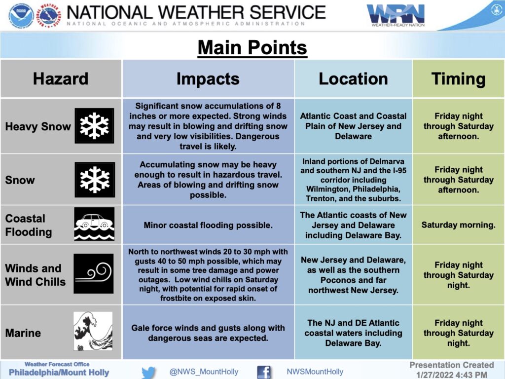
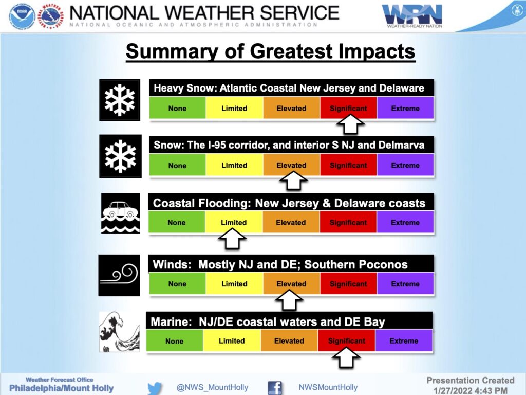
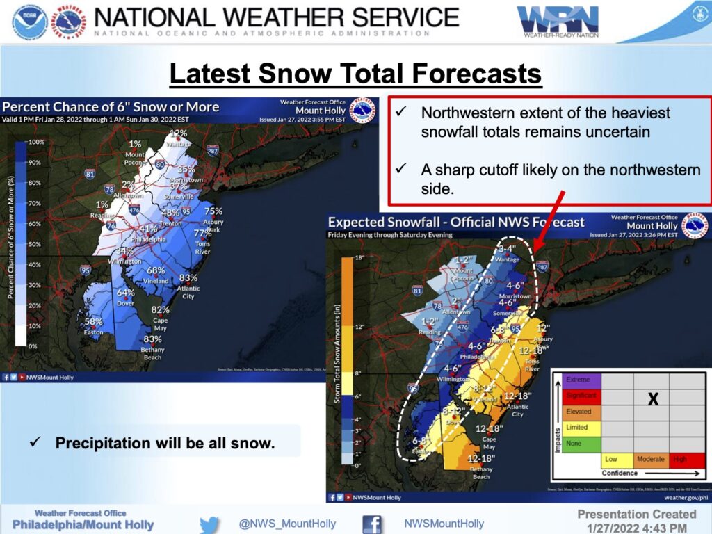
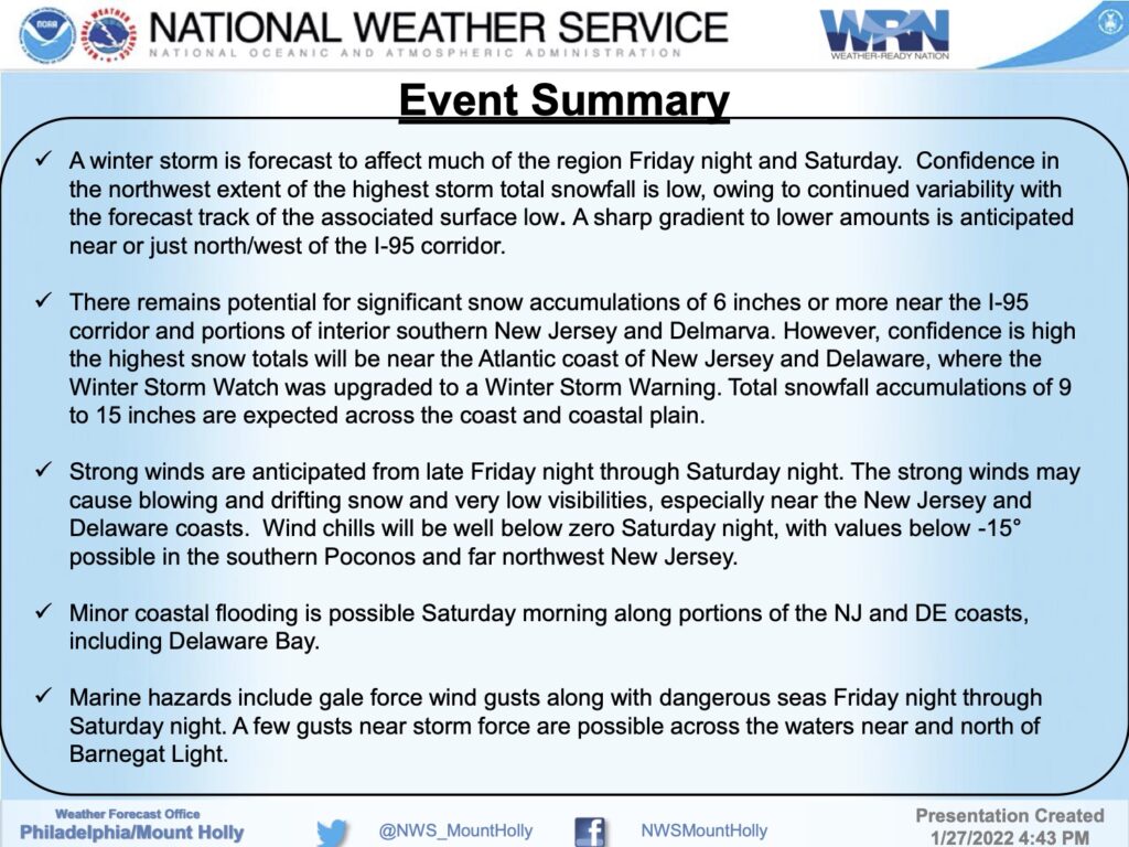
The National Weather Service has issued a Winter Storm Warning for our region. The Warning is in effect for Friday, January 28th, at 7pm until Saturday, January 29th, at 7pm. The current forecast calls for total snow accumulation of nine to 15 inches, and wind gusts of up to 50mph.
Hazardous travel conditions are anticipated late Friday night through Saturday.
There is no significant tidal flooding associated with this storm event. Exercise caution while driving and be aware that snow plows will likely be on our streets to clear snow as quickly and safely as possible. If you have any emergency, dial 911. Friday is the day to secure outdoor objects like trash cans and patio furniture that are subject to strong winds.
Here is the Winter Storm Warning issued by the National Weather Service:
Winter Storm Warning
URGENT – WINTER WEATHER MESSAGE
National Weather Service Mount Holly NJ
337 PM EST Thu Jan 27 2022
…WINTER STORM WARNING IN EFFECT FROM 7 PM FRIDAY TO 7 PM EST
SATURDAY…
* WHAT…Heavy snow expected. Total snow accumulations of 9 to 15
inches. Winds gusting as high as 50 mph.
* WHERE…Portions of central and southern New Jersey and
southern Delaware.
* WHEN…From 7 PM Friday to 7 PM EST Saturday.
* IMPACTS…Travel could be very difficult to impossible. Gusty
winds could bring down tree branches.
* ADDITIONAL DETAILS…Snow is expected to begin Friday evening in
Delmarva and southern New Jersey, spreading northward overnight
into Saturday morning. Snow may be heavy at times through mid
afternoon Saturday before diminishing Saturday evening. Strong
winds may generate blowing snow and very low visibilities at
times.
