

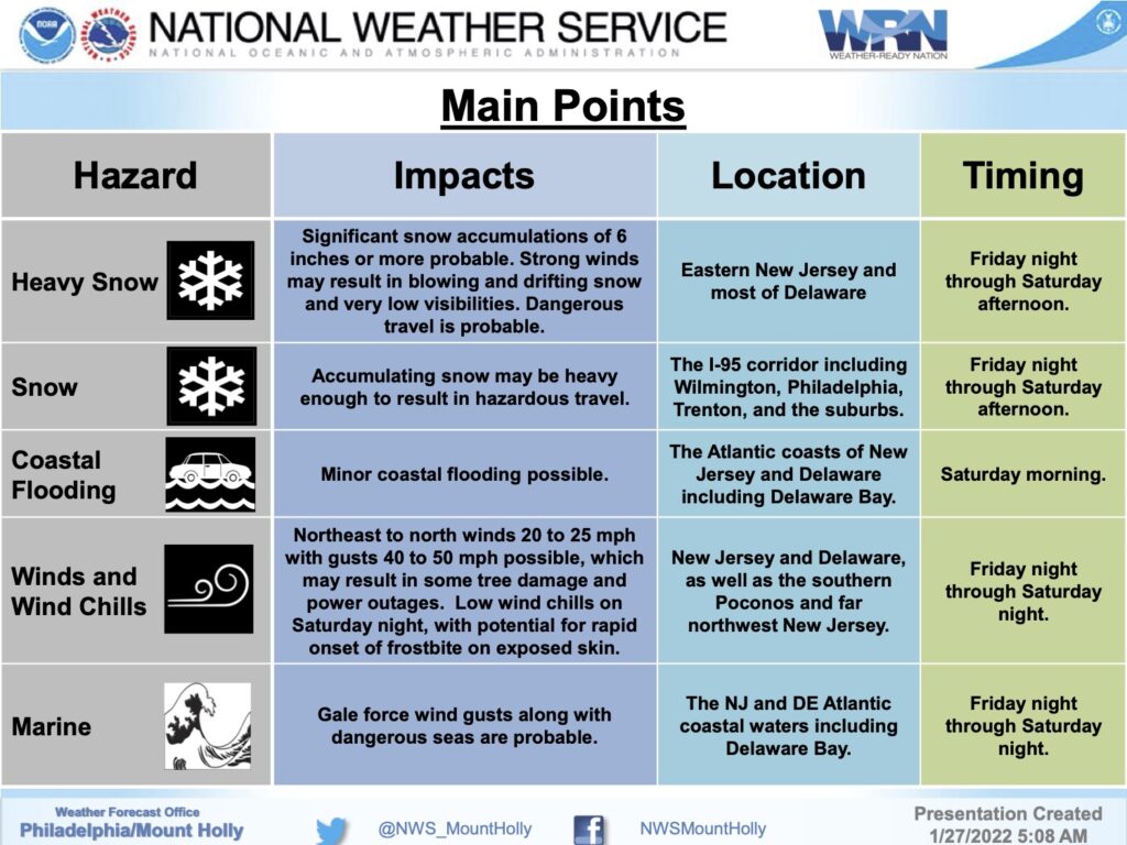
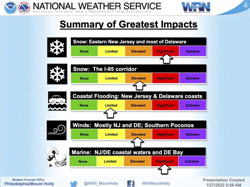
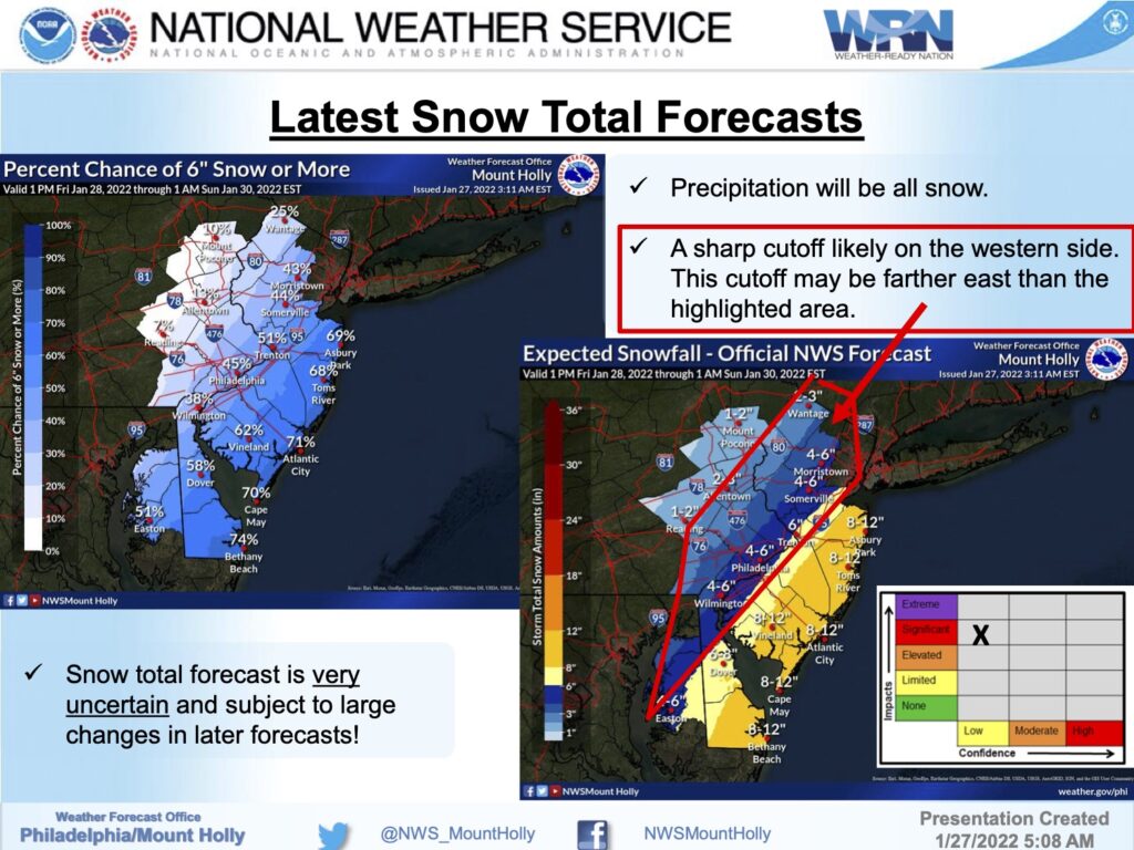
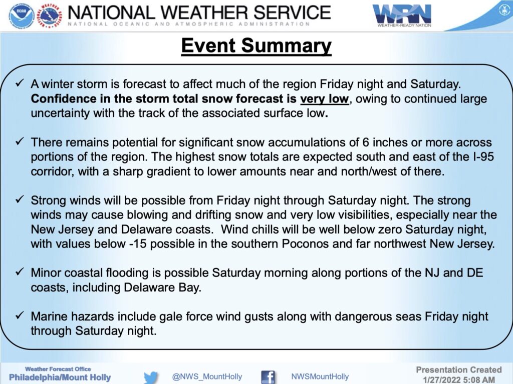
The National Weather Service has issued a Winter Storm Watch for Avalon. The Watch is in effect from Friday evening, January 28th through Saturday evening, January 29th. The current forecast calls for between six to 12 inches of snow during this storm with strong gusty winds and minor tidal flooding. There is an expectation this watch will be a warning.
The confidence in this forecast is very low, according to the National Weather Service, as the path of this winter storm will dictate the conditions that we experience locally. There could be changes to the forecast; continue to follow this website and traditional media outlets for updates.
Be aware that travel conditions late Friday night into Saturday will be hazardous. Please secure objects on your property that may be subject to high winds including trash cans and patio furniture. Contractors are required to secure their job sites in advance of this storm event.
We continue to be in contact with our partners at the Cape May County Department of Emergency Management and the New Jersey Office of Emergency Management for updates and alerts. Here is the text of the Winter Storm Watch issued by the National Weather Service:
Winter Storm Watch
URGENT – WINTER WEATHER MESSAGE
National Weather Service Mount Holly NJ
313 AM EST Thu Jan 27 2022
…WINTER STORM WATCH IN EFFECT FROM FRIDAY EVENING THROUGH
SATURDAY EVENING…
* WHAT…Heavy snow possible. Total snow accumulations of 6 to 12
inches possible. Winds could gust as high as 45 mph.
* WHERE…The coastal counties of New Jersey and Sussex County in
Delaware.
* WHEN…From Friday evening through Saturday evening.
* IMPACTS…Travel could be very difficult to impossible.
* ADDITIONAL DETAILS…Snow is expected to begin Friday evening in
Delmarva and southern New Jersey, spreading northward overnight
into Saturday morning. Snow may be heavy at times through mid
afternoon before diminishing Saturday evening. Strong winds may
generate blowing snow and very low visibilities at times. The
storm total snow forecast remains very uncertain, so stay tuned
to the latest forecasts.
