

From our partners at the National Weather Service/Mt. Holly:
High tide at the Townsend’s Inlet Bridge will occur as follows:
Friday: 11:38am, 11:57pm
Saturday: 12:33pm
Sunday: 12:58am, 1:38pm
Monday: 2:13am, 2:52pm
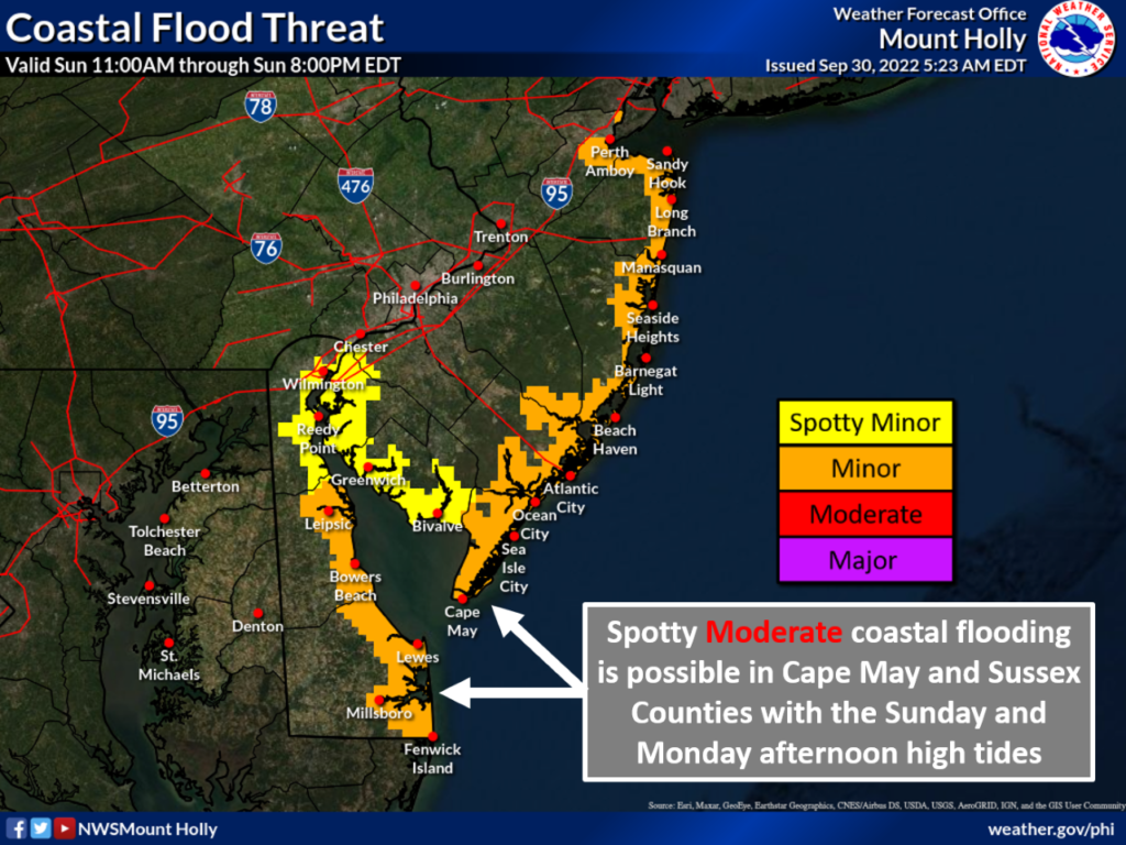
There is the potential for minor tidal flooding this weekend, and moderate tidal flooding Monday.
Here are the key messages for our region in regards to potential impacts with the remnants of what is currently Tropical Storm Ian this weekend.
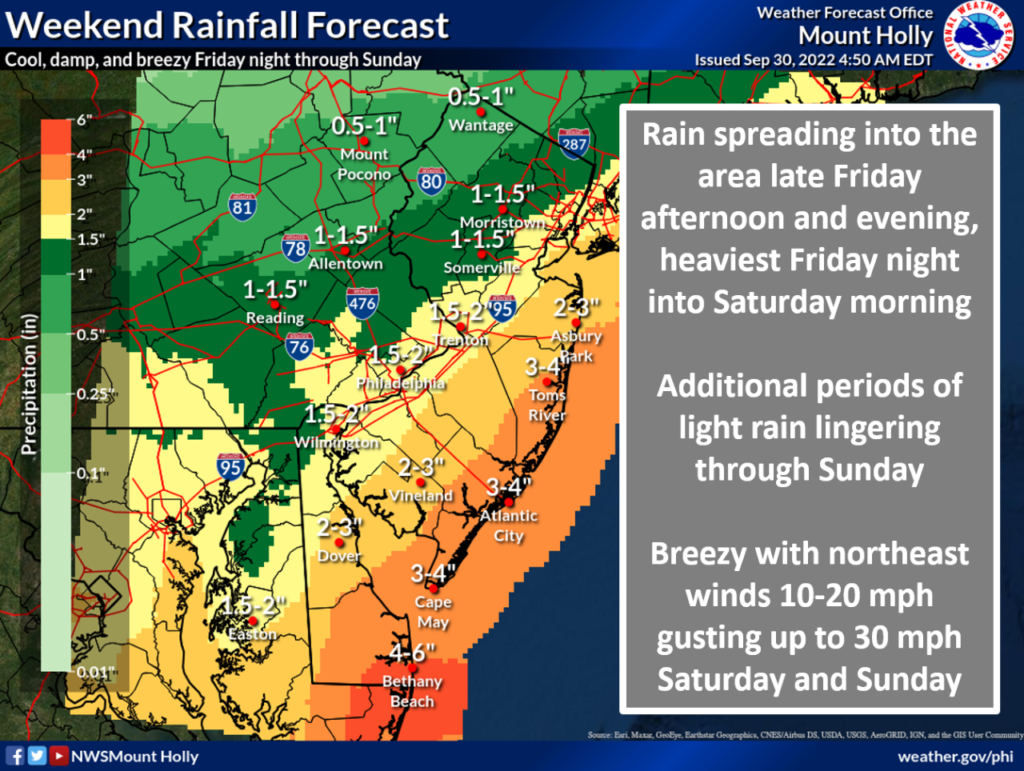
Heavy Rain: There is potential for heavy rain in Delmarva and southern New Jersey, especially along coastal areas. Periods of rain will develop Friday evening and will continue through Tuesday (not all due to the impacts of Ian). The main period of concern with the heavy rain threat is Friday night through Saturday. Rain amounts of 3 to 5 inches are possible for coastal areas of Delaware and New Jersey. For other areas along and southeast of the Interstate 95 corridor, 1 to 3 inches of rain is possible. North and west of the Interstate 95 corridor, rain amounts are expected to be generally up to one inch.
Tidal/Coastal Flooding: There is an increasing risk for minor tidal flooding beginning this afternoon for the Delaware Bay and Atlantic Ocean coasts of Delaware and Cape May County in New Jersey and on Saturday for the remaining Atlantic Coast of New Jersey. Peak water levels are currently expected to occur on Sunday or Monday producing widespread minor coastal flooding. Minor approaching moderate flooding is possible on Sunday and Monday, particularly along the southern Delaware and southern New Jersey Atlantic coasts. The coastal flooding threat will occur primarily with the afternoon/evening high tide cycles but spotty minor conditions will be possible with the overnight high tides.
Winds: Northeast winds will increase to 15 to 25 mph with 30 to 40 mph gusts, strongest along the New Jersey and Delaware coasts, on Sunday. These winds are short of Wind Advisory criteria. Lower winds are expected for areas north of Interstate 78.
Marine hazards: Northeasterly gale force winds are expected for the lower Delaware Bay and the Delaware and southern New Jersey coastal waters Friday night into Saturday morning. Another period of northeasterly gales is likely Sunday into early Monday.
