

The National Weather Service has continued the Coastal Flood Advisory for Saturday, October 1st and has issued a Coastal Flood Watch for Monday, October 3rd as remnants of Ian move over our region this weekend. There is the potential for minor tidal flooding during the afternoon high tides Saturday and Sunday, and the potential for moderate tidal flooding Monday afternoon, also during high tide.
High tide at the Townsend’s Inlet Bridge occurs Saturday at 12:33pm; Sunday at 12:58am and again at 1:38pm; and Monday at 2:13am and 2:52pm.
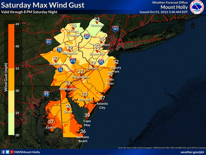
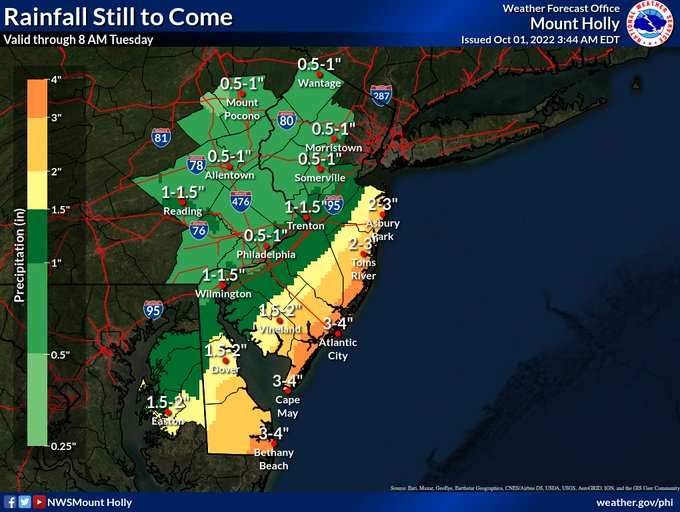
There is the potential for heavy rainfall of up to four inches in our area. There will be gusty winds throughout the day. The maximum wind gust recorded overnight was 48mph. Thunderstorms are also possible at any time. Rainfall is likely through Tuesday. During times of high tide it is possible access to the Townsend’s Inlet Bridge may be impossible. The road to the bridge was closed for a short time during the early morning hours of Saturday.
Please avoid areas of Avalon that may receive tidal flooding and rainwater flooding. Never drive on a flooded street. If you experience a power outage, contact Atlantic City Electric at 1-800-833-7476.
Shown are rainfall and wind predictions by the National Weather Service, along with Avalon’s own flood risk map that is color coded to represent both rainfall and tidal flooding threats.
![]()
