

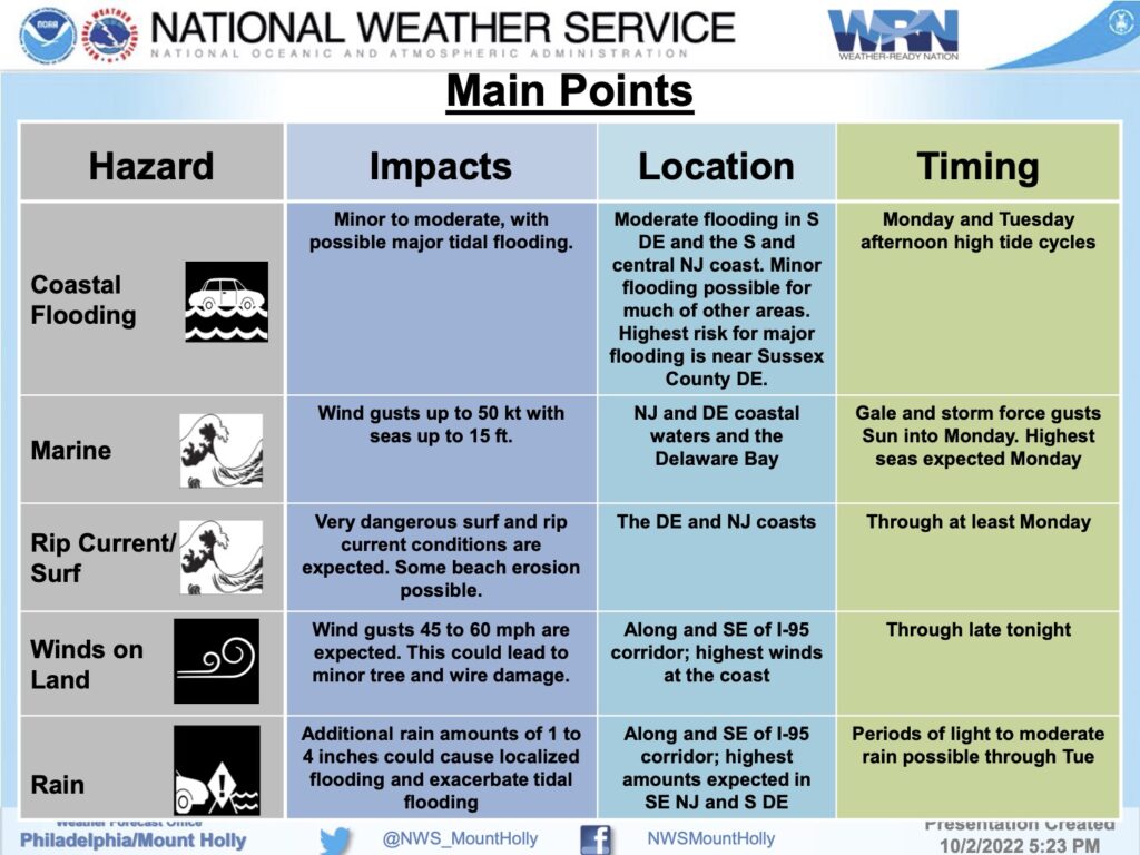
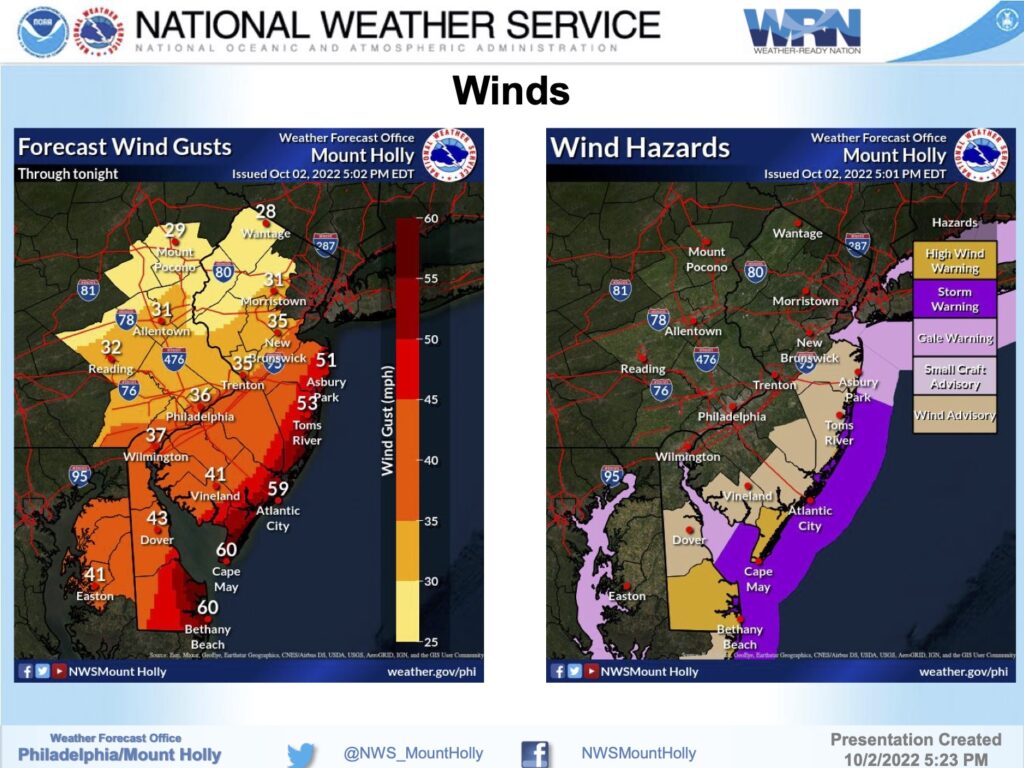
The National Weather Service has provided updates on the coastal storm which may linger into Tuesday. A Coastal Flood Warning remains in effect through Tuesday, October 4th, at 9:00pm for the potential of moderate tidal flooding. The High Wind Warning remains in effect for Avalon through Monday at 4:00am; wind gusts approaching 60mph may occur this evening.
As expected, Avalon experienced street flooding during Sunday afternoon’s high tide. Parts of Ocean and Dune drives remain flooded hours after the high tide event, as well as other locations in our community. Similar street flooding is anticipated Monday. Rain is expected to continue until Monday evening as remnants of Ian continue to impact our region. There are also strong rip currents in the ocean through Monday; do not enter the ocean at any time.
Here are the high tides for the next two days at the Townsend’s Inlet Bridge: Monday, 2:13am and 2:52pm, and Tuesday, 3:34am and 4:05pm. Moderate tidal flooding is anticipated at time of high tide Monday afternoon. This will likely result in some street flooding. Never drive your vehicle on a street that is flooded as this puts you and your vehicle at risk. There may be times when the Townsend’s Inlet Bridge access may be closed due to wave over wash onto the roadway; access was restricted at times over the weekend.
![]()
Winds are expected to gust at 60mph or higher. If you have a power outage, contact Atlantic City Electric at 1-800-833-7476. If you have any emergency, please call 9-1-1. In anticipation of the Monday afternoon flooding event, Avalon will dismiss non-essential personnel Monday at 1:00pm at which time Borough Hall and Community Hall will close.
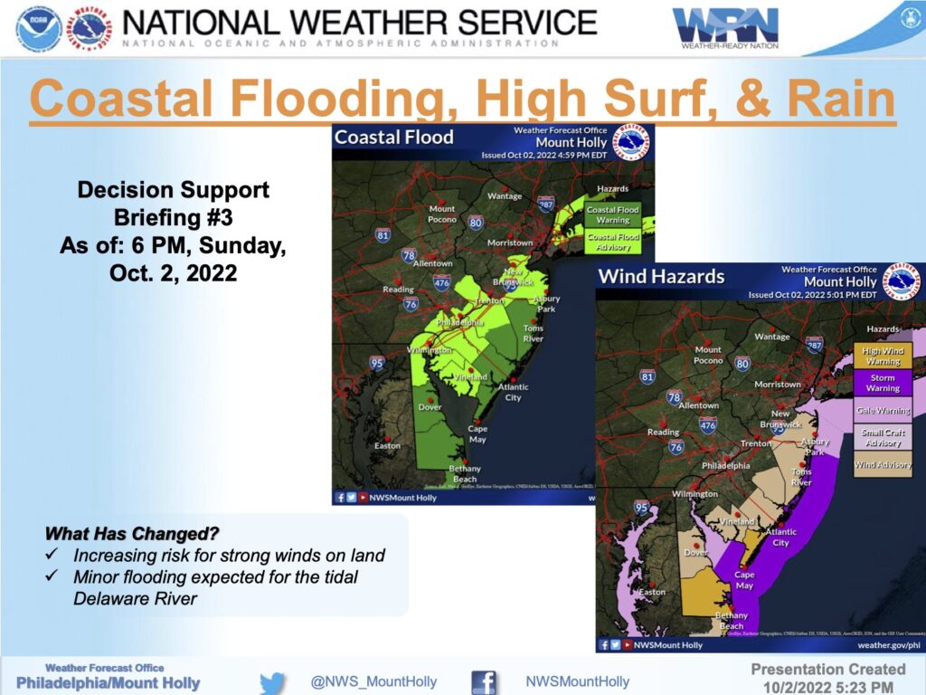
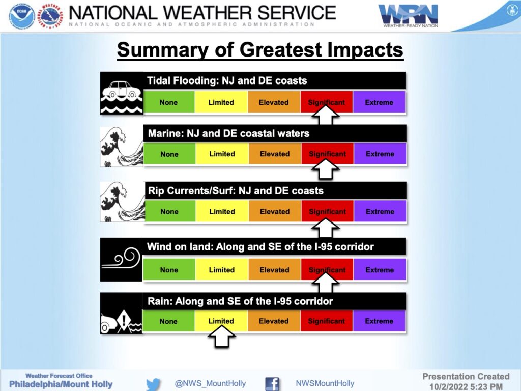
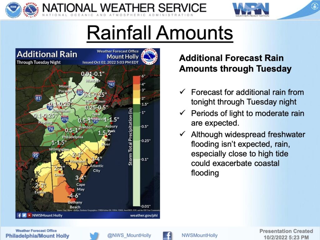
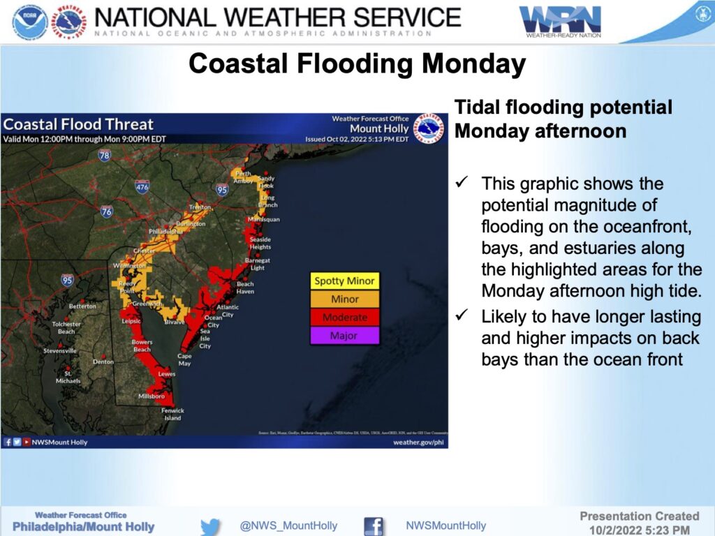
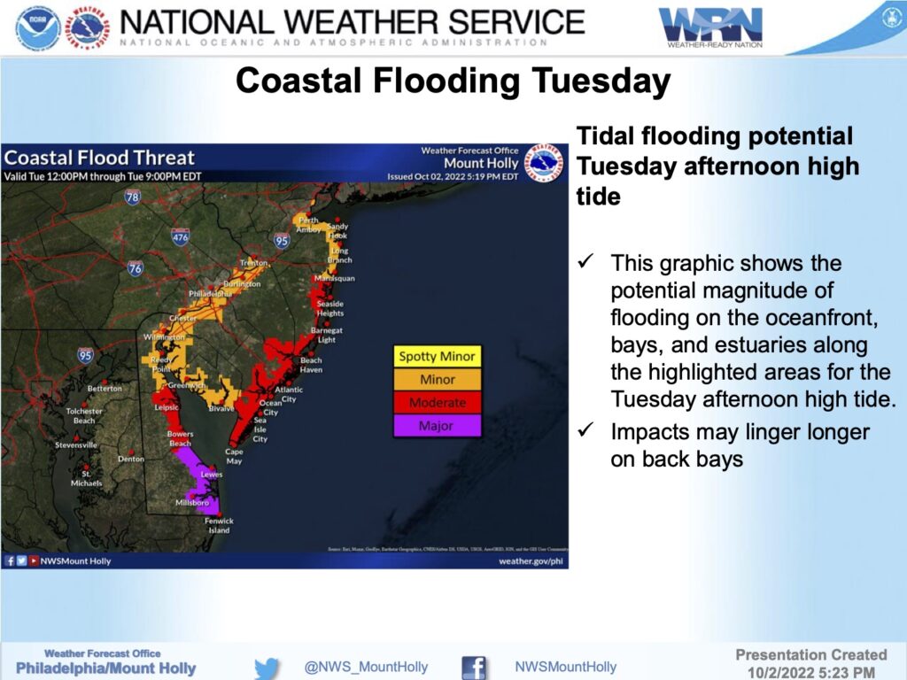
See the graphics for the wind, flooding, and rainfall threats courtesy of the National Weather Service. Also please review the flood risk map prepared by the Borough of Avalon that shows where tidal flooding is likely to occur during minor, moderate, and major tidal flooding events. Updates will be provided when necessary.
Coastal Flood Warning
Coastal Hazard MessageNational Weather Service Mount Holly NJ402 PM EDT Sun Oct 2 2022 …COASTAL FLOOD WARNING NOW IN EFFECT UNTIL 9 PM EDT TUESDAY… * WHAT…Two to three feet of inundation above ground level in low-lying areas near shorelines and tidal waterways. * WHERE…In Delaware, Inland Sussex. In New Jersey, Cape May. * WHEN…Until 9 PM EDT Tuesday. * IMPACTS…At this level, widespread roadway flooding occurs in coastal and bayside communities and along inland tidal waterways. Many roads become impassable. Some damage to vulnerable structures may begin to occur. At this level, flooding may become severe enough to cause structural damage along with widespread roadway flooding in coastal and bayside communities, and near inland tidal waterways. Some locations may become isolated by the flood waters. * ADDITIONAL DETAILS…The worst impacts will be with the afternoon high tides Monday and Tuesday. Back bays may have worse and longer lasting impacts than the oceanfront. PRECAUTIONARY/PREPAREDNESS ACTIONS… Take the necessary actions to protect flood-prone property. Iftravel is required, do not drive around barricades or throughwater of unknown depth.
