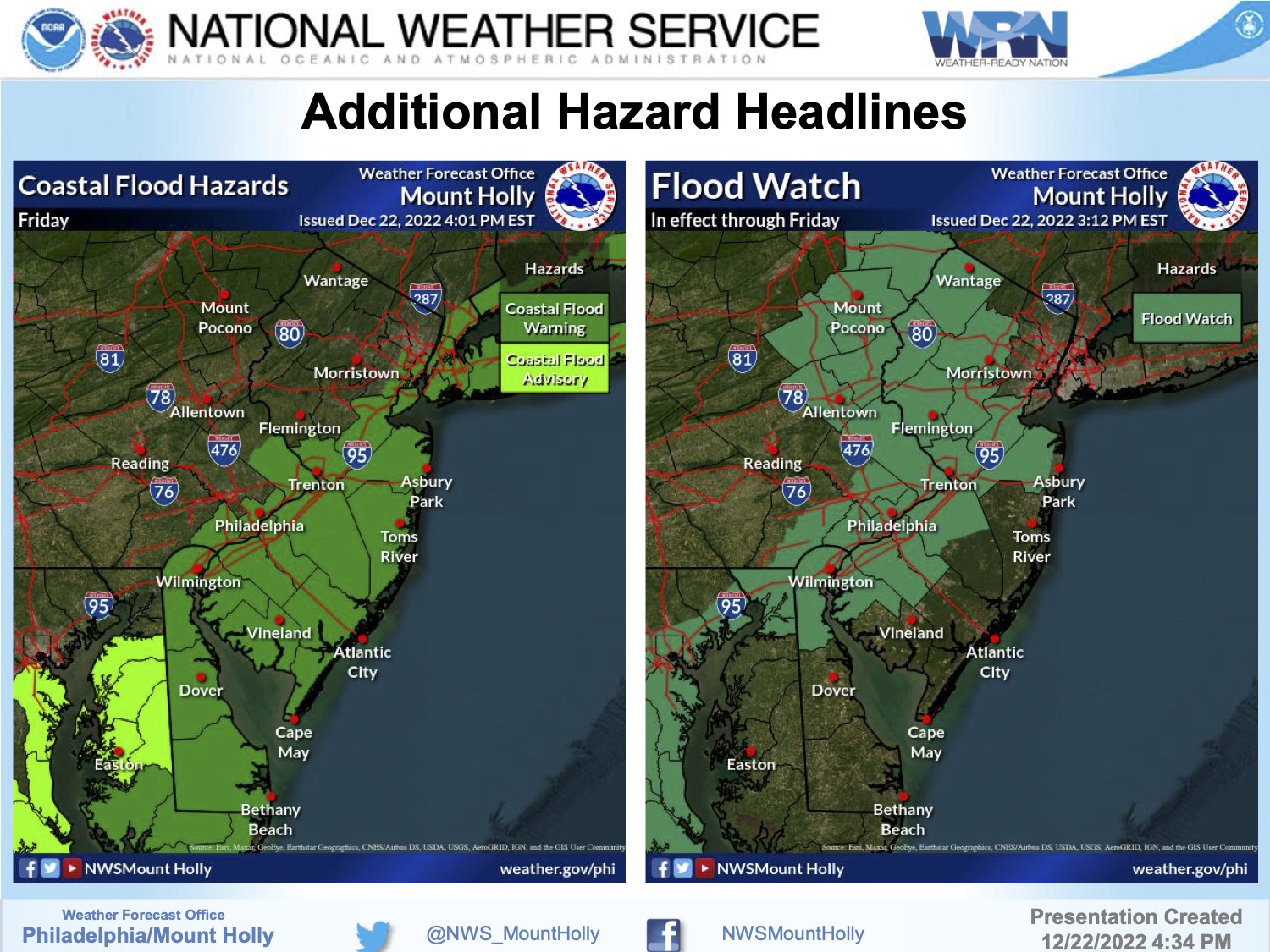
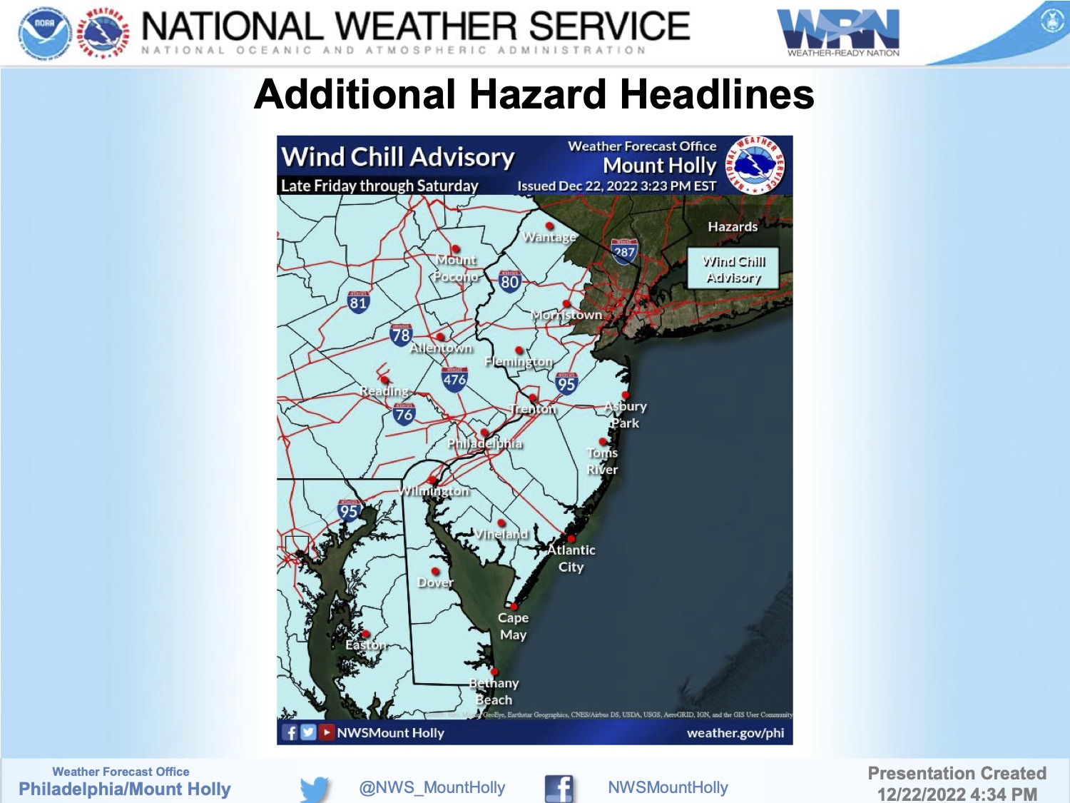
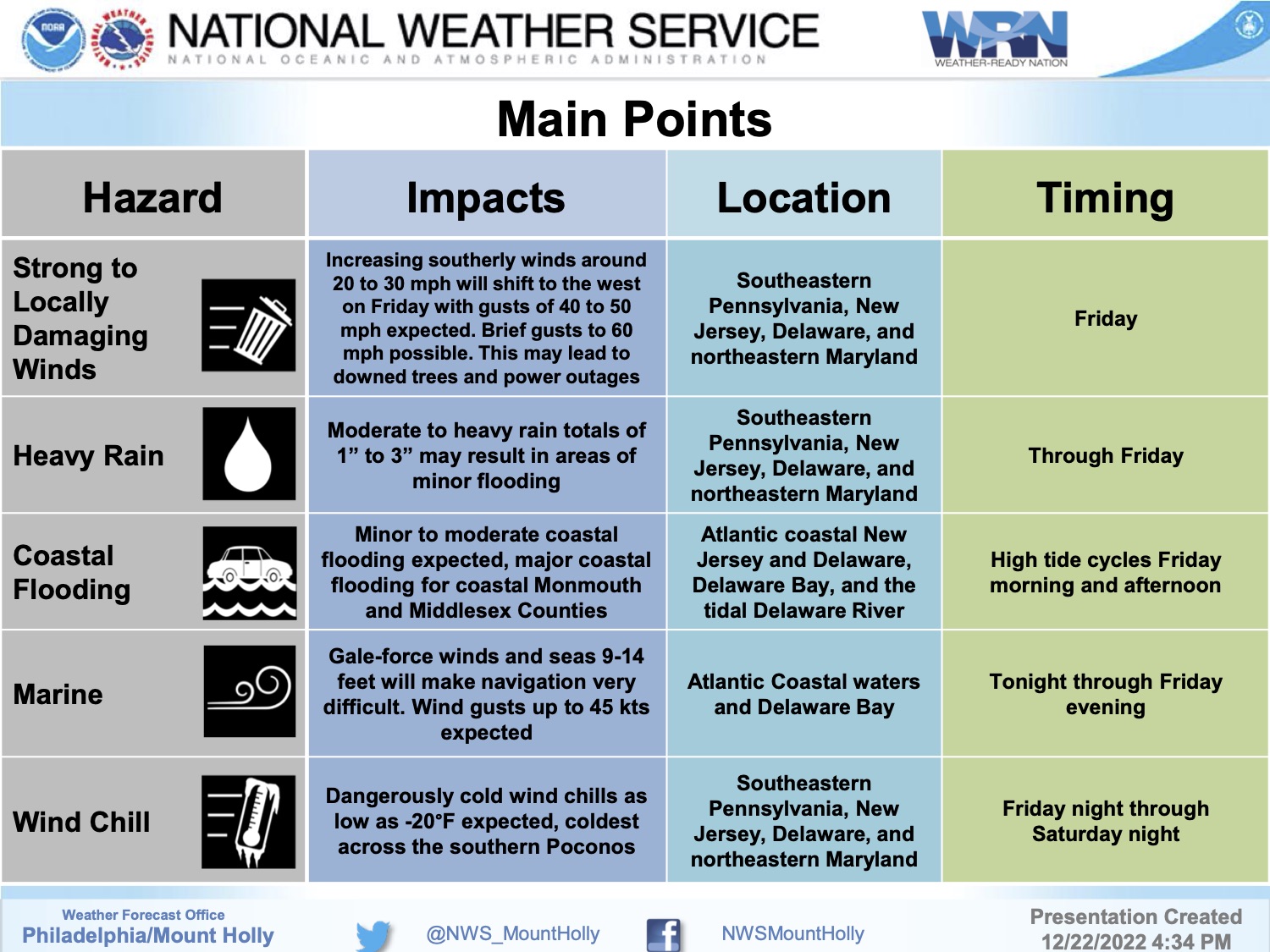
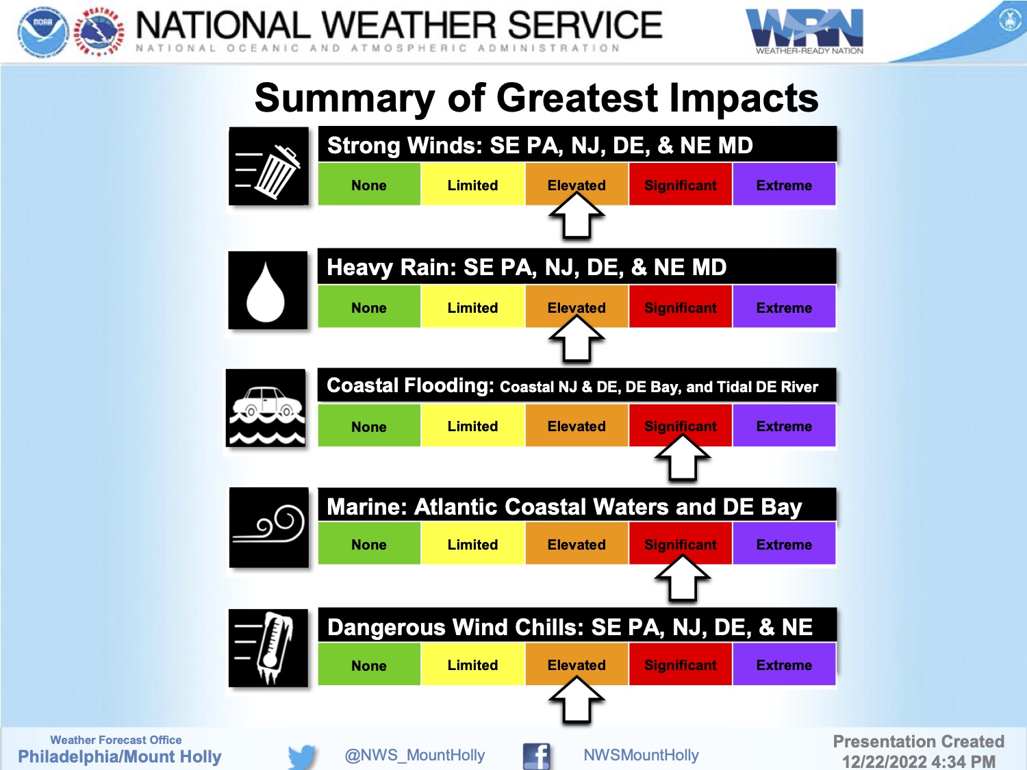
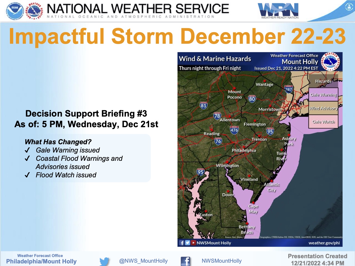
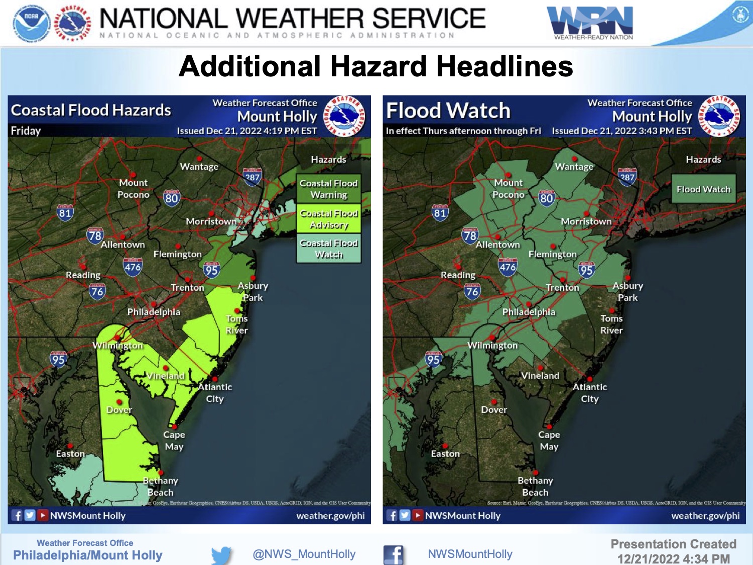
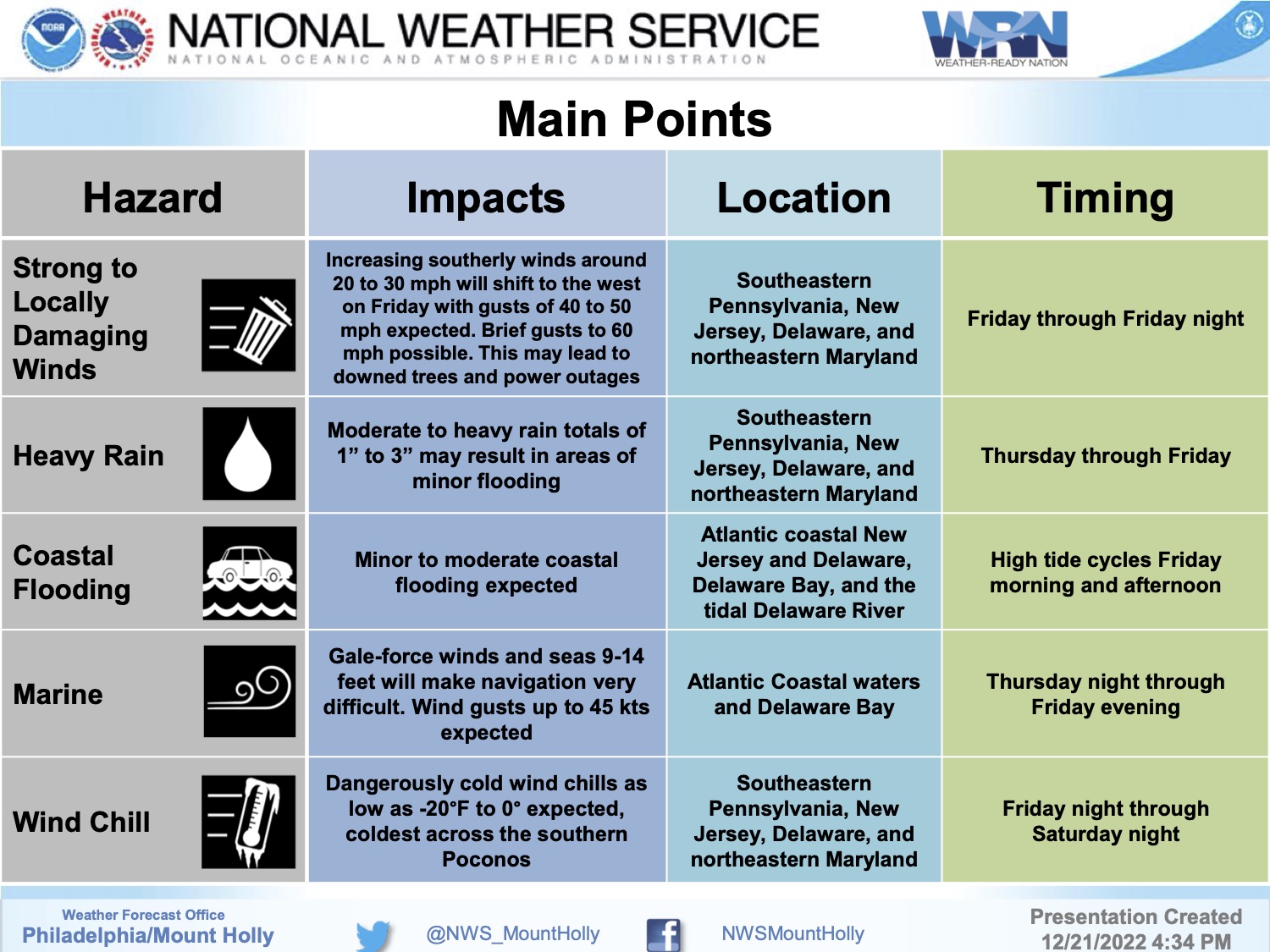
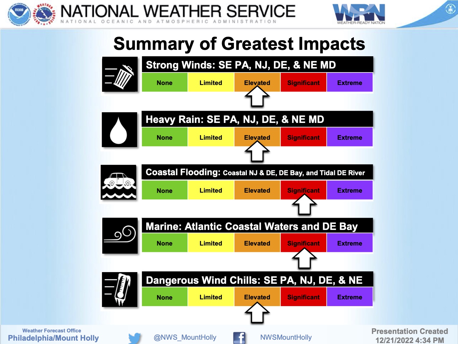
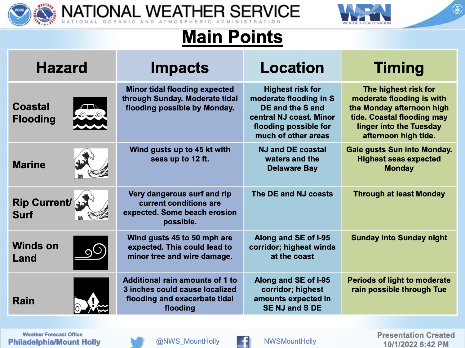
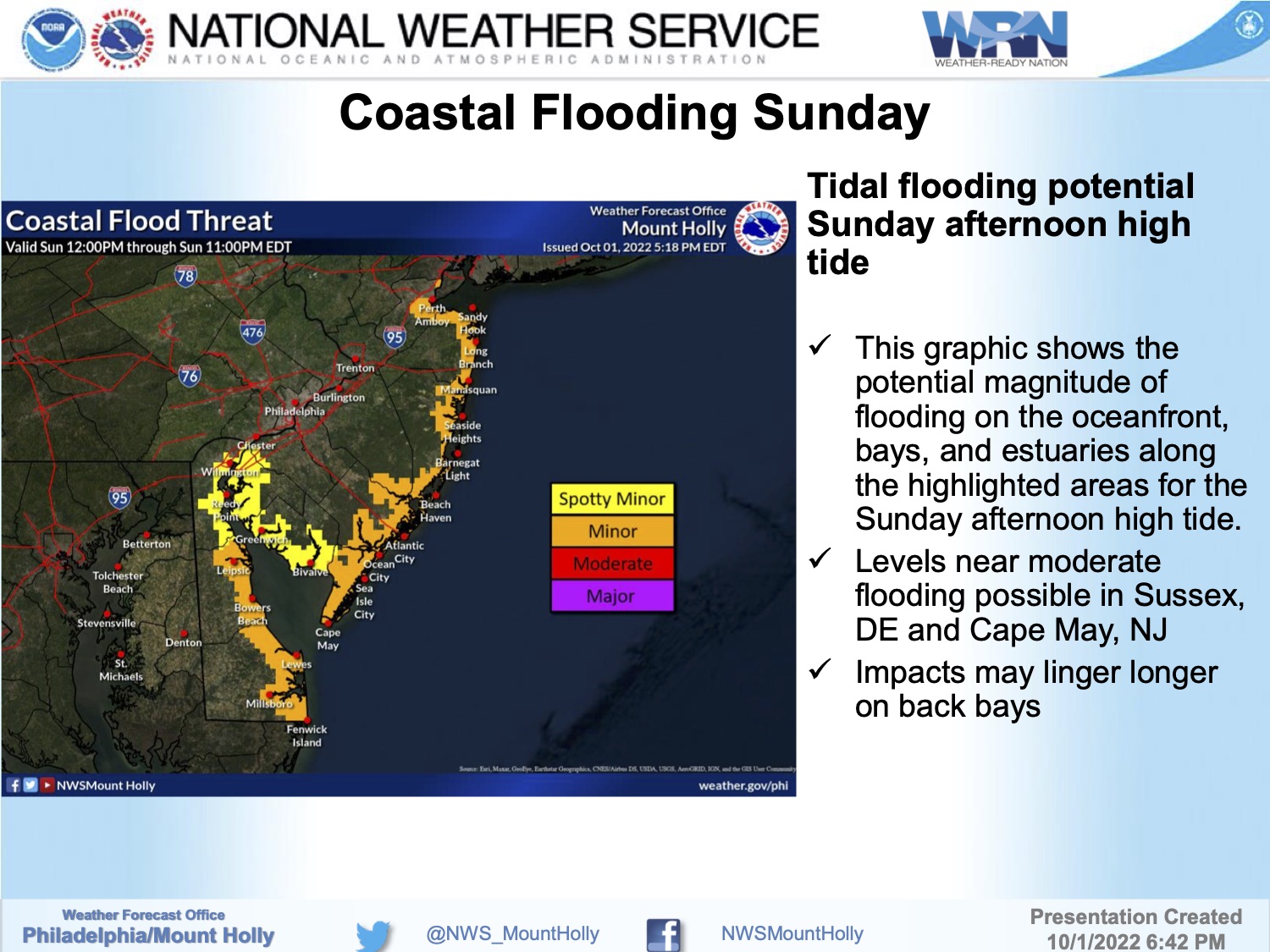
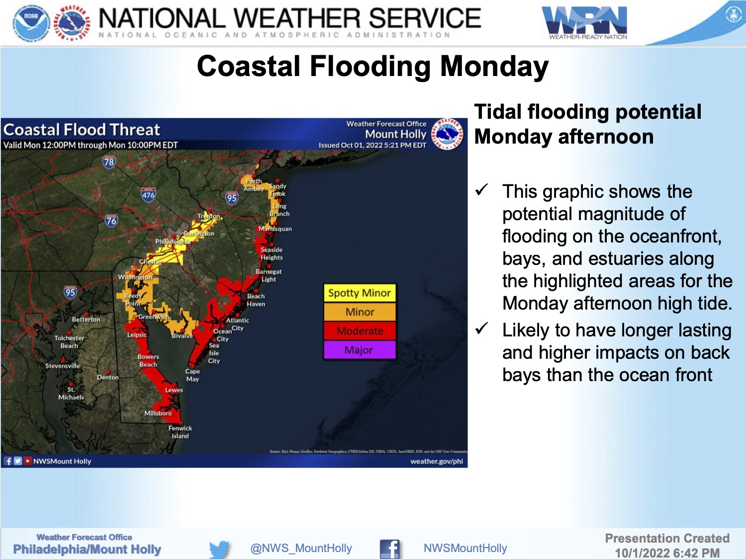
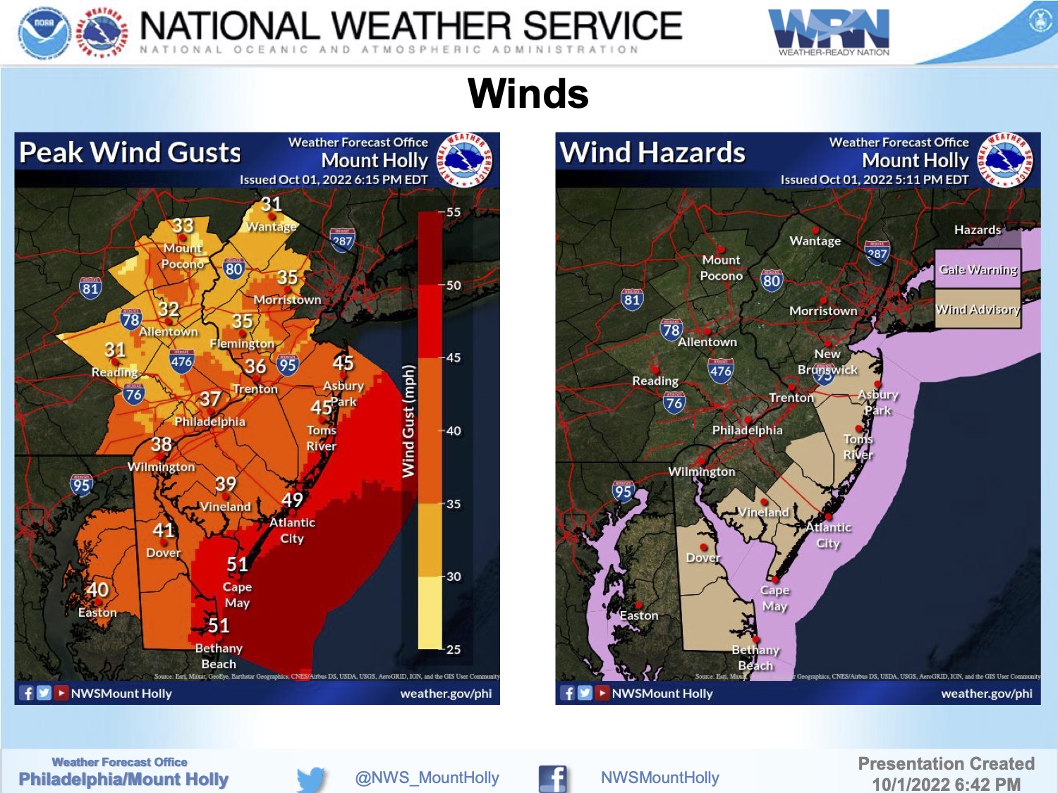
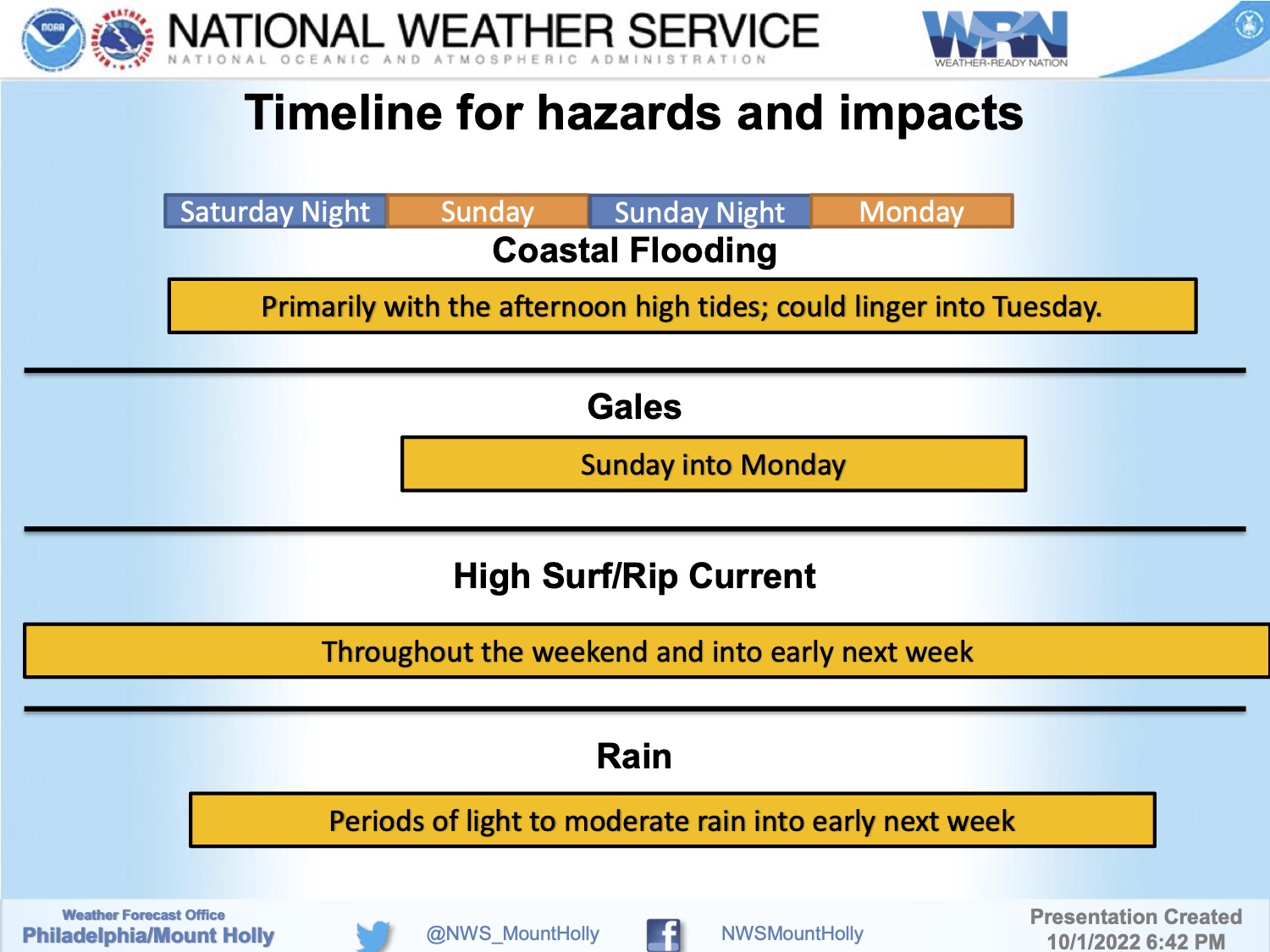
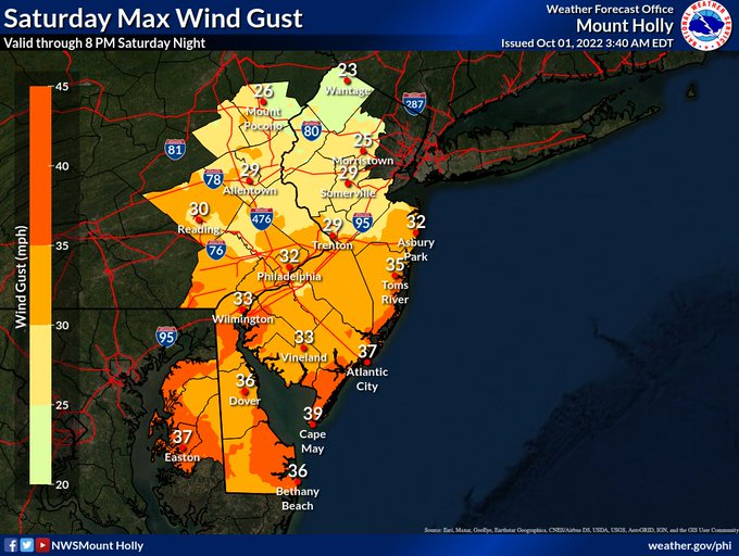
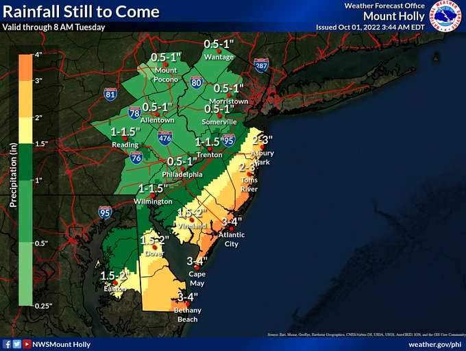
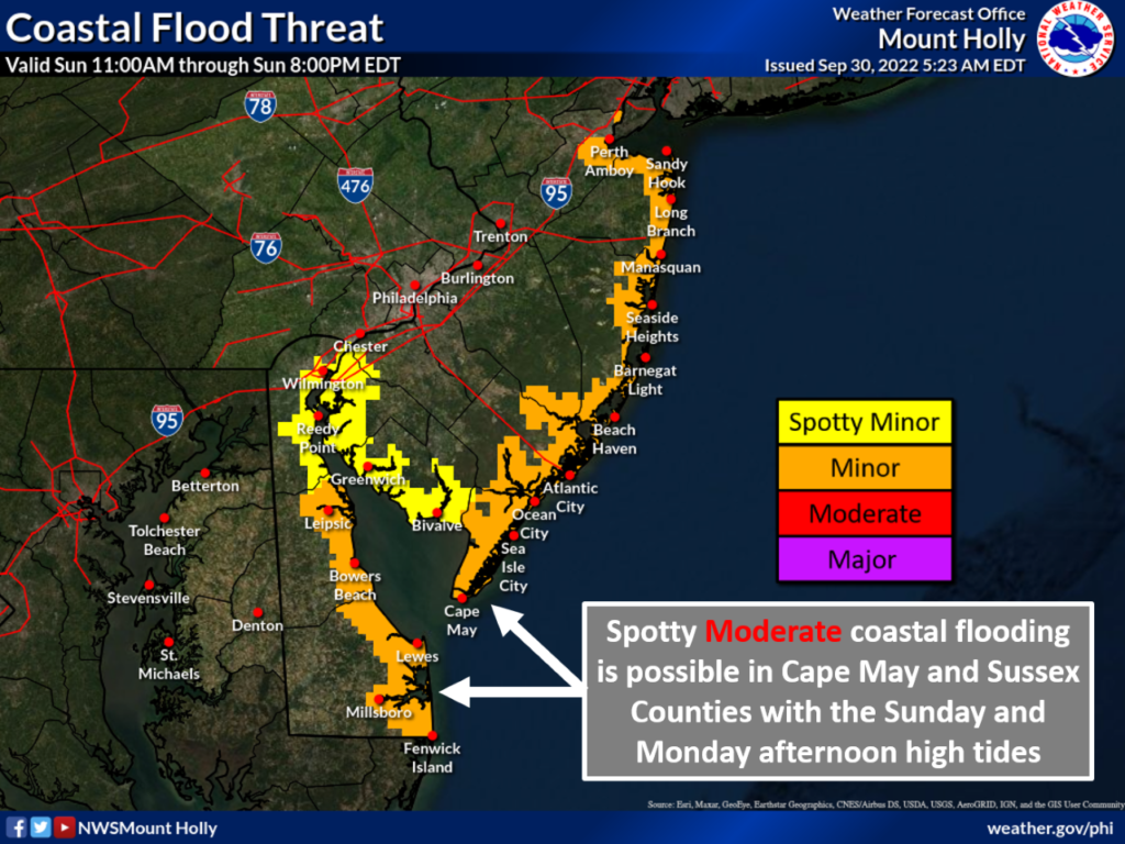
Thursday, December 22nd, 6:09pm: Coastal Flood Warning, Strong Winds to Come, Very Cold Wind Chills
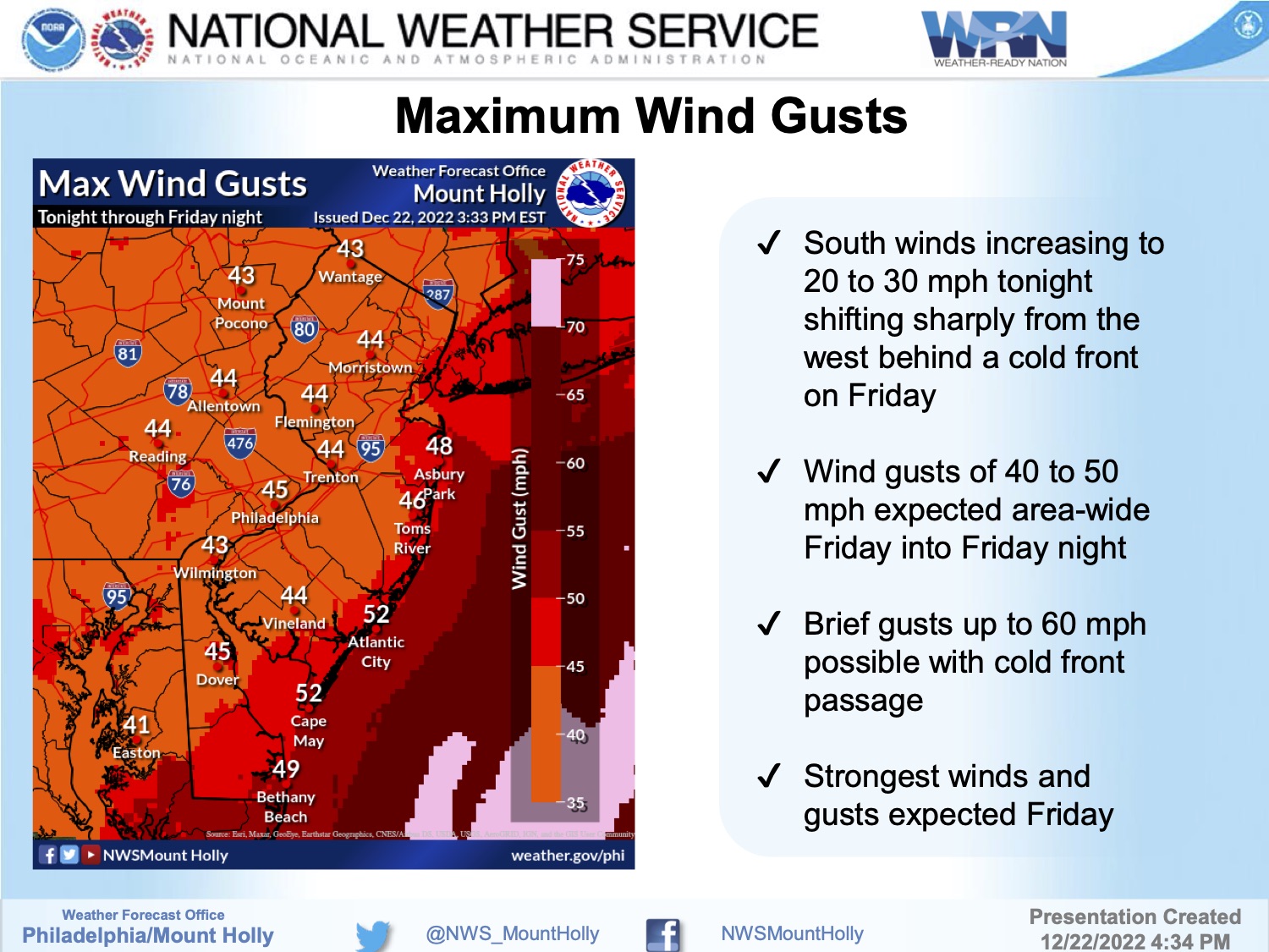
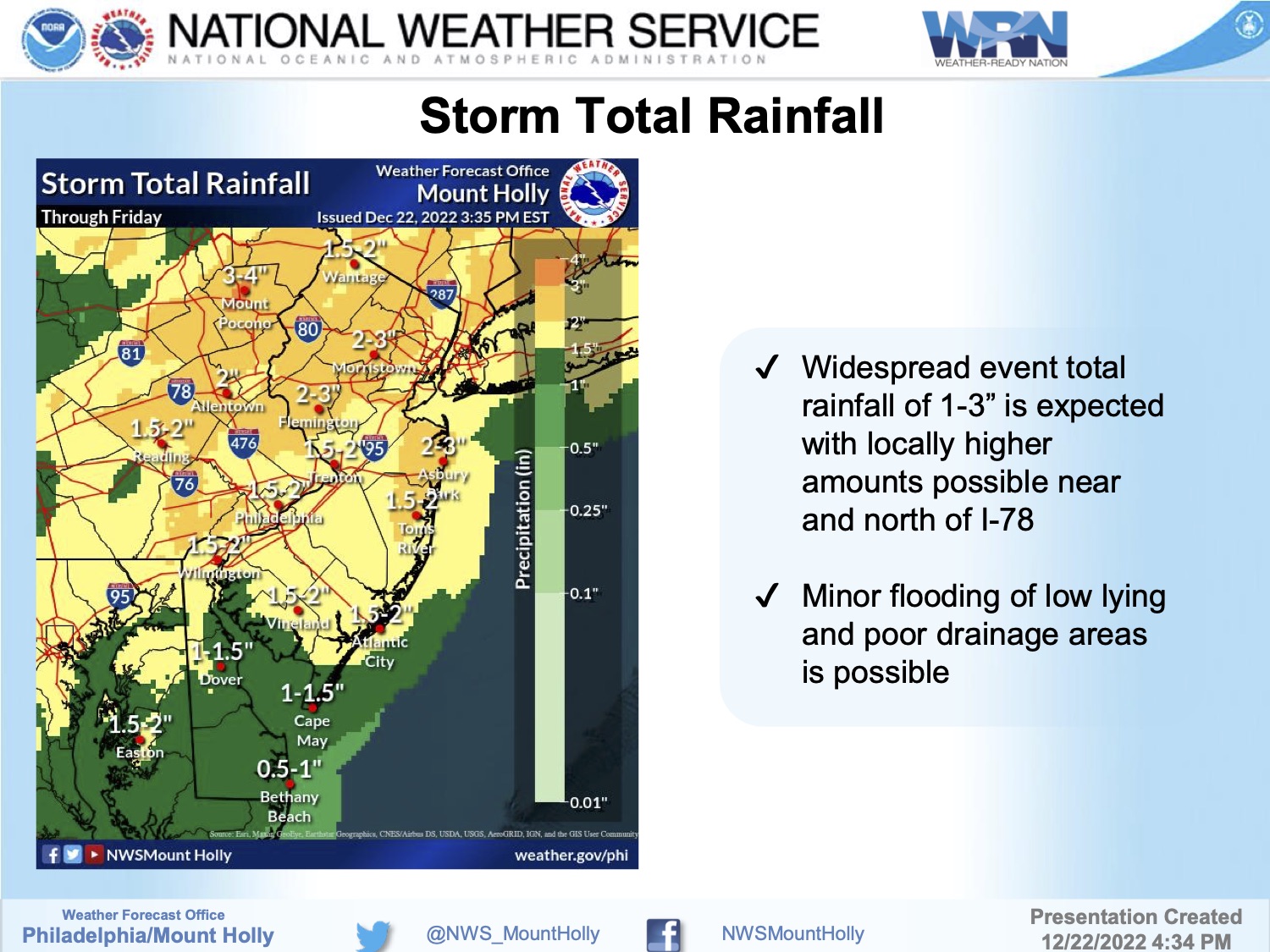
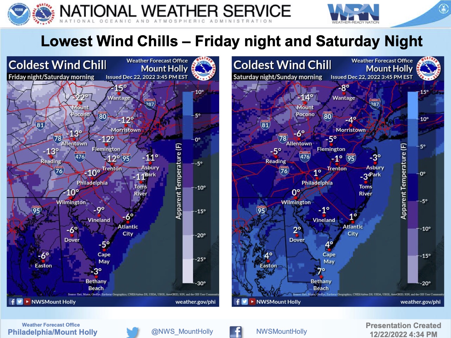
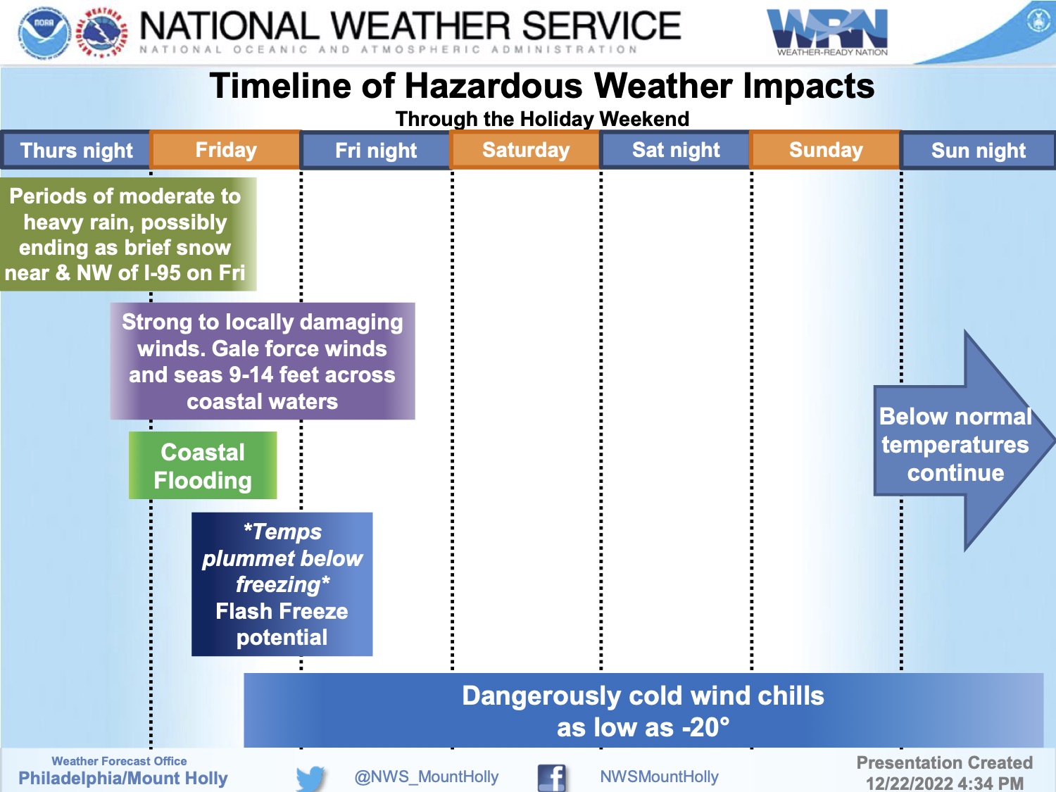
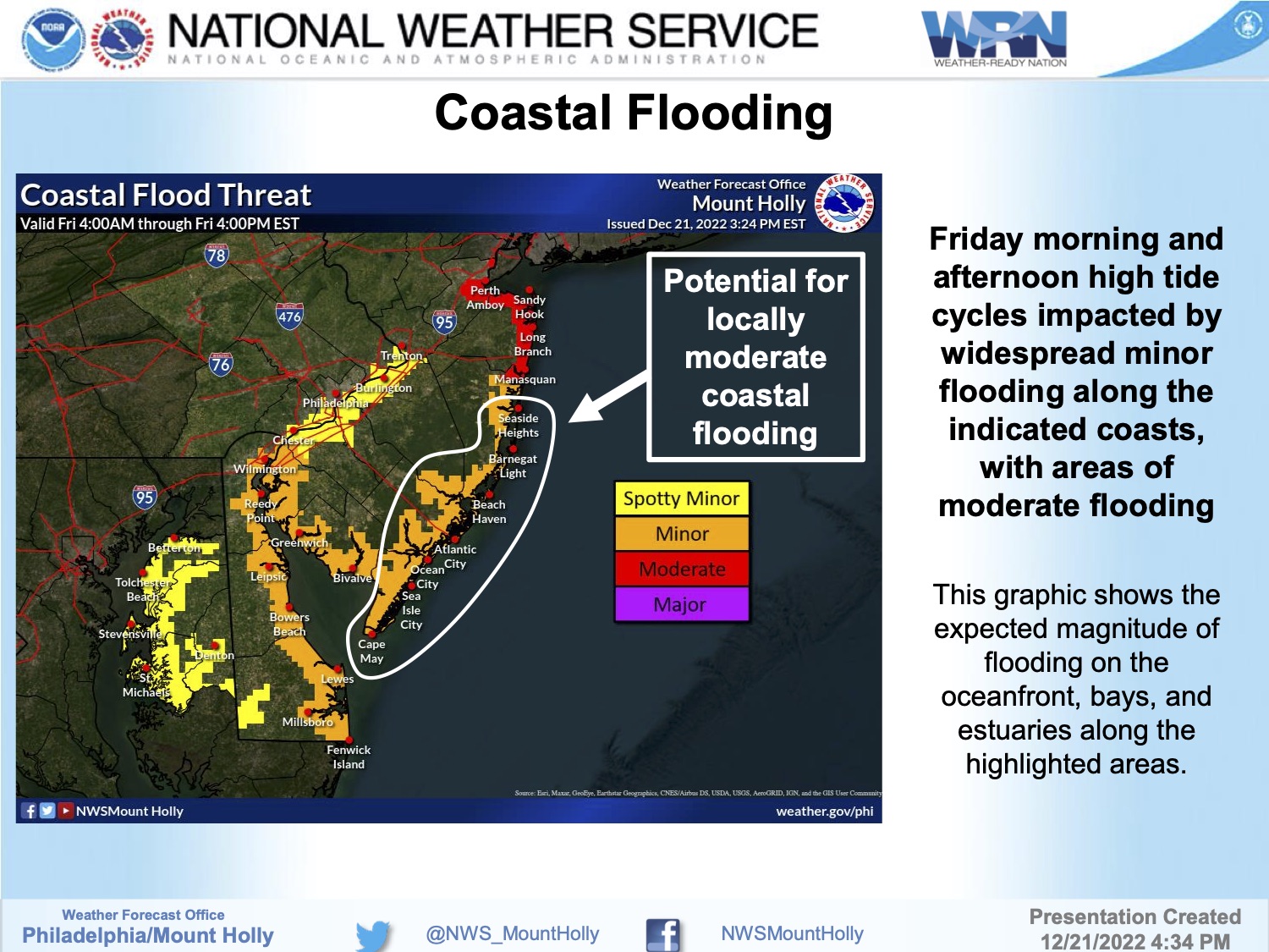
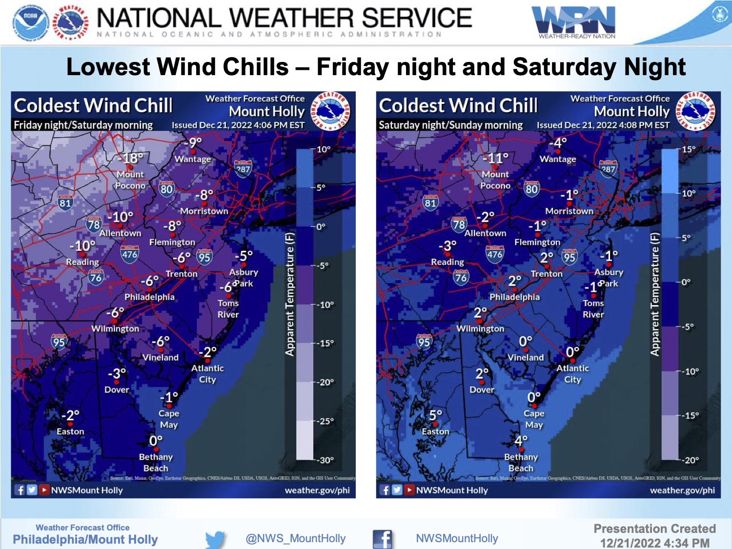
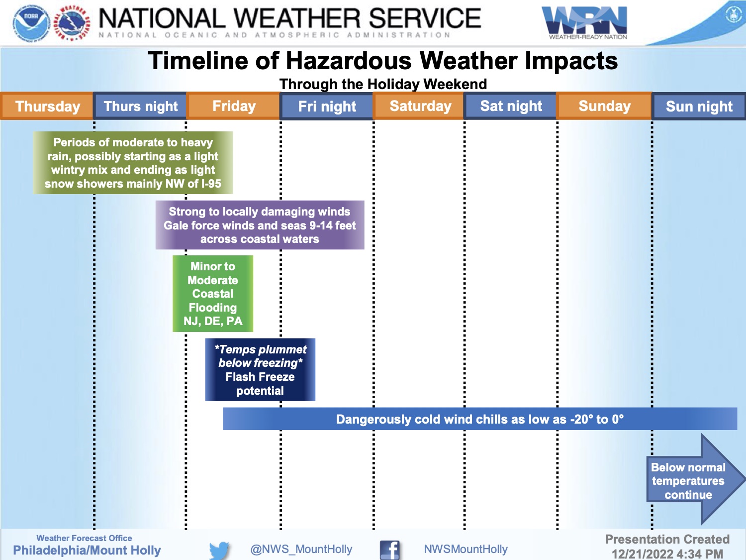
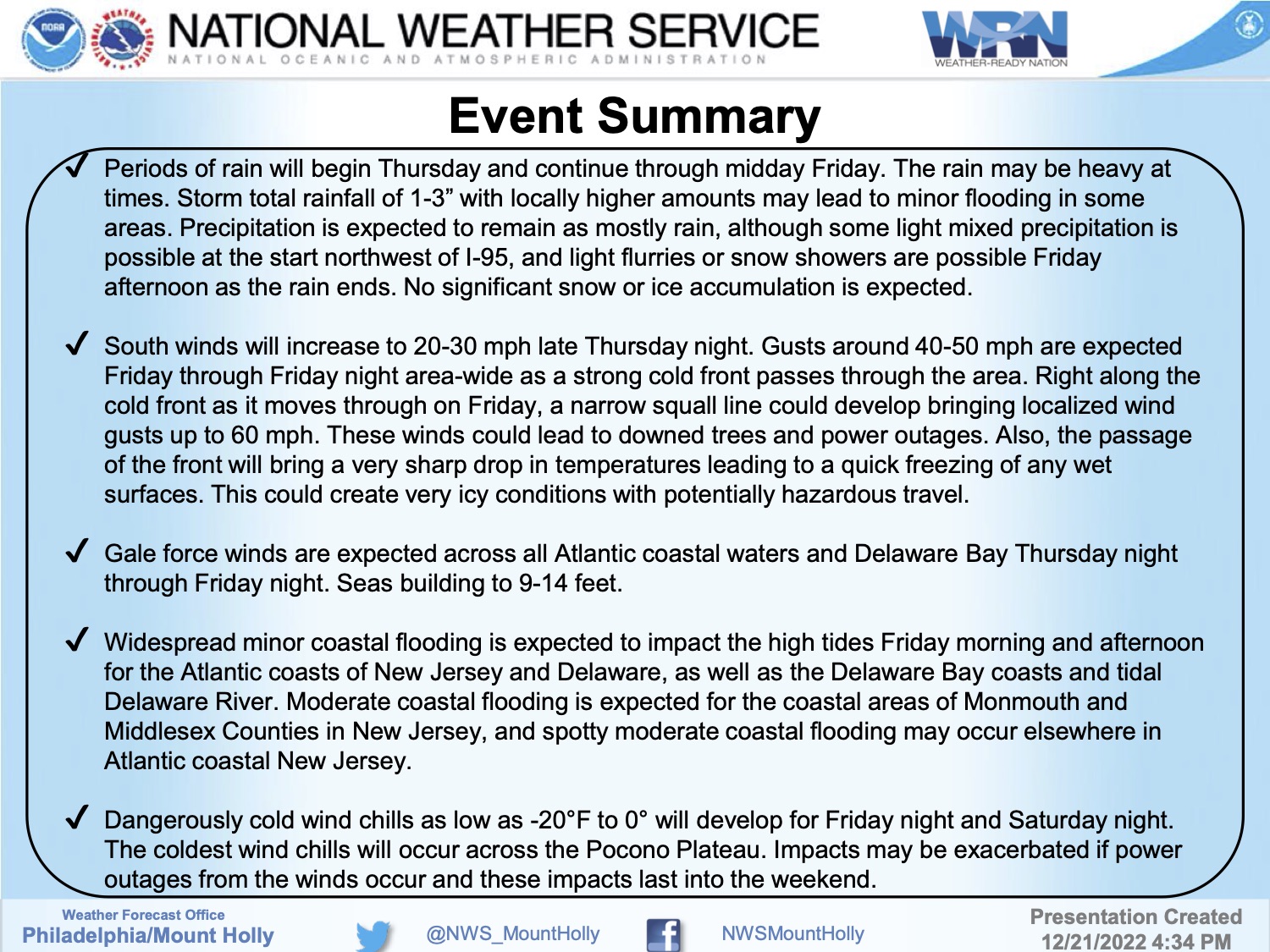
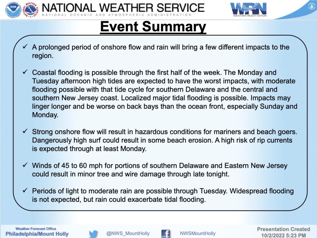
The National Weather Service has provided this briefing package for this winter storm event. It will bring strong winds, rain, minor to moderate tidal flooding, and very cold weather for the Christmas weekend. Please note that high tides on Friday, December 23rd at the Townsend’s Inlet Bridge are at 7:25am, and again at 7:49pm. If you experience a power outage, contact Atlantic City Electric at 1-800-833-7476. A Coastal Flood Warning, a Wind Advisory, and a Wind Chill Advisory are all in effect for Avalon.