The Avalon Office of Emergency Management presents this weather briefing for you regarding a significant coastal storm that will impact our region Friday-Saturday, September 22nd-23rd. Please be aware of the impacts of this storm, including flooding from rainfall and tidal flooding, strong winds, and heavy rain. A High Wind Warning is in effect; a Coastal Flood Watch is in effect which will likely become a Coastal Flood Warning for Saturday’s high tide, which occurs in Avalon at approximately 3:00pm. Please secure outdoor objects now. If you live in an area of Avalon that is prone to flooding from either heavy rainfall or tidal flooding, consider moving your vehicle to higher ground on Friday. Contractors are required to secure their job sites. Beach erosion and rough surf are expected. Please continue to follow updates on traditional Avalon media channels, and on traditional media. If you have any emergency, dial 911. Do NOT drive on any flooded street. If you experience a power outage during this storm event, call Atlantic City Electric’s outage number at 1-800-833-7476. Be prepared for this storm event; updates will be provided as warranted, thank you.
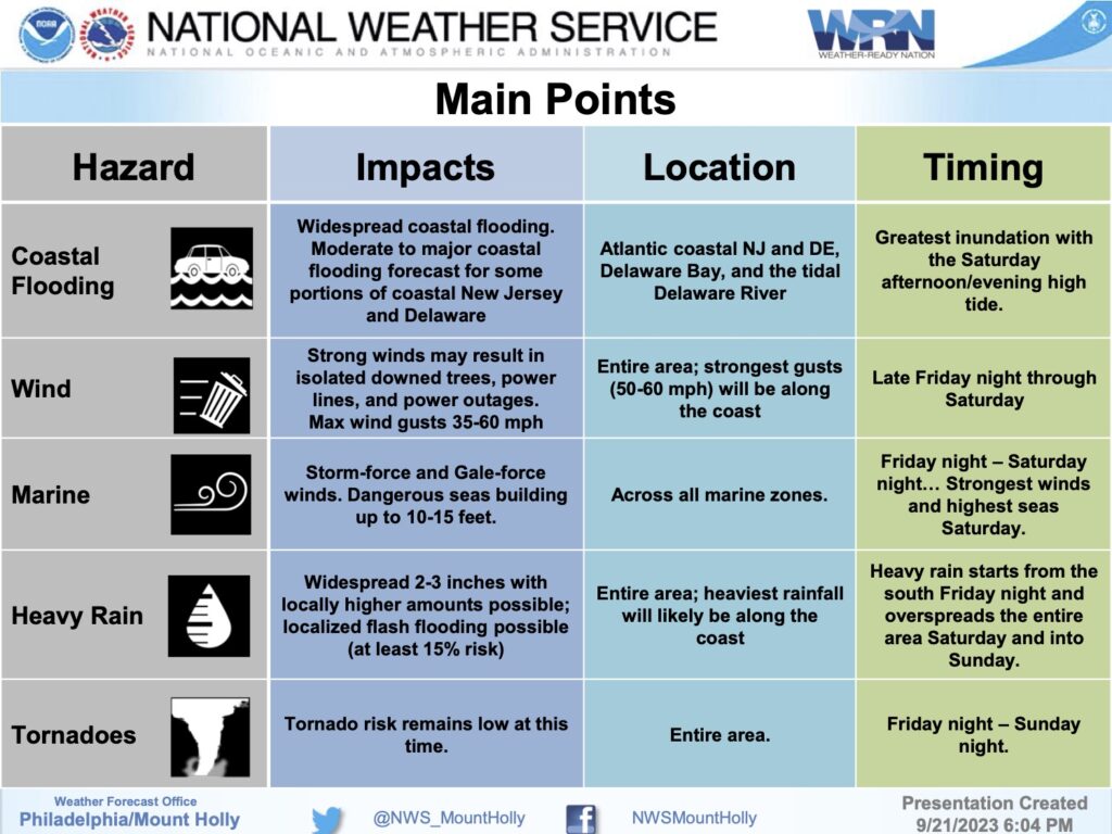
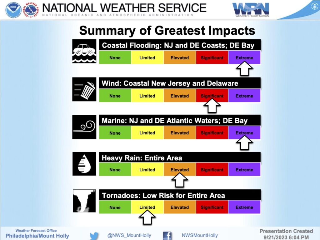
1 – A coastal storm will impact our region this weekend, starting Friday Night and lasting through Sunday. The most significant impacts will be to areas along the immediate coast on Saturday, in the form of coastal flooding and strong winds, along with periods of heavy rain.
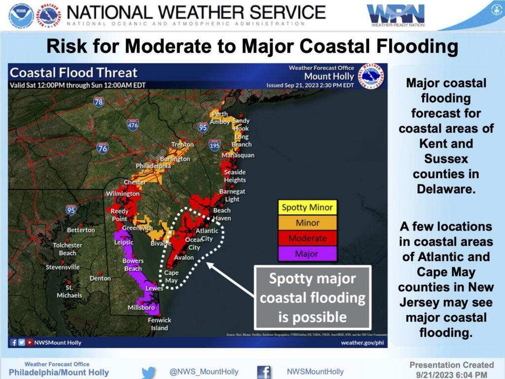
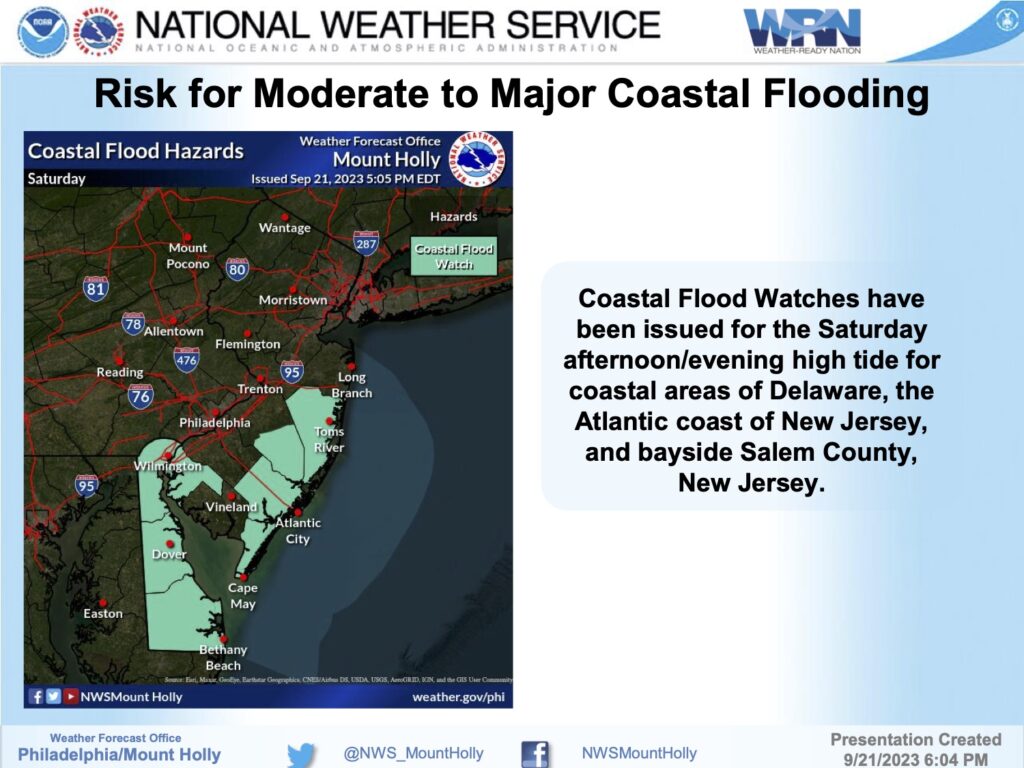
2 – MAJOR coastal flooding is possible along coastal areas of Kent and Sussex Counties in Delaware. Moderate coastal flooding is possible along southern coastal areas of New Jersey; some major coastal flooding cannot be ruled out in spots for Cape May and Atlantic counties in New Jersey. The greatest concern for coastal flooding will likely occur during the Saturday afternoon high tide, around 2-3pm, but could linger into following high tide cycles on Sunday.
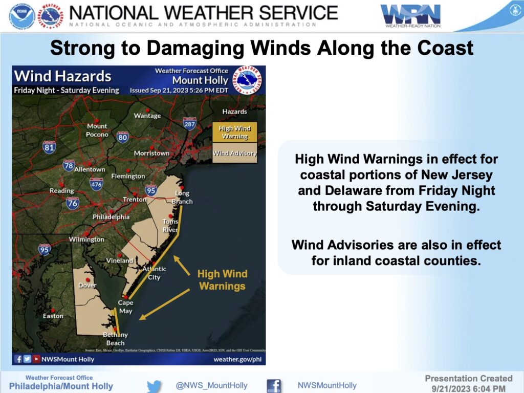
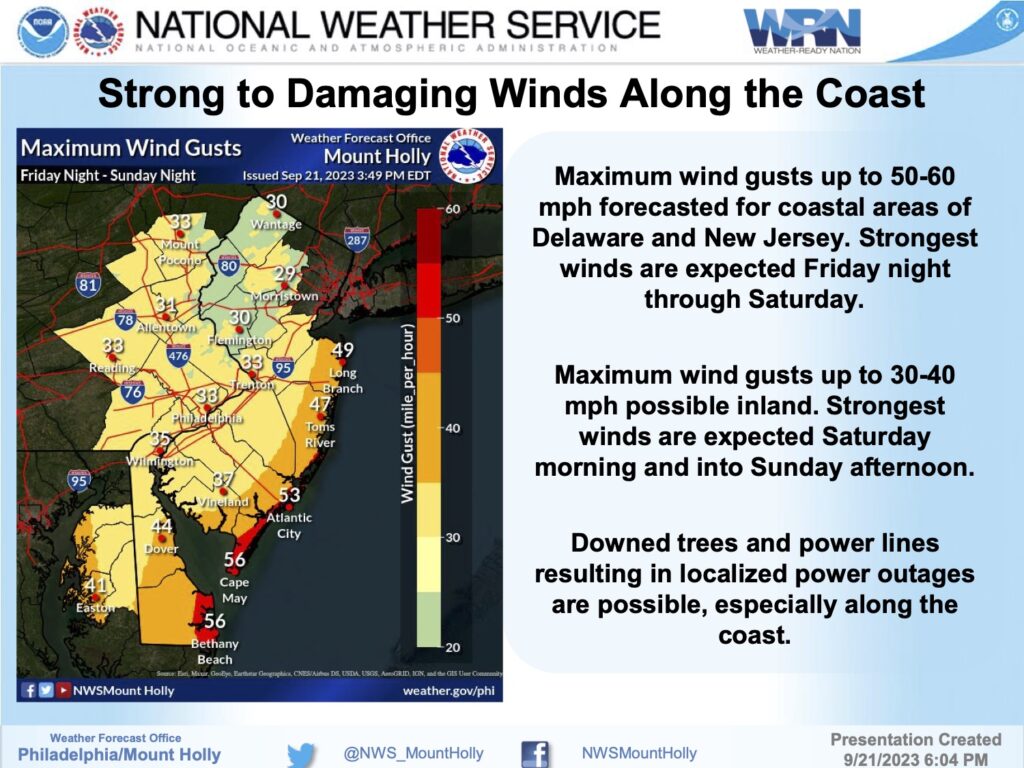
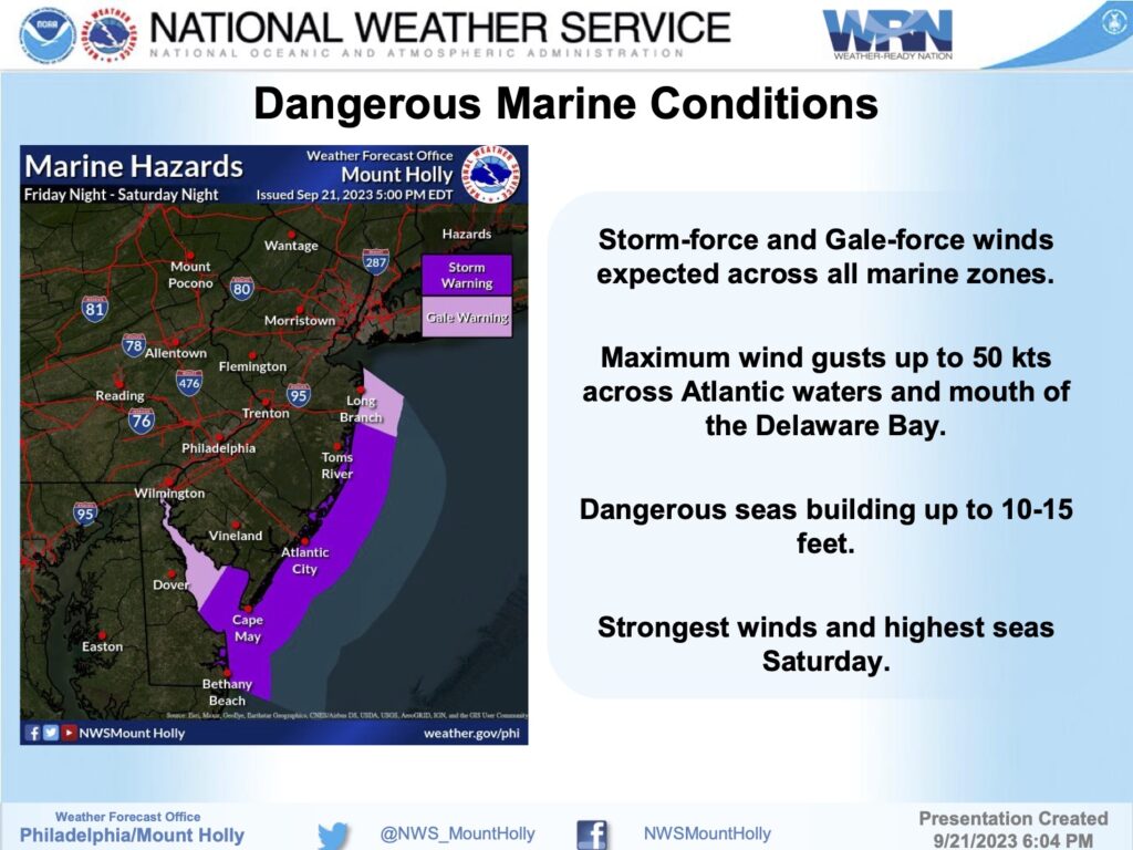
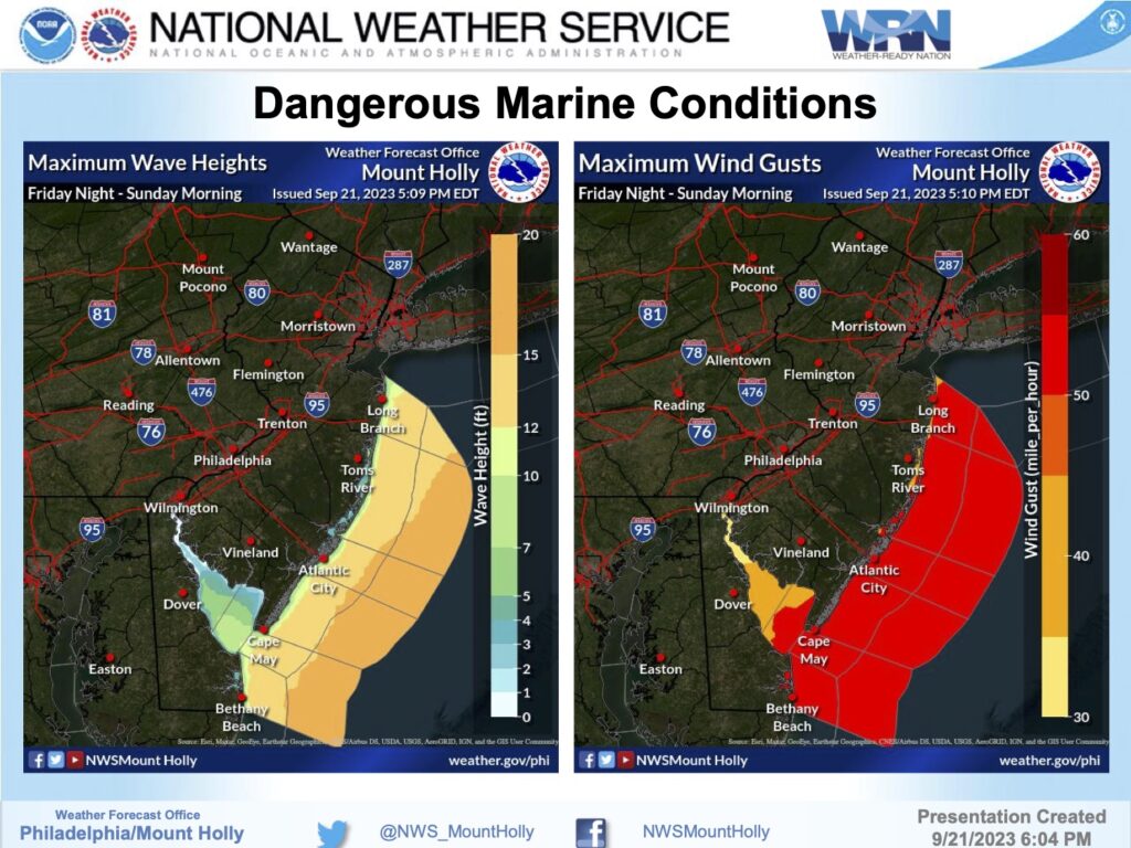
3 – Strong onshore winds are forecast on Saturday. Gusts 50-60 mph are possible across the immediate coastal areas and over the ocean waters; peaking up to 30-40 mph inland. Combined with coastal flooding, this could result in at least minor beach erosion, along with dangerous rip currents. A High Wind Warning has been issued for the coast with Wind Advisories up further inland for all coastal counties of DE and NJ. For our marine zones, dangerous winds and seas have warranted a Storm Warning and Gale Warnings for all waters.
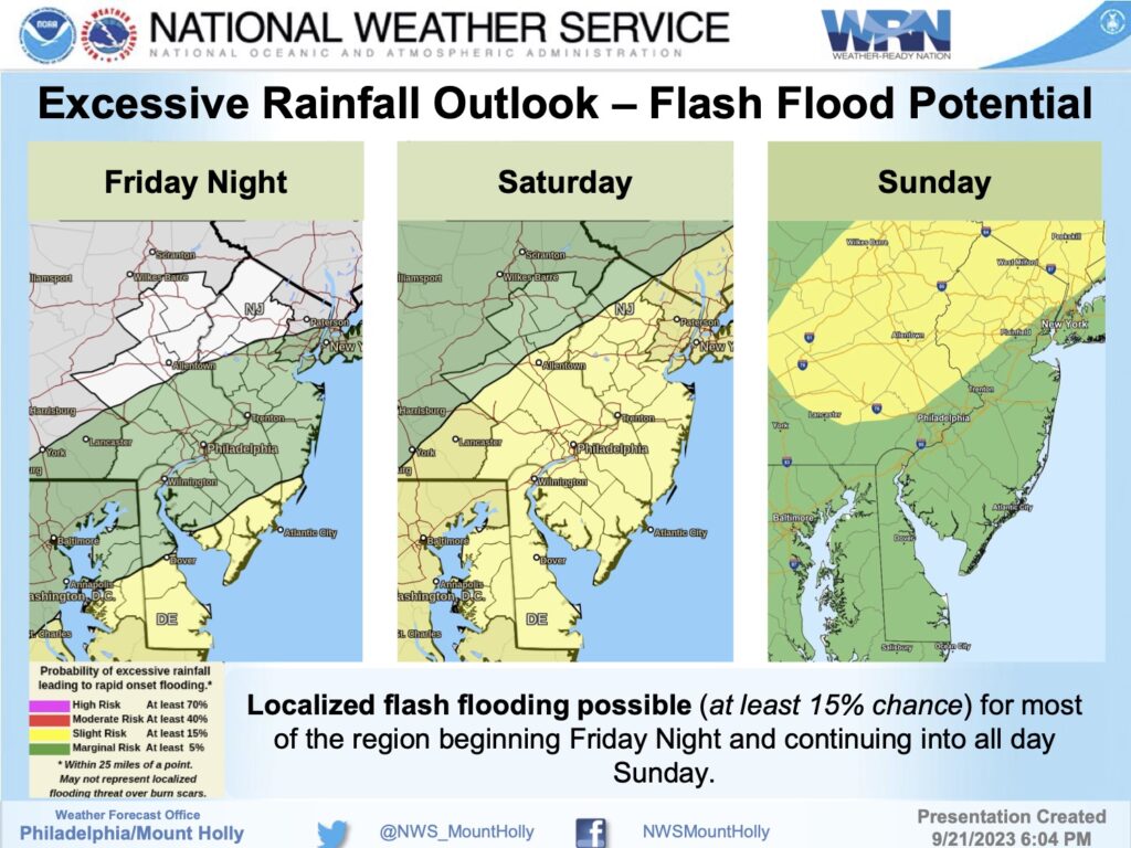
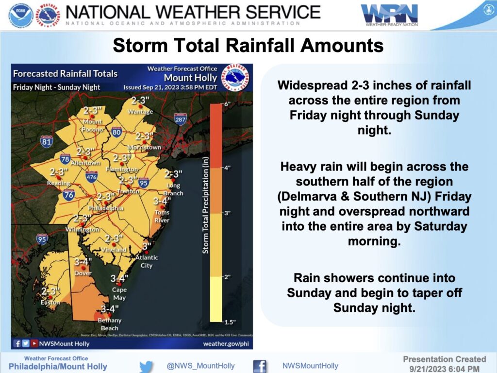
4 – Periods of heavy rain will fall from Friday night into Sunday, with the heaviest during the day on Saturday. Locally over 2 to 3 inches of rain may fall across portions of the region with coastal areas seeing 3-4 inches. Amounts may change depending on the exact track of the storm system. Locally heavier amounts will be possible, resulting in a risk for localized flash flooding.
![]()