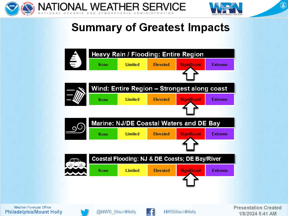
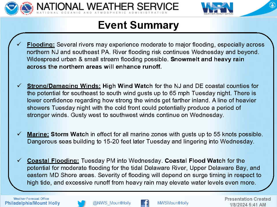
Friday, August 9th, 8:08am: Tornado Watch for Avalon, Threat of Rip Currents and High Surf
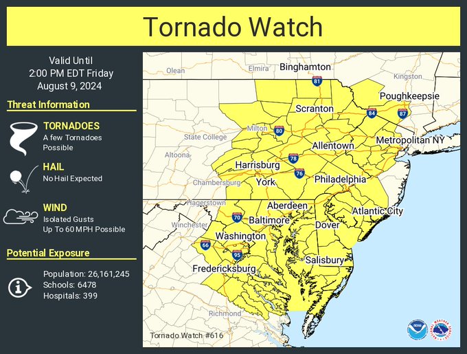
FRIDAY, AUGUST 9TH: TORNADO WATCH FOR AVALON UNTIL 2:00PM
TORNADO WATCH OUTLINE UPDATE FOR WT 616
NWS STORM PREDICTION CENTER NORMAN OK
615 AM EDT FRI AUG 9 2024
TORNADO WATCH 616 IS IN EFFECT UNTIL 200 PM EDT FOR THE
FOLLOWING LOCATIONS
NJC001-005-007-009-011-013-015-019-021-023-027-031-033-035-037-
039-041-091800-
/O.NEW.KWNS.TO.A.0616.240809T1015Z-240809T1800Z/
NJ
. NEW JERSEY COUNTIES INCLUDED ARE
ATLANTIC BURLINGTON CAMDEN
CAPE MAY CUMBERLAND ESSEX
GLOUCESTER HUNTERDON MERCER
MIDDLESEX MORRIS PASSAIC
SALEM SOMERSET SUSSEX
UNION WARREN