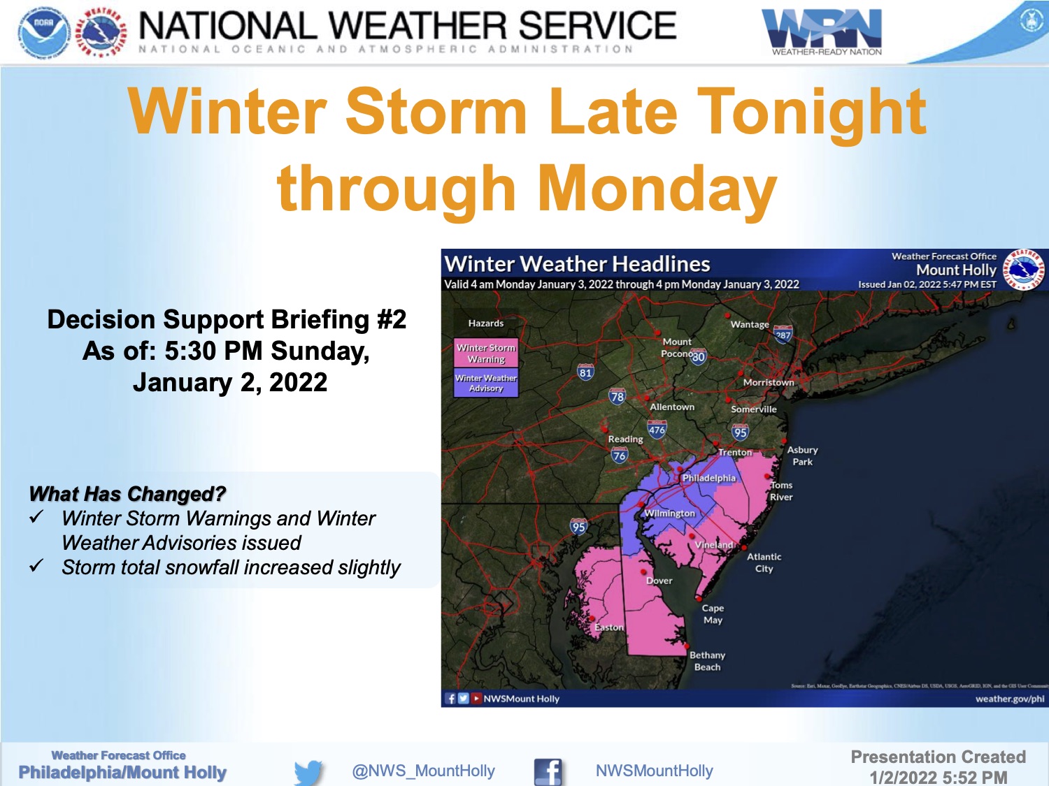
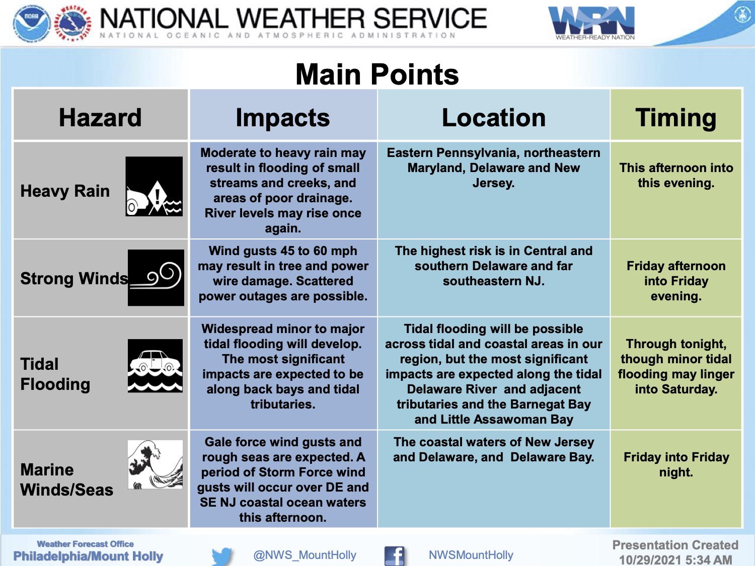
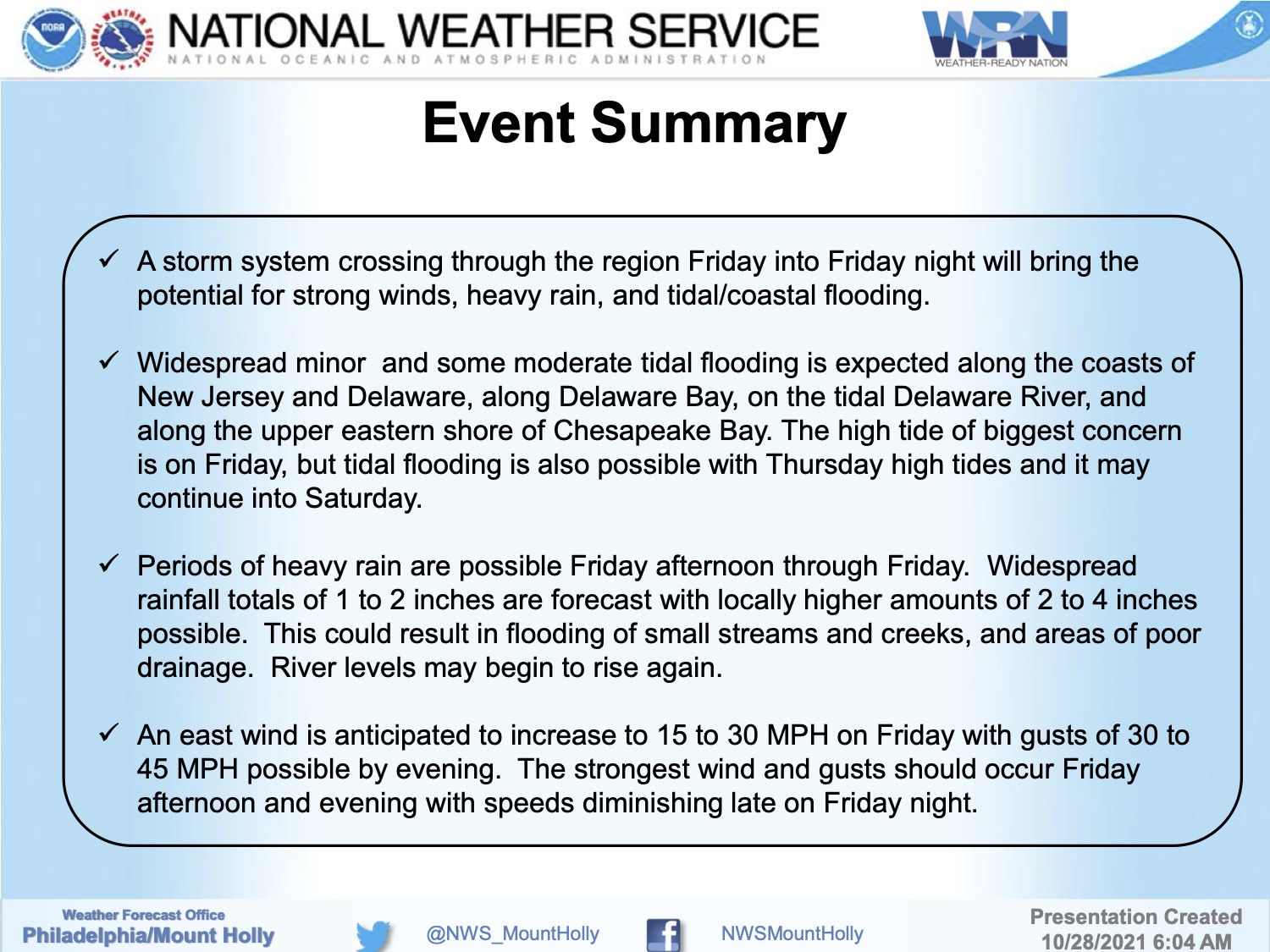
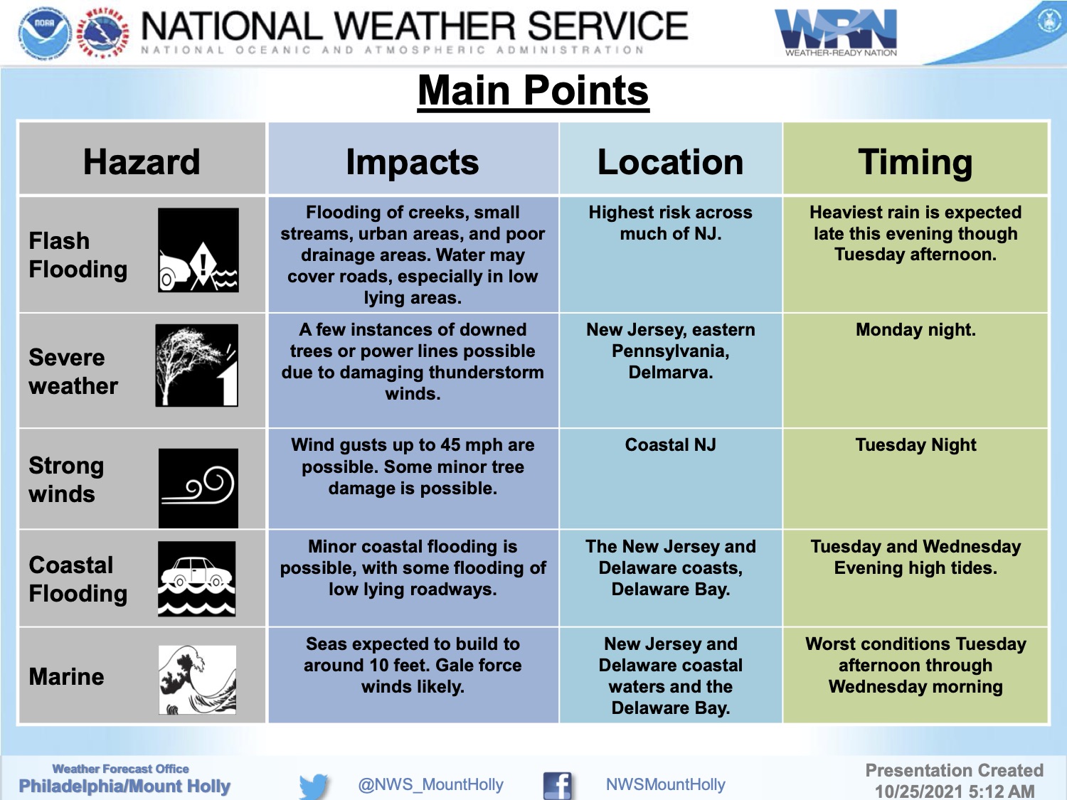
Monday, January 3rd, 6:48am: Winter Storm Warning and Coastal Flood Warning, Avalon Buildings Closed
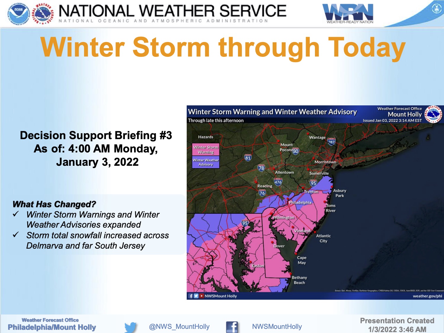
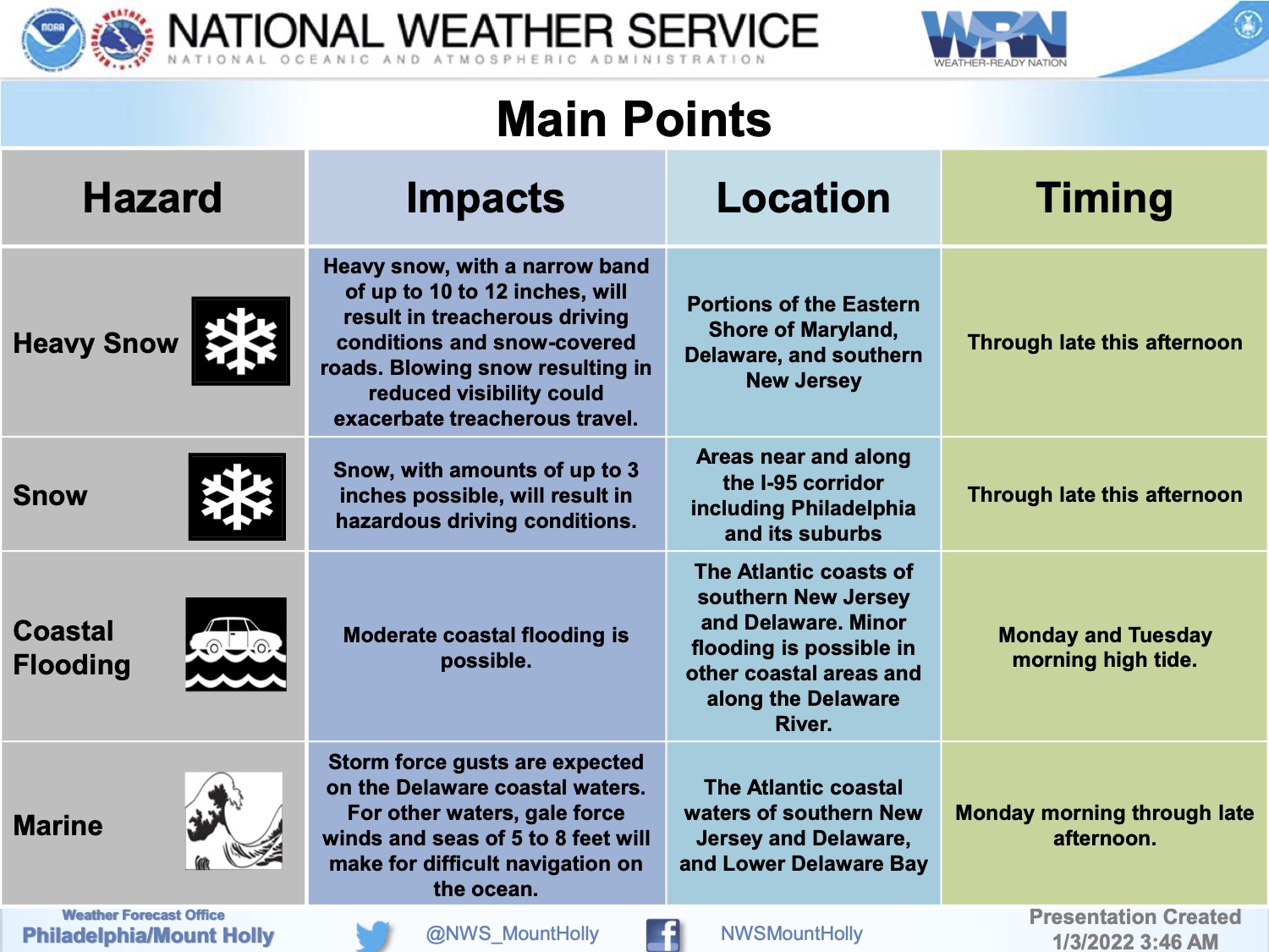

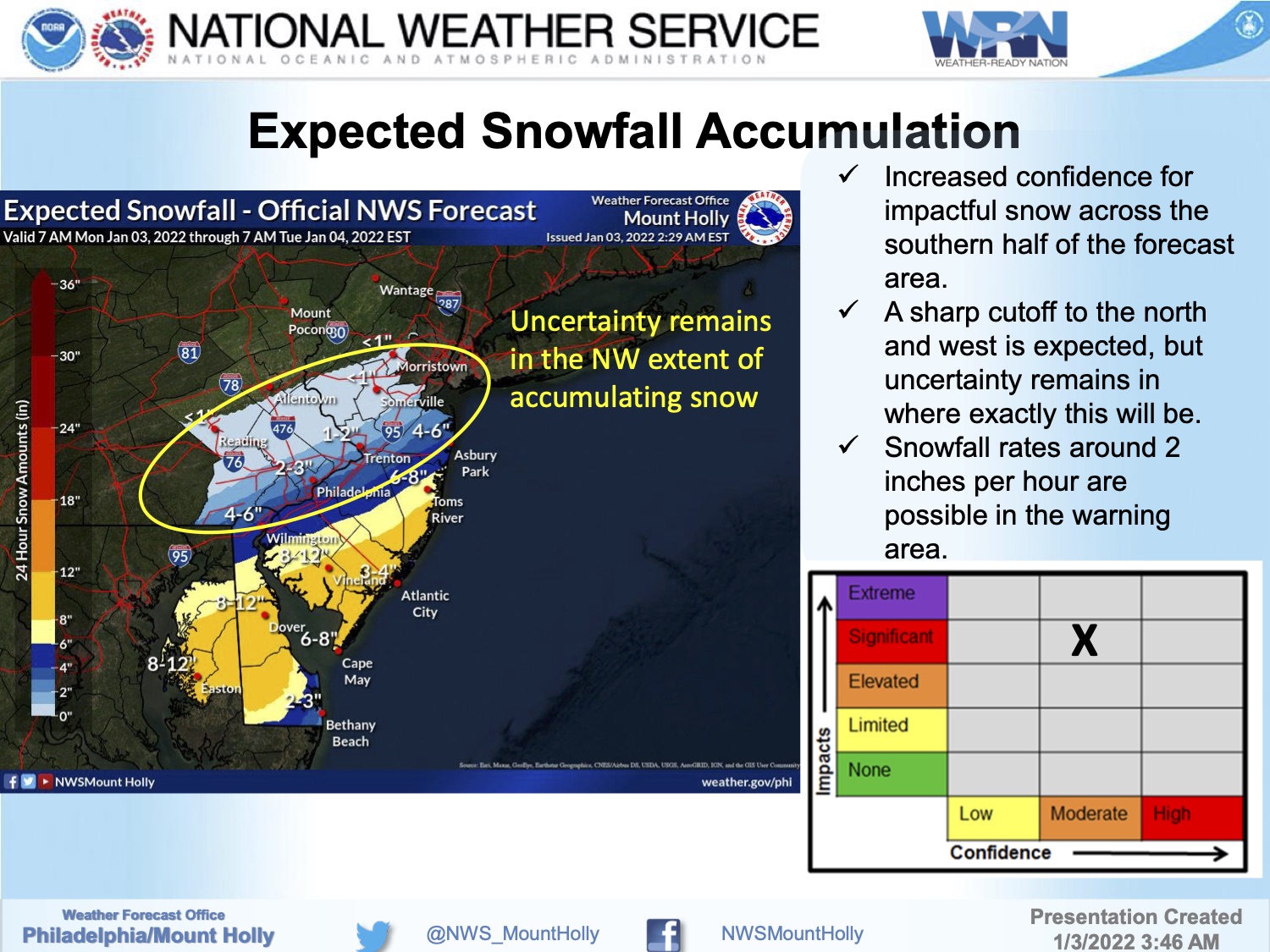

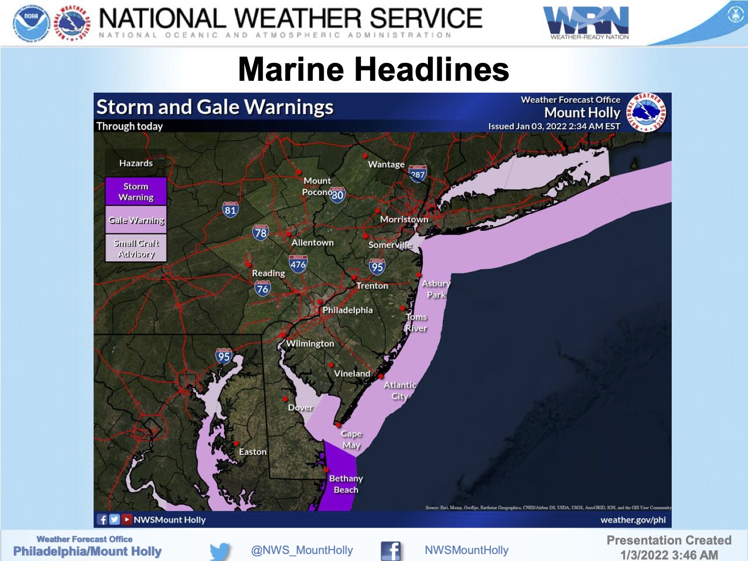
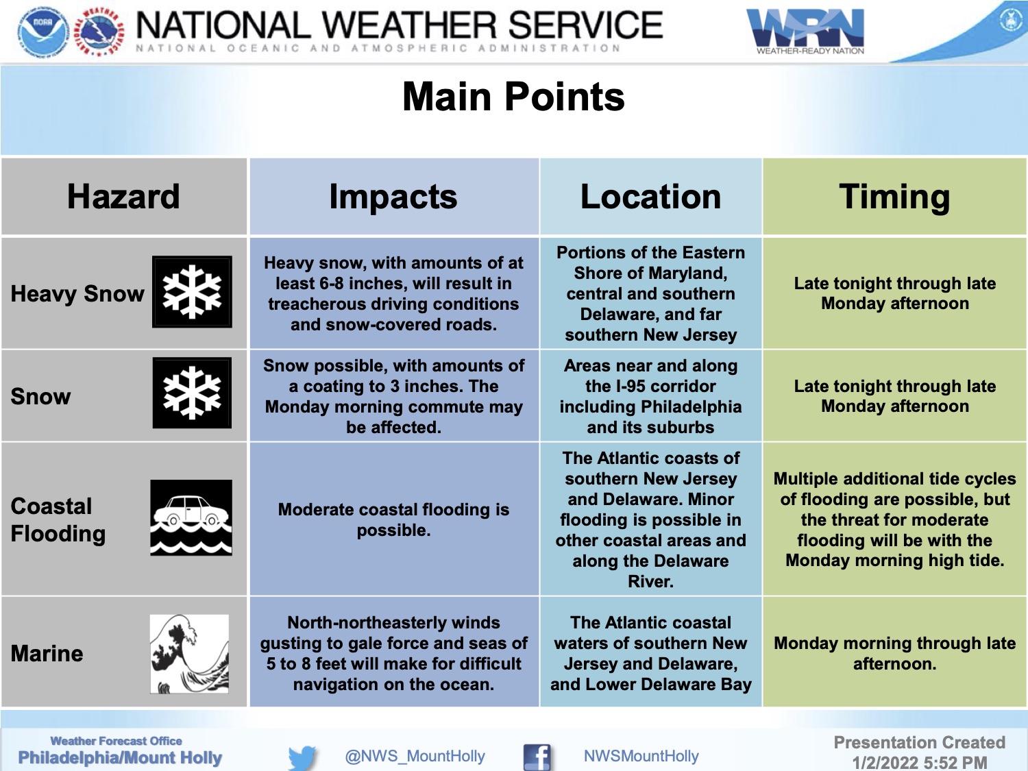
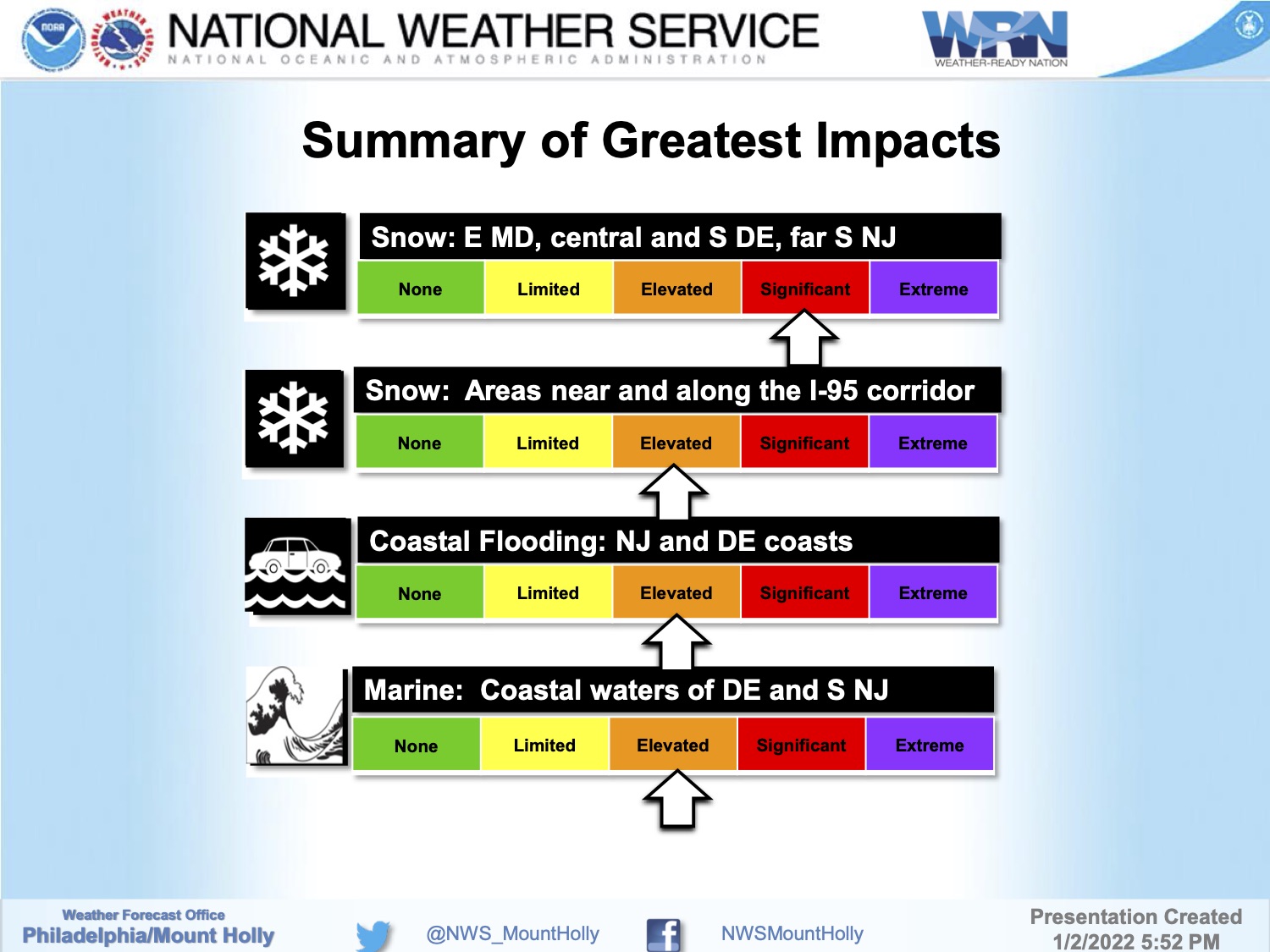
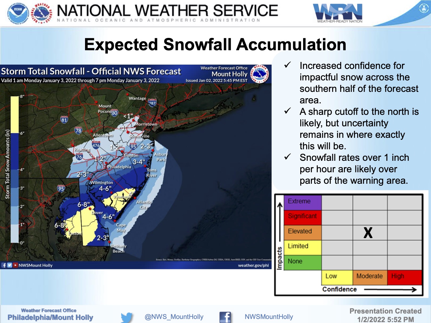
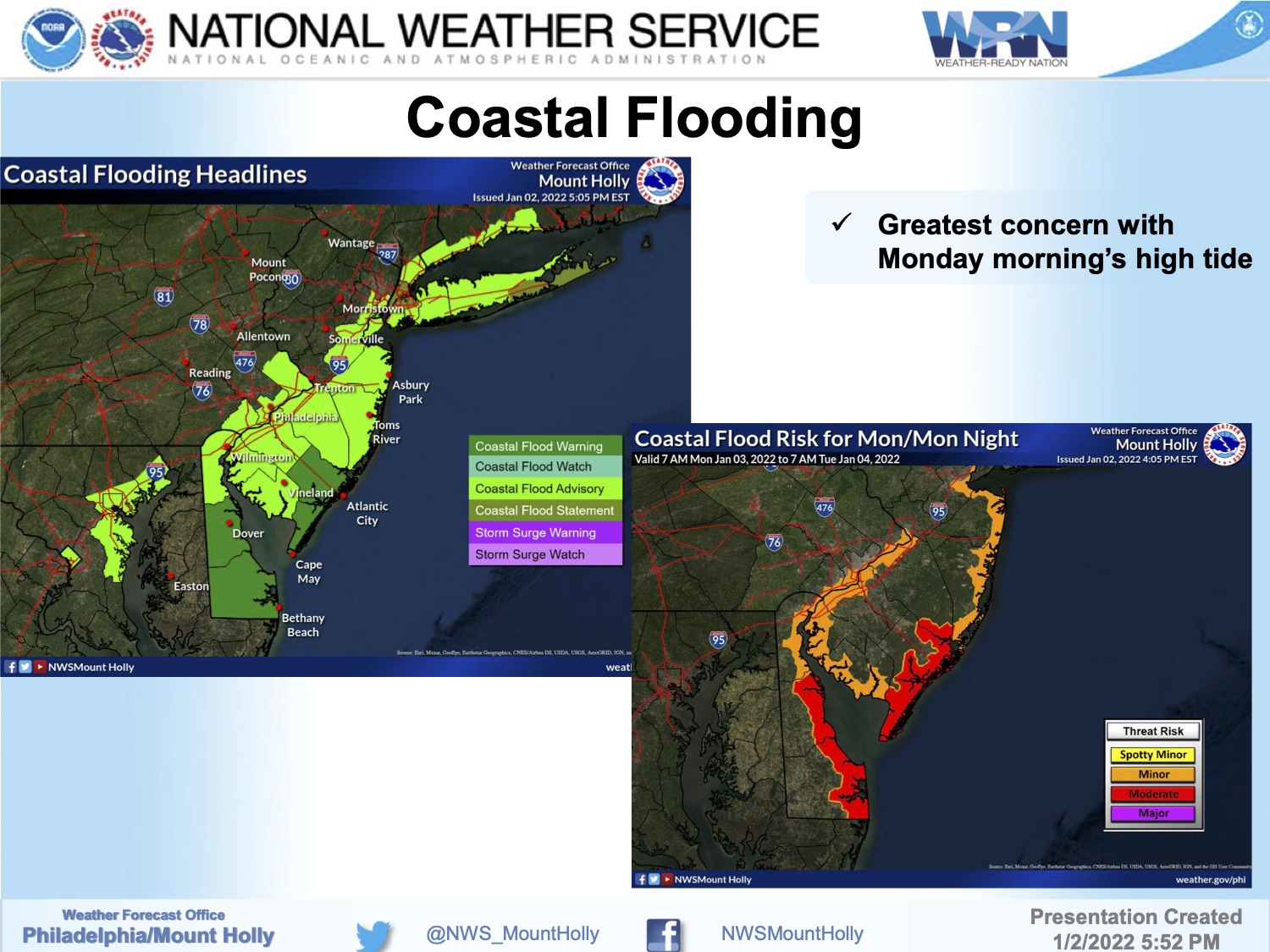
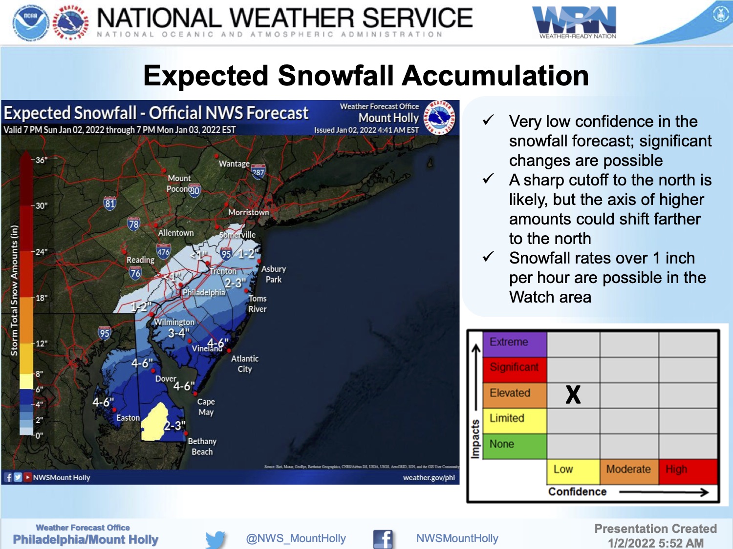
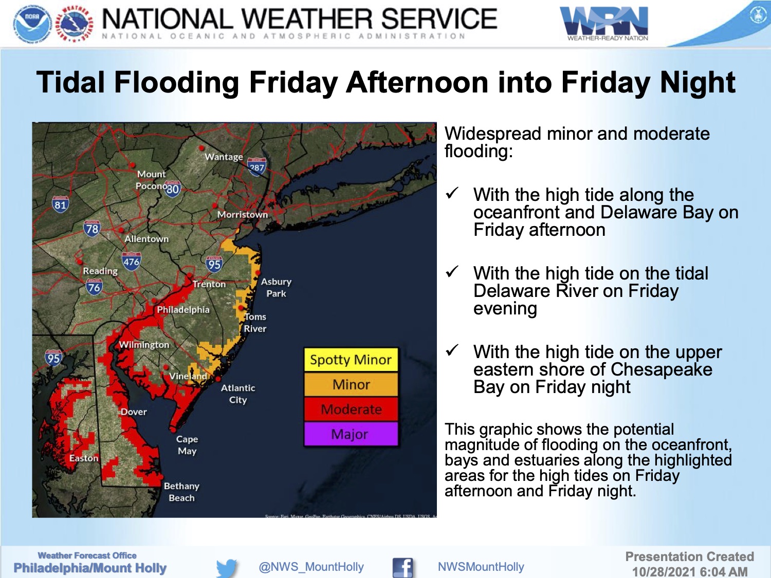
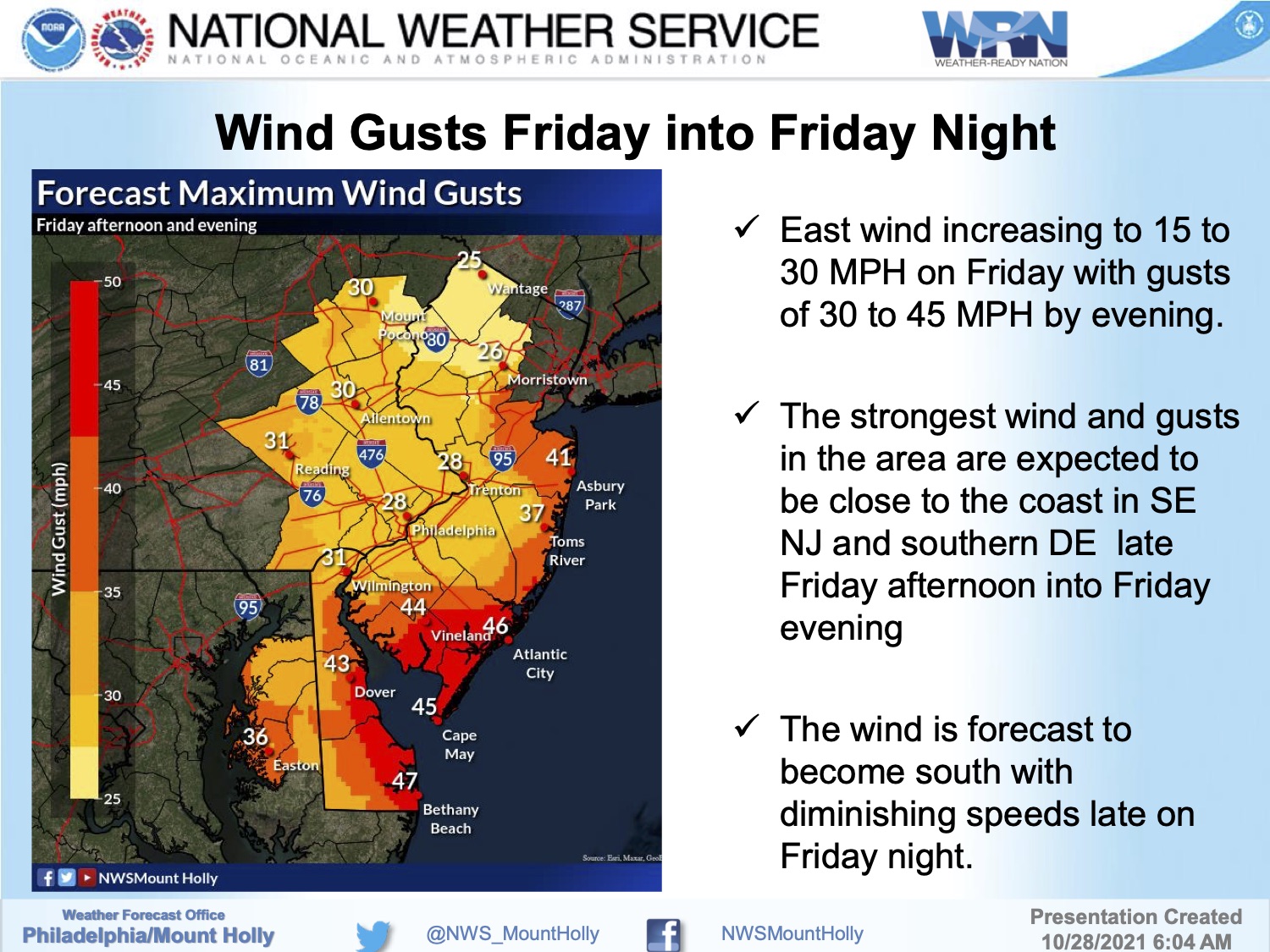
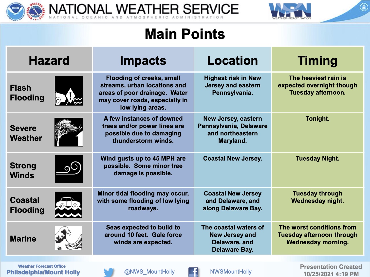
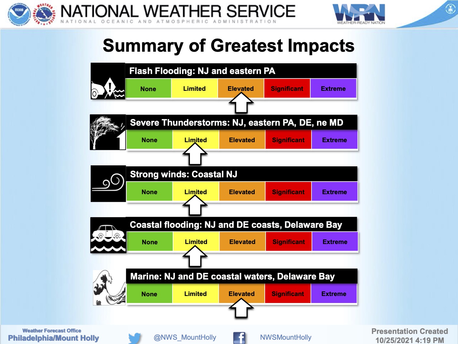
The National Weather Service has issued a Winter Storm Warning for Avalon through Monday afternoon at 4:00pm. There is the potential for 6 to 12 inches of snowfall, with wind gusts approaching 40mph. Additionally, a Coastal Flood Warning has been issued until 1:00pm Monday afternoon with widespread minor tidal flooding expected with the potential for moderate tidal flooding. Flooding is also possible Tuesday morning.
Snow has developed over our region Monday around day break and continue until the mid afternoon hours. Snowfall may obscure tidal flooding in the roadway. Be mindful of areas of our community that receive water in the streets during tidal flooding events and avoid driving on them during this storm event. Please consider moving your vehicle off the street in the event snow plowing operations are required.
High tide will occur at the Townsend’s Inlet Bridge Monday at 8:05am, and again at 8:34pm. The current forecast has an increased chance of tidal flooding during the morning high tide when snow is expected in our area.
![]()
Avalon Borough Hall, the Avalon Elementary School, Avalon Community Hall, Avalon History Center, and the Avalon Free Public Library are all closed on Monday. Governor Phil Murphy has declared a State of Emergency for Cape May County, and four other counties.
Continue to follow updates on this media channel for the impact to our community, and continue to follow traditional media outlets for updates to the forecast.
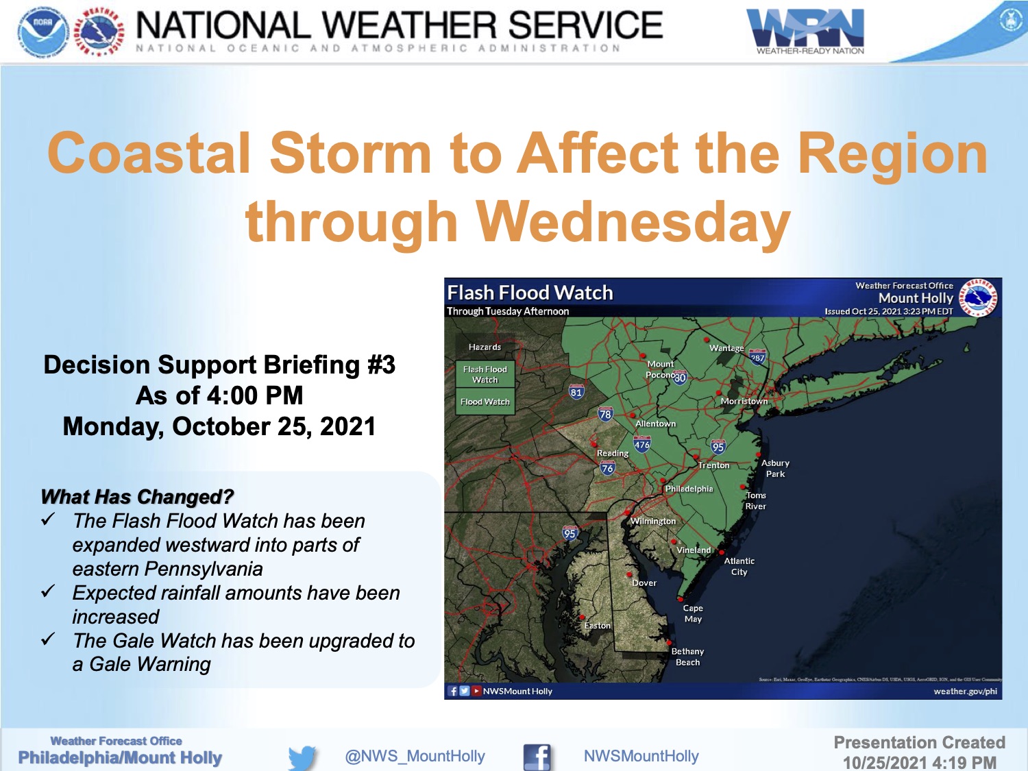
Here is the text of the Winter Storm Warning and the Coastal Flood Warning issued Sunday morning by the National Weather Service:
Winter Storm Warning
URGENT – WINTER WEATHER MESSAGENational Weather Service Mount Holly NJ
...WINTER STORM WARNING REMAINS IN EFFECT UNTIL 4 PM EST THIS AFTERNOON... * WHAT...Heavy snow expected. Total snow accumulations of 6 to 12 inches. Winds gusting as high as 40 mph. * WHERE...Portions of southern New Jersey, northeast Maryland and central and southern Delaware. * WHEN...Until 4 PM EST this afternoon. * IMPACTS...Travel could be very difficult. The hazardous conditions will impact travel through much of the day today. * ADDITIONAL DETAILS...Some locally higher totals over 12 inches are possible. Also, a period of near blizzard conditions is possible from mid-morning through mid-afternoon.
Coastal Flood Warning
…COASTAL FLOOD WARNING REMAINS IN EFFECT UNTIL 1 PM EST THISAFTERNOON… * WHAT…One to two feet of inundation above ground level expected in low-lying areas near shorelines and tidal waterways. * WHERE…Tidal areas in the New Jersey counties of Atlantic and Cape May. Tidal areas in the Delaware counties of Sussex and Kent. * WHEN…Until 1 PM EST this afternoon. * IMPACTS…At this level, widespread roadway flooding occurs in coastal and bayside communities and along inland tidal waterways. Many roads become impassable. Some damage to vulnerable structures may begin to occur. * ADDITIONAL DETAILS…Additional tidal flooding is expected on Monday evening and again on Tuesday morning. …WINTER STORM WARNING REMAINS IN EFFECT UNTIL 4 PM EST THISAFTERNOON… * WHAT…Heavy snow expected. Total snow accumulations of 6 to 12 inches. Winds gusting as high as 40 mph. * WHERE…Portions of southern New Jersey, northeast Maryland and central and southern Delaware. * WHEN…Until 4 PM EST this afternoon. * IMPACTS…Travel could be very difficult. The hazardous conditions will impact travel through much of the day today. * ADDITIONAL DETAILS…Some locally higher totals over 12 inches are possible. Also, a period of near blizzard conditions is possible from mid-morning through mid-afternoon.