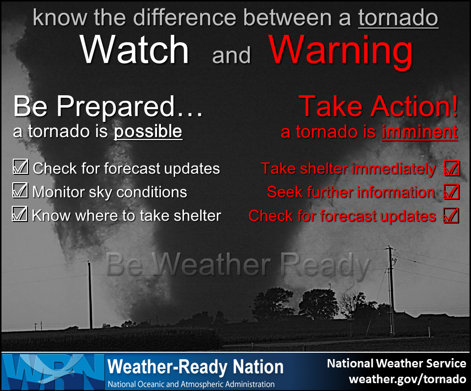
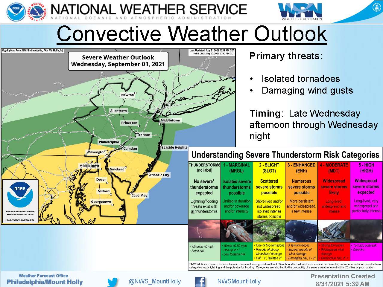
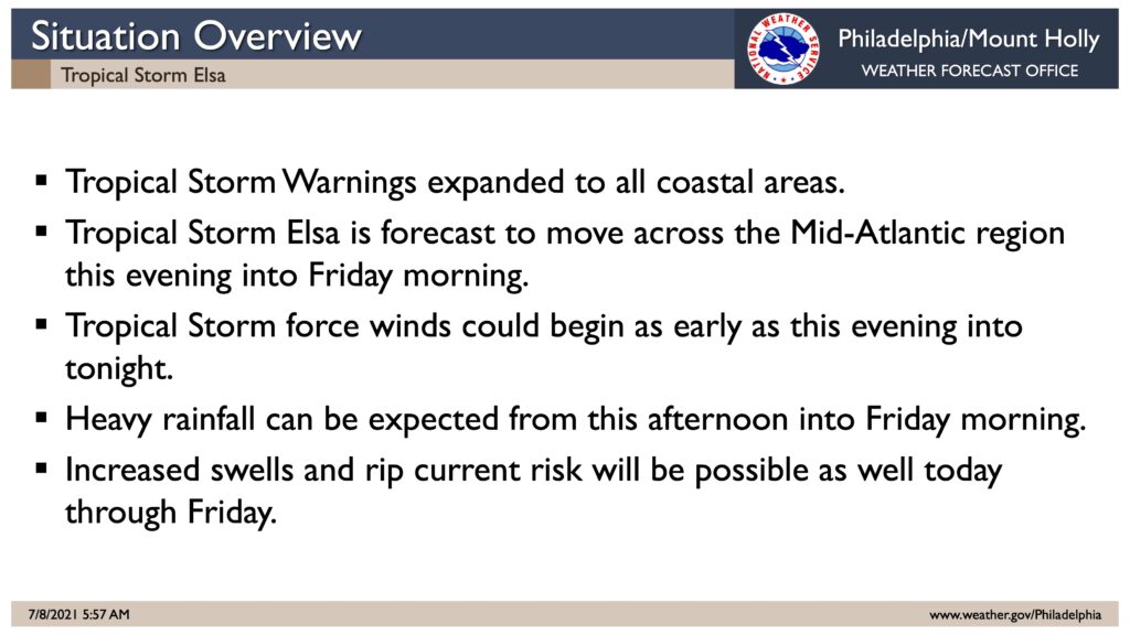
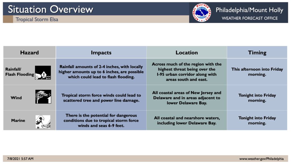
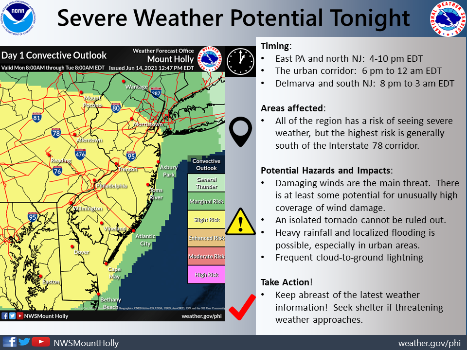
Wednesday, September 1st, 12:45pm: Tornado Watch Issued By National Weather Service
Tornado Watch
TORNADO WATCH OUTLINE UPDATE FOR WT 483 NWS STORM PREDICTION CENTER NORMAN OK 1240 PM EDT WED SEP 1 2021 TORNADO WATCH 483 IS IN EFFECT UNTIL 1000 PM EDT FOR THE FOLLOWING LOCATIONS NJ . NEW JERSEY COUNTIES INCLUDED ARE ATLANTIC BURLINGTON CAMDEN CAPE MAY CUMBERLAND GLOUCESTER HUNTERDON MERCER MIDDLESEX MONMOUTH MORRIS OCEAN SALEM SOMERSET WARREN