Monday, June 14th, 1:37pm: Risk of Severe Thunderstorms This Evening in Avalon


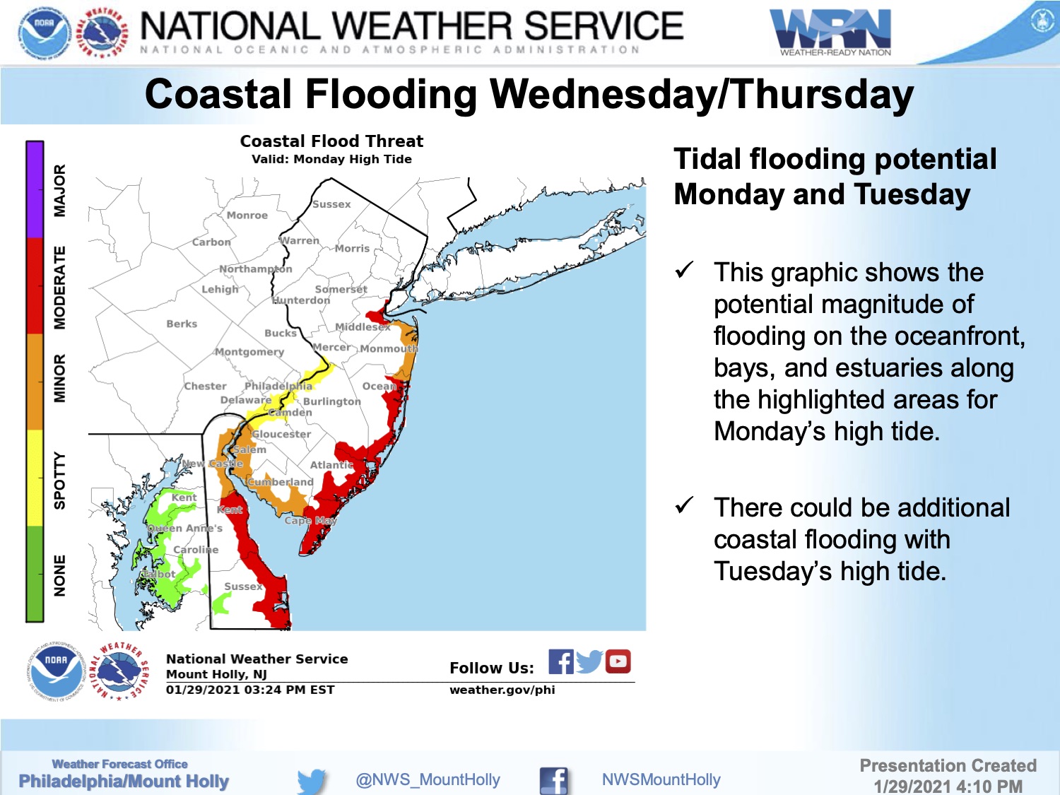
The National Weather Service has continued the Coastal Flood Warning for Avalon until early Sunday morning. Moderate to potentially major tidal flooding is anticipated at time of high tide this evening, which occurs at the Townsend’s Inlet Bridge at 11:33pm.
Residents and visitors who live in, or are visiting in, flood prone areas of Avalon are strongly encouraged to move their vehicles to portions of Avalon that are not typically subject to tidal flooding. Street flooding is anticipated along Ocean Drive, west of Ocean Drive, and in the Dune Drive business district north to approximately 10th Street. Street flooding is a temporary condition; streets can flood quickly and once a street floods, it is too late to move your vehicle to higher ground. To view the Borough’s advisory flood risk map, please visit avalonemergency.org or see a copy of the 2021 Avalon Information and Recreation Guide.
![]()
Never drive on a flooded street as this puts you and your vehicle at risk. Streets always have more flooding than it appears. Turn around, don’t drown. First Avenue in the northern portion of Avalon may be available if you encounter street flooding on Dune Drive. If you have any emergency, dial 911.
The Townsend’s Inlet Bridge between Sea Isle City and Avalon may be forced to close this evening due to wave conditions in the inlet that impact the roadway.
Here is the text of the Coastal Flood Warning from the National Weather Service:
Coastal Flood Warning
Coastal Hazard Message
National Weather Service Mount Holly NJ
321 PM EDT Sat May 29 2021
…HIGH RIP CURRENT RISK REMAINS IN EFFECT THROUGH SUNDAY
EVENING…
…COASTAL FLOOD WARNING REMAINS IN EFFECT FROM 9 PM THIS EVENING
TO 5 AM EDT SUNDAY…
* WHAT…For the Coastal Flood Warning, one to two feet of
inundation above ground level expected in low-lying areas near
shorelines and tidal waterways. For the High Rip Current Risk,
dangerous rip currents.
* WHERE…The Atlantic coast of Atlantic and Cape May Counties in
New Jersey.
* WHEN…For the Coastal Flood Warning, from 9 PM this evening
to 5 AM EDT Sunday. For the High Rip Current Risk, through
Sunday evening.
* IMPACTS…At this level, widespread roadway flooding occurs in
coastal and bayside communities and along inland tidal
waterways. Many roads become impassable. Some damage to
vulnerable structures may begin to occur. Rip currents can
sweep even the best swimmers away from shore into deeper water.
PRECAUTIONARY/PREPAREDNESS ACTIONS…
A Coastal Flood Warning means that moderate or major tidal
flooding is occurring or imminent. Be prepared for rising water
levels and take appropriate action to protect life and property.
Follow the recommendations of local emergency management
officials.
Do not drive your vehicle through flood waters. The water may be
deeper than you think it is. You will be putting yourself in
danger and your vehicle may be damaged, leading to costly
repairs.
Visit the Advanced Hydrologic Prediction Service at
water.weather.gov/ahps for additional water level and flood
impact information for your local tide gauge.
Entering the surf is discouraged. If caught in a rip current,
relax and float. Don`t swim against the current. If able, swim in
a direction following the shoreline. If unable to escape, face
the shore and call or wave for help.
The National Weather Service has issued a Coastal Flood Warning for the Borough of Avalon and the Jersey Shore in advance of the high tide Saturday night, May 29th. There is the risk of moderate coastal flooding in flood prone areas of our community.
A coastal storm continues to impact our region with windy conditions, and periods of heavy rain. There are two high tide events for Saturday, at 11:12am and again at 11:33pm. Tidal flooding is expected, especially during tonight’s high tide.
Portions of Ocean Drive, the Dune Drive business district, and areas closer to the bay in Avalon could receive flooding this evening.
If you live, or are staying, in a section of Avalon that is prone to tidal flooding, consider moving your vehicle to another section of the community that is not prone to flooding. Avalon provides a flood risk map that is helpful for you to make a decision. Never drive on a flooded street. This puts you and your vehicle at risk and the wake causes damage to private and public property. Turn around, don’t drown.
![]()
Access to the Townsend’s Inlet Bridge between Avalon and Sea Isle City will be closed due to rough surf conditions in the inlet at times over the next 24 hours. The Ingram’s Thorofare Bridge remains your best option to leave the island. The Avalon Beach Patrol is restricting access to the surf due to unsafe conditions and strong rip currents.
Here is the text of the Coastal Flood Warning from the National Weather Service:
…HIGH RIP CURRENT RISK REMAINS IN EFFECT THROUGH SUNDAY
EVENING…
…COASTAL FLOOD WARNING REMAINS IN EFFECT FROM 9 PM THIS EVENING
TO 5 AM EDT SUNDAY…
* WHAT…For the Coastal Flood Warning, one to two feet of
inundation above ground level expected in low-lying areas near
shorelines and tidal waterways. For the High Rip Current Risk,
dangerous rip currents expected.
* WHERE…Atlantic Coastal Cape May and Coastal Atlantic.
* WHEN…For the Coastal Flood Warning, from 9 PM this evening
to 5 AM EDT Sunday. For the High Rip Current Risk, through
Sunday evening.
* IMPACTS…At this level, widespread roadway flooding occurs in
coastal and bayside communities and along inland tidal
waterways. Many roads become impassable. Some damage to
vulnerable structures may begin to occur. Rip currents can
sweep even the best swimmers away from shore into deeper water.
PRECAUTIONARY/PREPAREDNESS ACTIONS…
A Coastal Flood Warning means that moderate or major tidal
flooding is occurring or imminent. Be prepared for rising water
levels and take appropriate action to protect life and property.
Follow the recommendations of local emergency management
officials.
Do not drive your vehicle through flood waters. The water may be
deeper than you think it is. You will be putting yourself in
danger and your vehicle may be damaged, leading to costly
repairs.
Visit the Advanced Hydrologic Prediction Service at
water.weather.gov/ahps for additional water level and flood
impact information for your local tide gauge.
Entering the surf is discouraged. If caught in a rip current,
relax and float. Don`t swim against the current. If able, swim in
a direction following the shoreline. If unable to escape, face
the shore and call or wave for help.
The National Weather Service has continued the Coastal Flood Warning until 5:00pm today. There is the potential for moderate coastal flooding at time of high tide, which occurs at the Townsend’s Inlet Bridge at 11:05am Tuesday. The graphic below shows red squares where moderate tidal flooding occurred late Monday night during the last high tide event. The wind is out of the west-northwest this morning which could help mitigate this morning’s high tide. Exercise caution while driving as snow/sleet/rain is in the forecast this morning.
New Jersey has declared a State of Emergency starting Sunday at 7:00pm due to the winter storm; all State offices will be closed.
The National Weather Service has issued a Coastal Flood Warning for Avalon for Monday morning through Tuesday afternoon. Moderate tidal flooding is expected at time of high tide, especially during the Monday morning high tide. There is also a Wind Advisory in effect Monday for wind gusts approaching 50mph.
High tide at the Townsend’s Inlet Bridge will occur Monday will at 10:17am, and again at 10:54pm. Tuesday’s first high tide occurs at 11:05am. Streets prone to tidal flooding may be compromised, including portions of the Dune Drive business district, portions of Ocean Drive, and other areas. If you live on a street that floods during storm events, consider moving your vehicle to another section of Avalon in advance of tomorrow morning’s high tide.
Exercise caution while driving through this event as snow, ice, and rain are all expected. Turn around, don’t drown, never drive on a flooded street.
Continue to follow traditional media outlets, and updates are always available at Avalon emergency dot org and other Avalon communication channels. Thank you.
Avalon’s Flood Risk Map
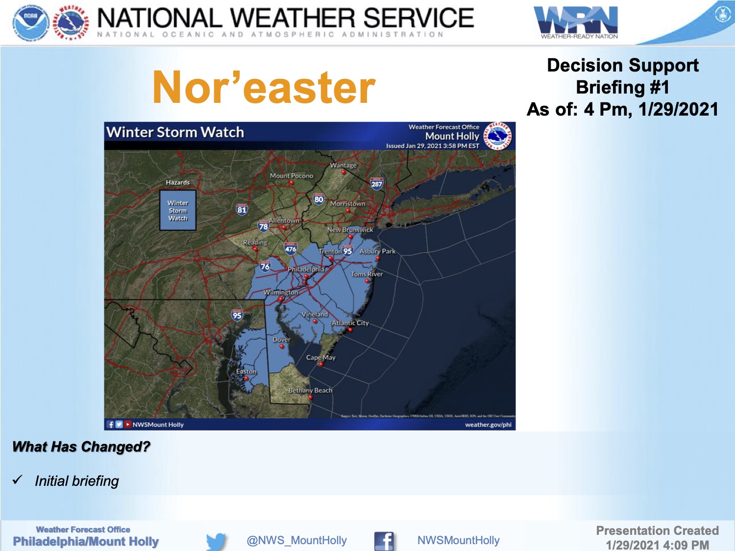
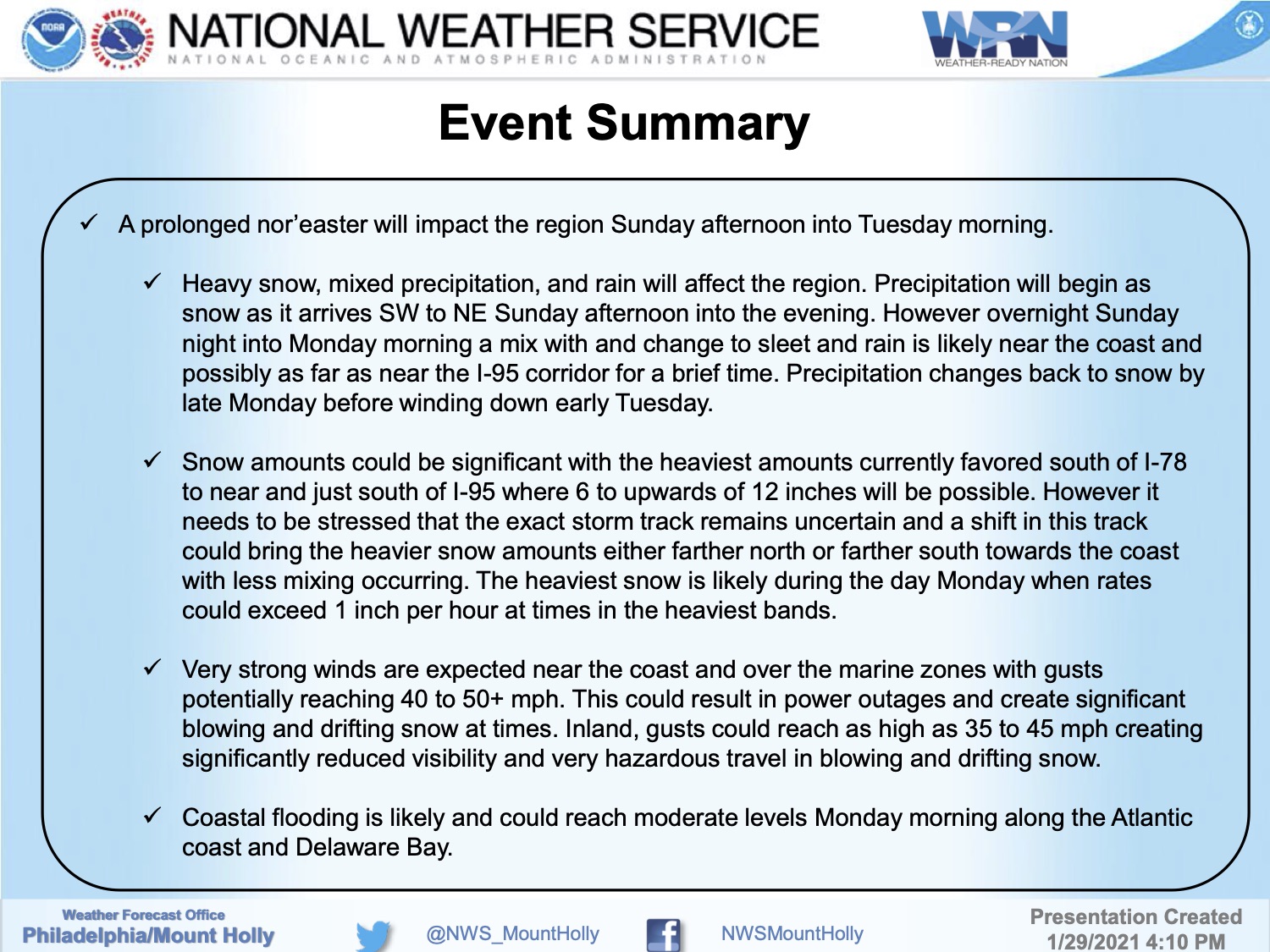
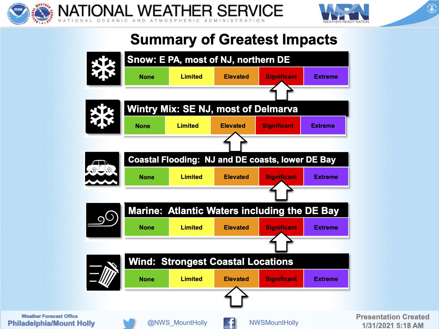
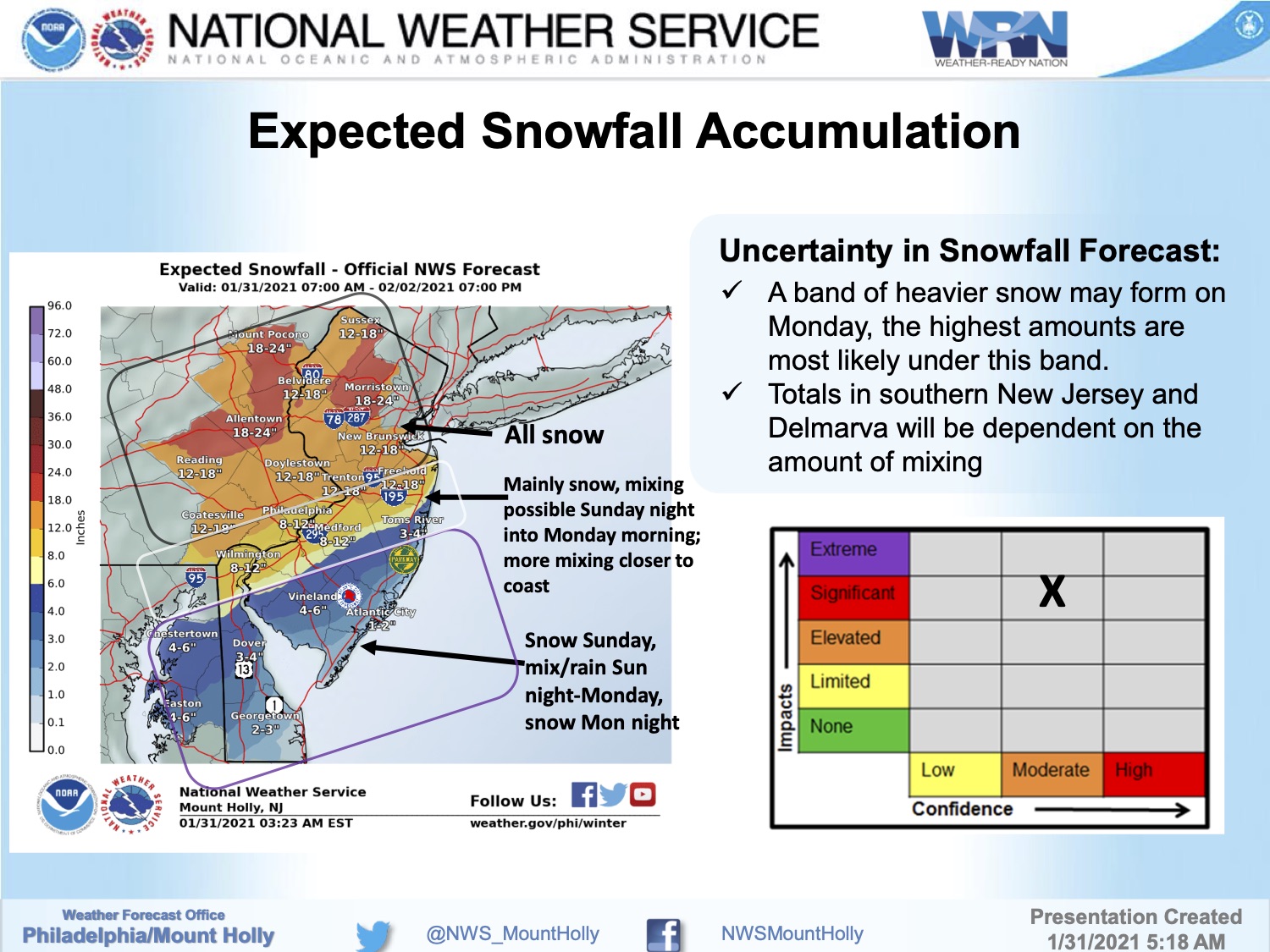
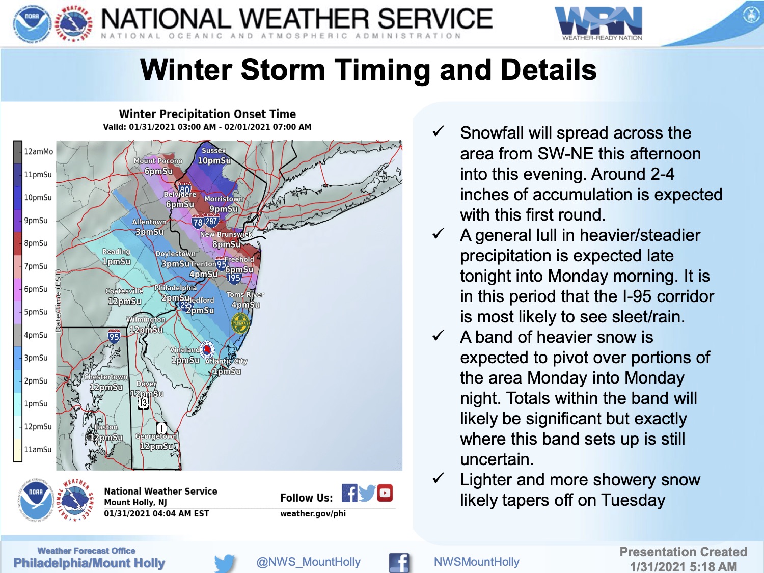
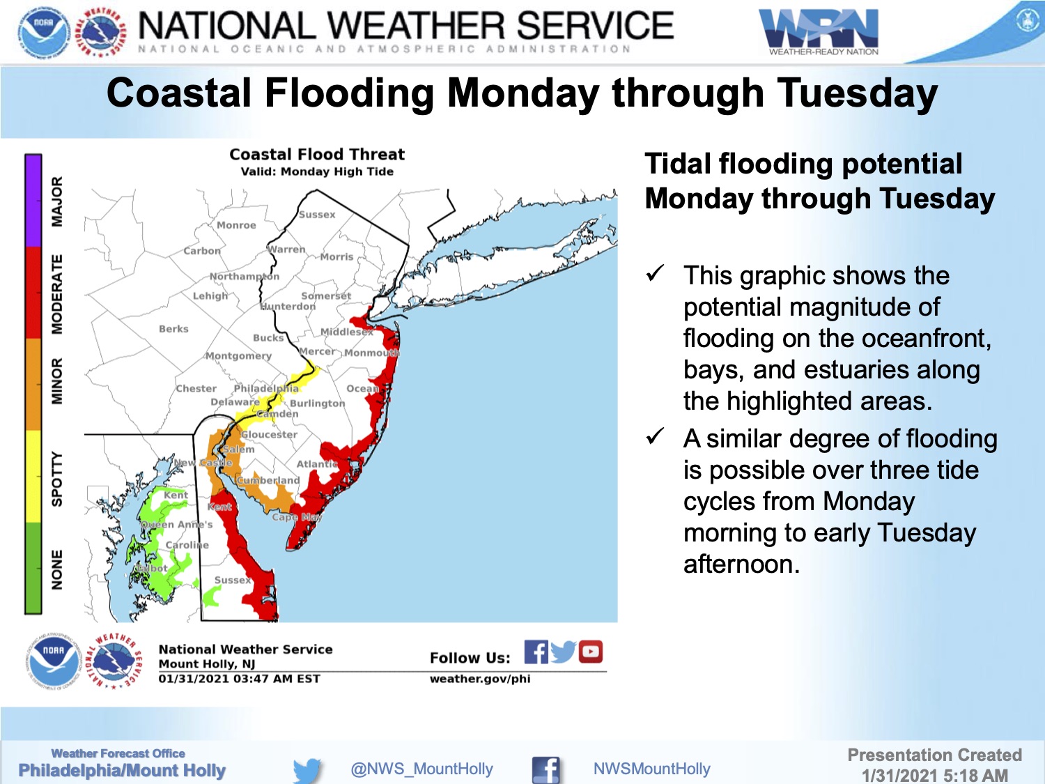
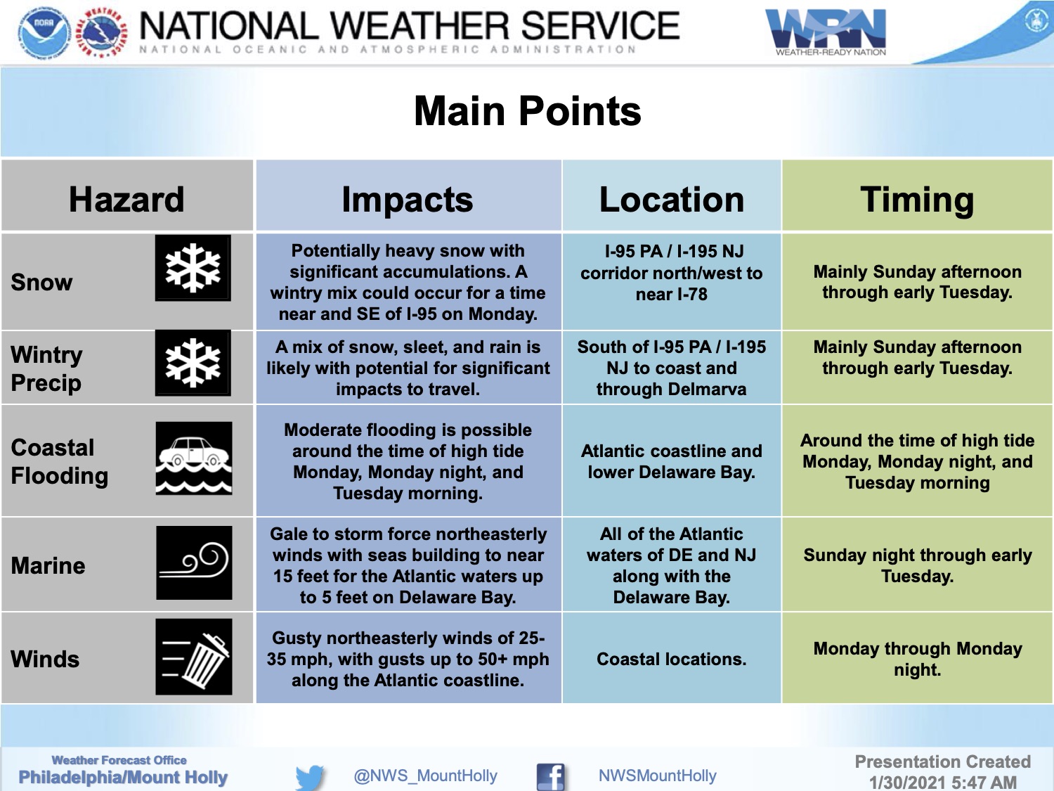
The National Weather Service has issued a Coastal Flood Warning and a Wind Advisory for Cape May County beach communities in advance of a nor’easter-type winter storm that will bring rain, snow, sleet, strong winds, and the potential for moderate coastal flooding.
Snow is expected to develop during the mid afternoon hours on Sunday, followed by rain after sunset through Monday. The storm is expected to end with a rain and snow mix Monday evening. Please exercise caution while driving.
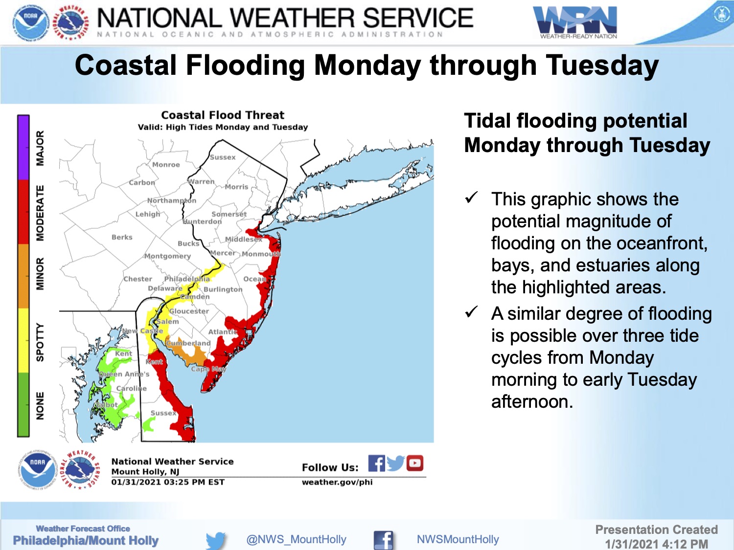
The Coastal Flood Warning is in effect for Monday morning through Tuesday afternoon. High tide occurs at the Townsend’s Inlet Bridge Monday at 10:17am, and again at 10:54pm; high tide occurs Tuesday morning at 11:05am. If you live on a street that typically receives tidal flooding, consider moving your vehicle to another portion of our community on Sunday. Never drive on a flooded street as this puts you and your vehicle at risk.
The Wind Advisory is in effect for Monday. Strong winds up to 40mph with gusts to 50mph are possible starting late morning through the evening hours. Secure any loose objects on your property. If you have any emergency, dial 911.
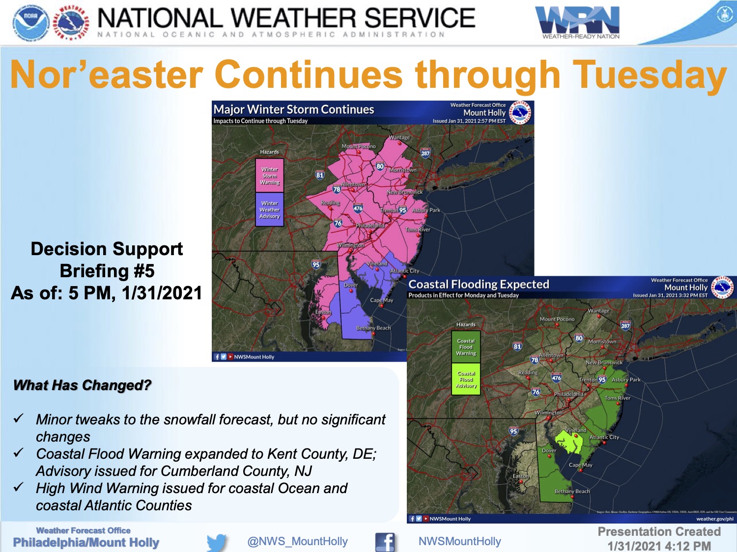
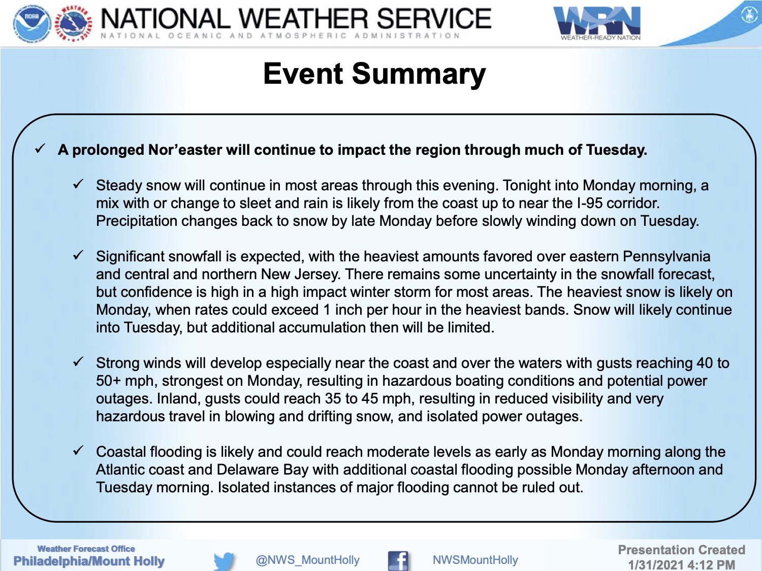
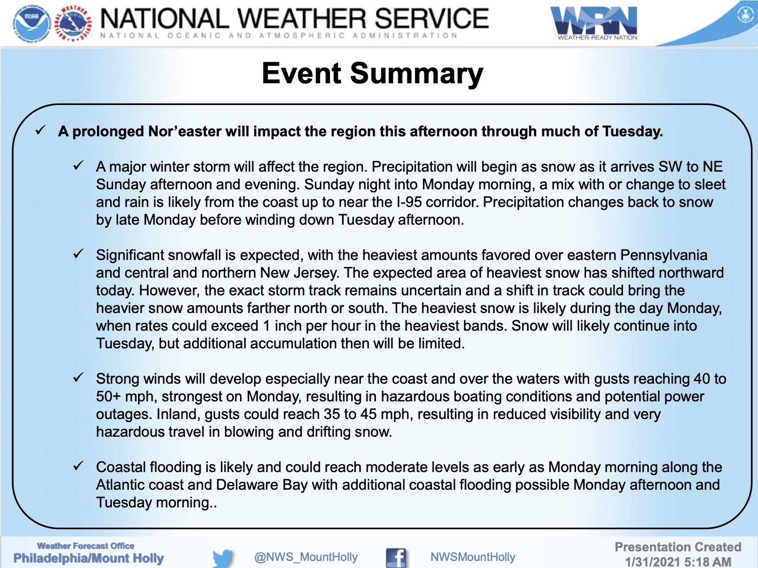
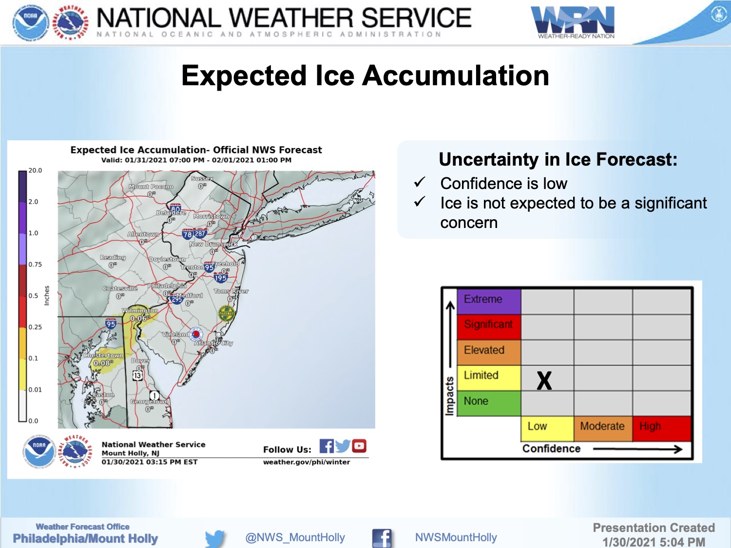
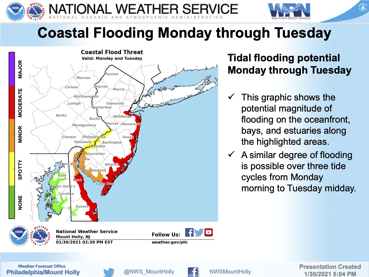
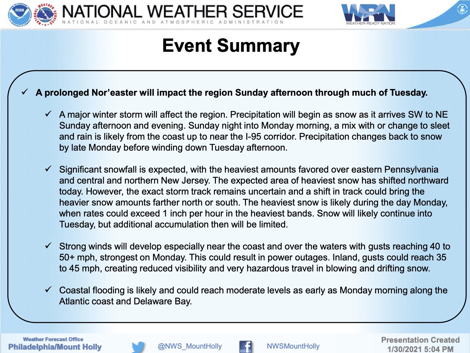
Continue to monitor this storm on traditional media outlets and on this communication channel. Updates will be provided as needed. Here is the graphics package on this nor’easter courtesy of the National Weather Service:
![]()
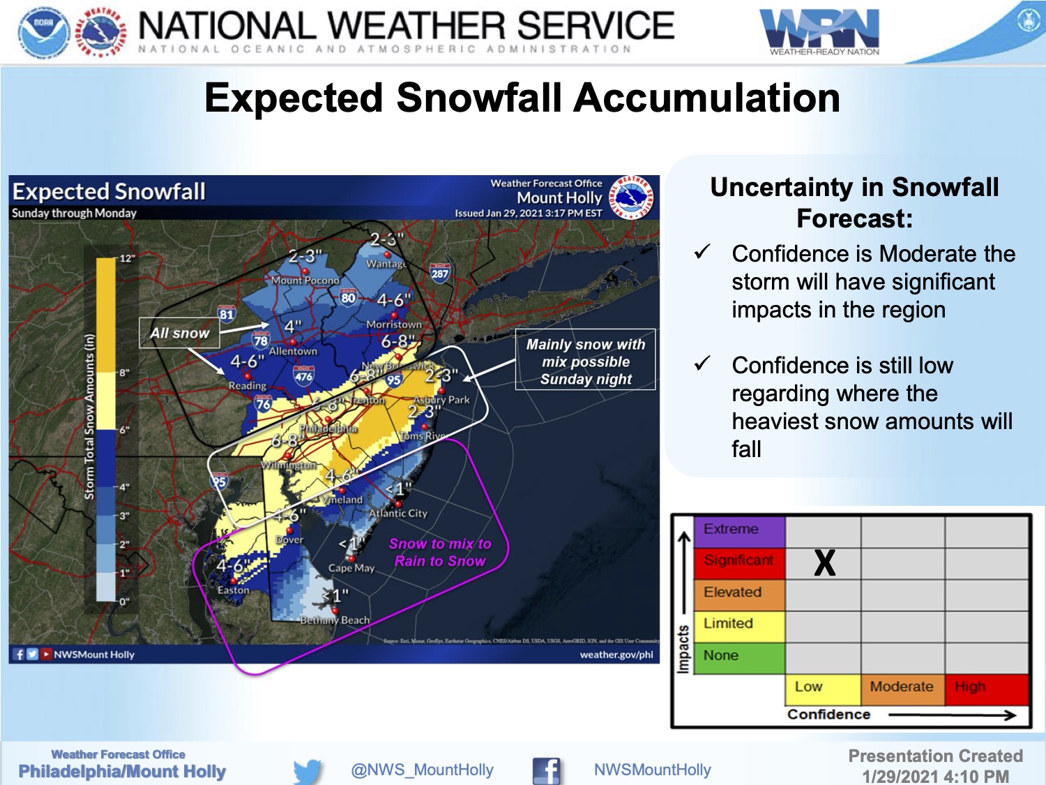
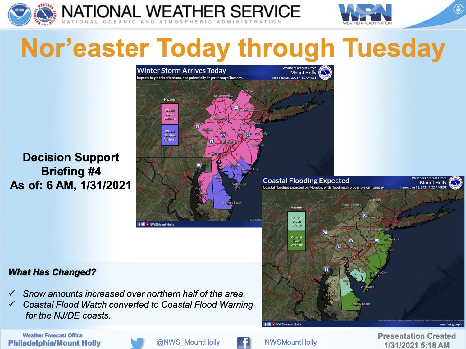
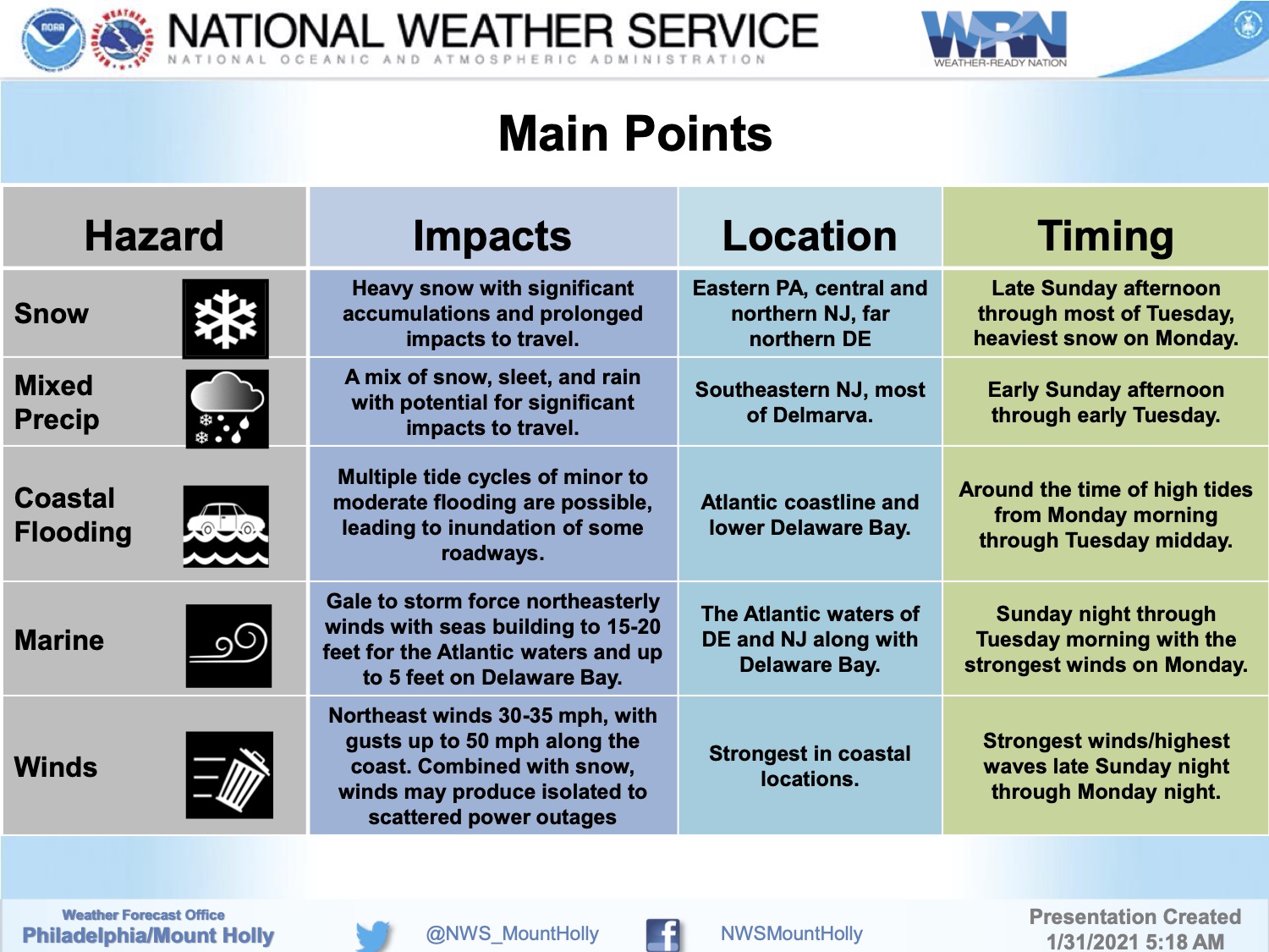
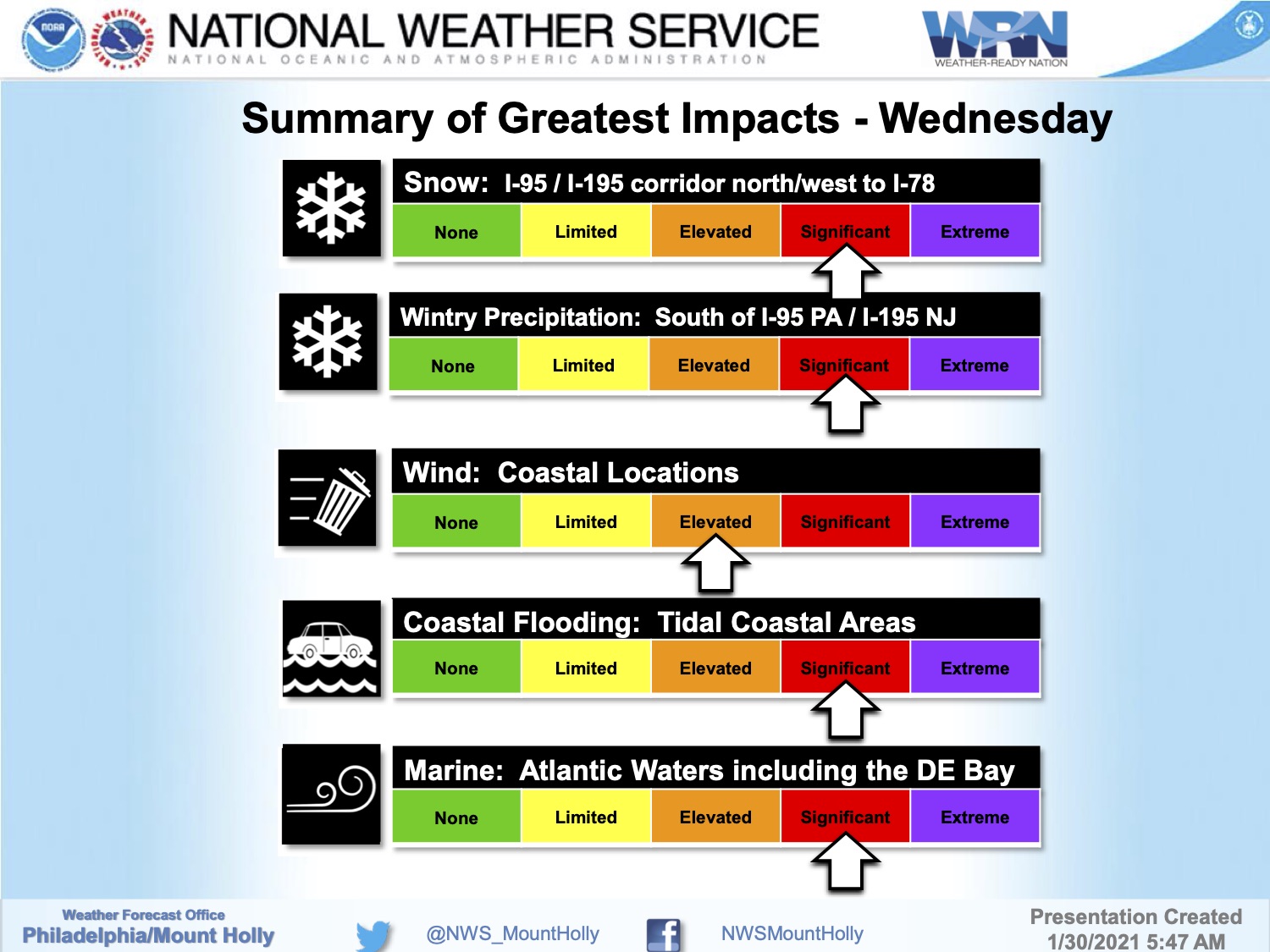
The National Weather Service has issued a package of advisories for coastal Cape May County in advance of a nor’easter-type winter storm that will impact our region Sunday afternoon through Tuesday morning. A Coastal Flood Watch is in effect from Monday morning through Tuesday afternoon; and a Wind Advisory is in effect late Monday morning through Monday evening.
Snow is expected to begin Sunday afternoon, and transition to snow, rain, and sleet during the overnight hours into Monday morning. Monday will produce rainy, windy conditions along the coast with wind gusts over 40mph possible. The storm is expected to end with a snow/rain/sleet mix through Tuesday around midday.
Moderate coastal flooding is possible at time of high tide Monday and Tuesday. Some streets may be impassable due to tidal flooding. Never drive on a flooded street; turn around, don’t drown. If you live on a street that typically floods during storm events, consider moving your vehicle by Sunday morning. Secure any objects at your home that may be subject to strong winds, including trash cans and lawn furniture.
High tide will occur Monday at the Townsend’s Inlet Bridge at 10-:17am, and again at 10:54pm. Tuesday’s first high tide occurs at 11:05am.
If you have a power outage, contact Atlantic City Electric directly at 1-800-833-7476. If you have an emergency, dial 911.
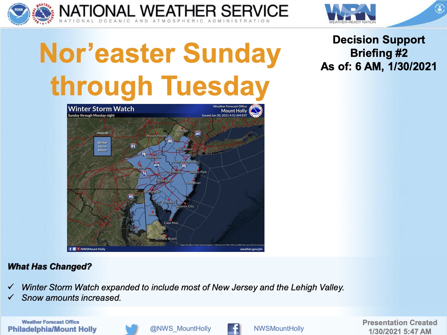
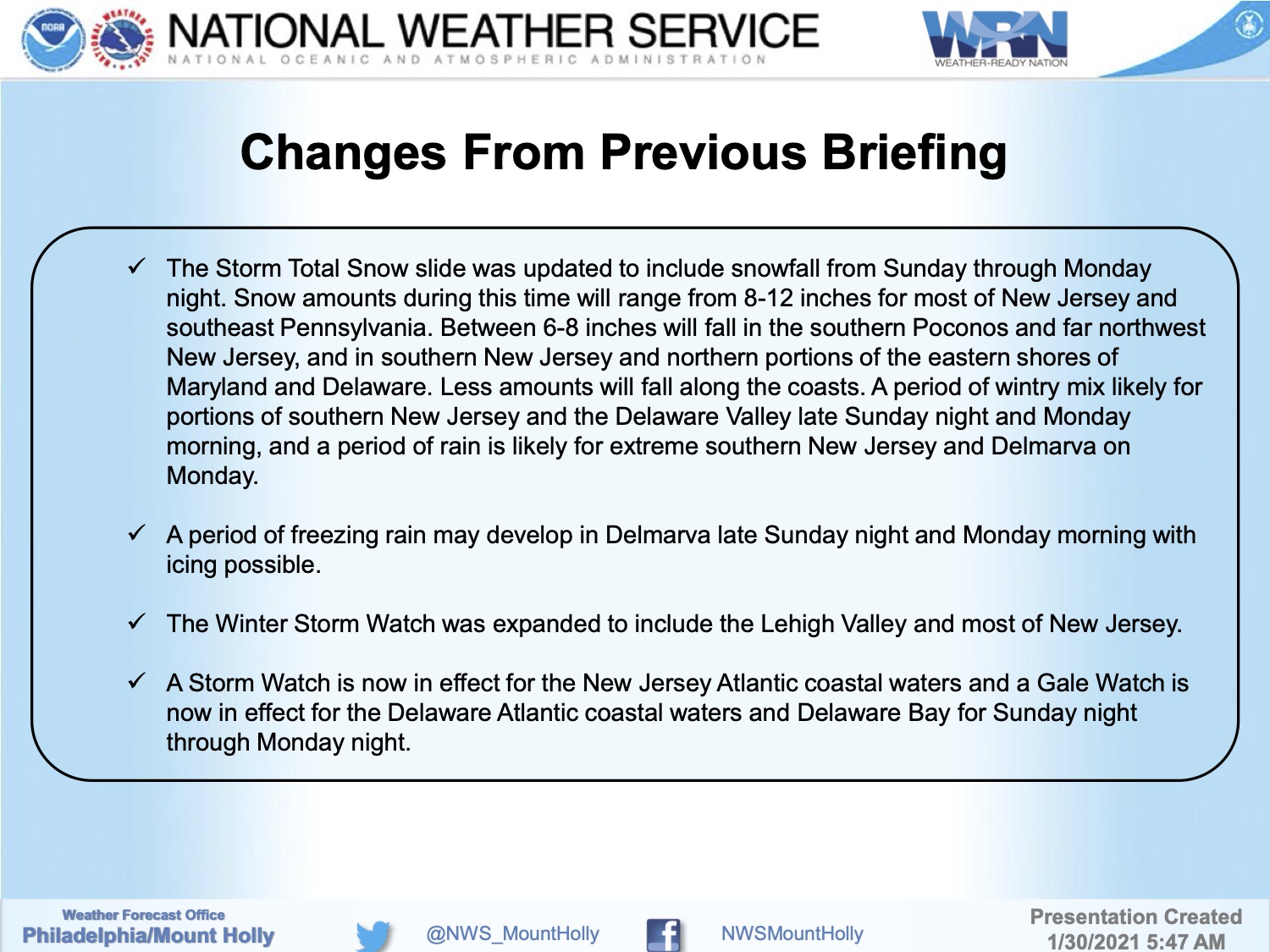
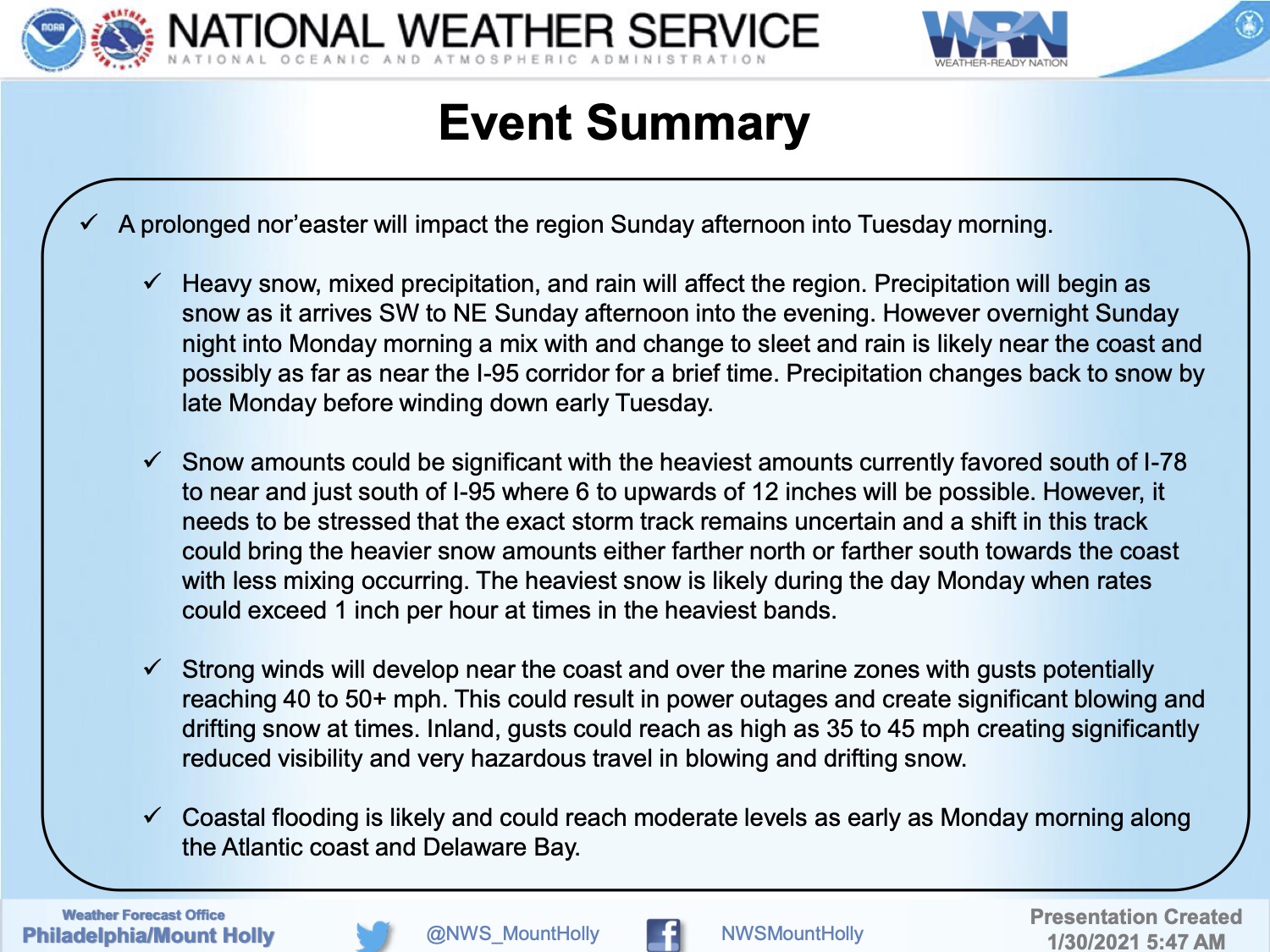
Here is the briefing package provided by the National Weather Service on Saturday evening, January 30th:

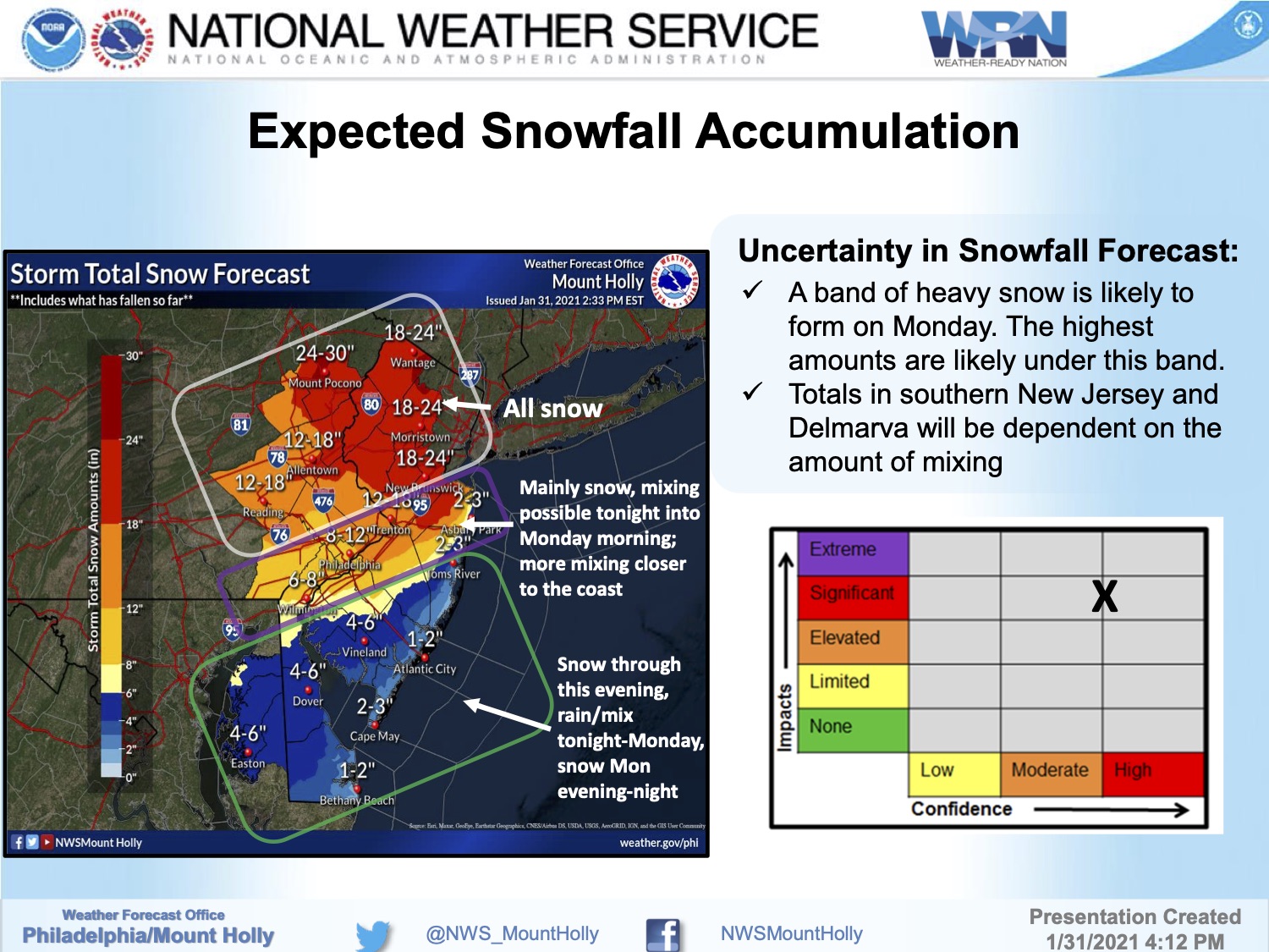
The National Weather Service has issued a Winter Storm Watch for most of southern New Jersey, except some coastal areas. A nor’easter type of storm is coming Sunday with snow, a snow and rain mix, windy conditions, and the potential for moderate tidal flooding. High tide at the Townsend’s Inlet Bridge on Sunday will occur at 9:33am and again at 10:06pm; high tide on Monday will occur at 10:17am and 10:54pm. Please continue to follow updates on traditional media channels.
![]()


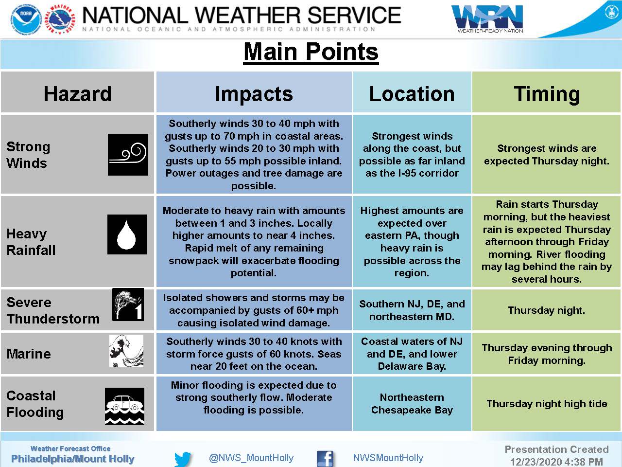
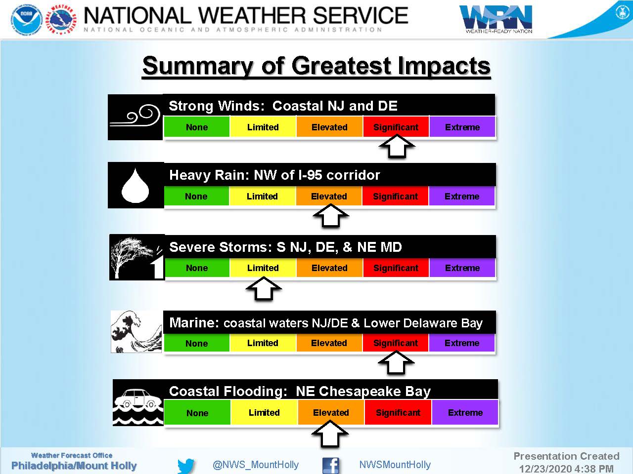
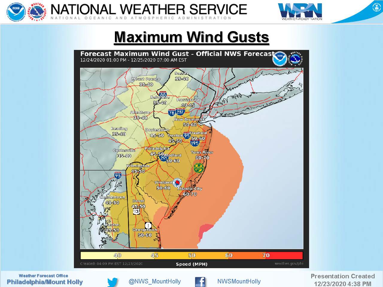
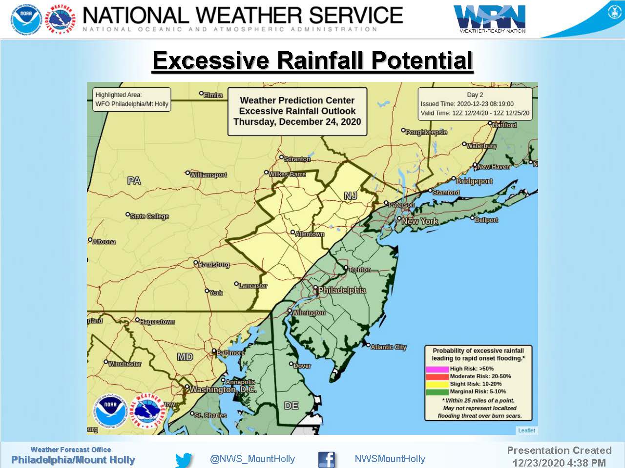
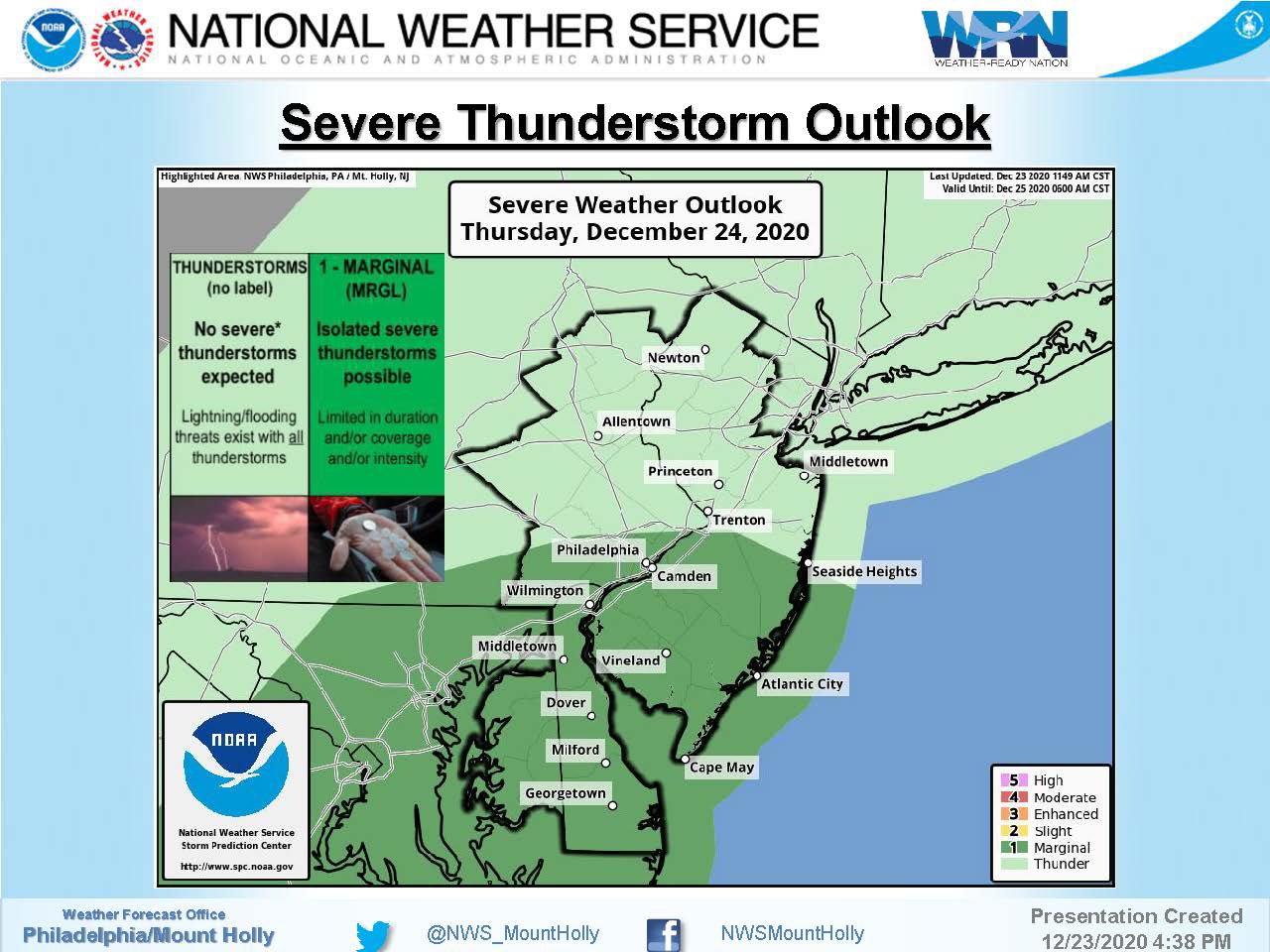
The National Weather Service has issued a High Wind Warning for coastal regions of southern New Jersey. There is the potential for wind gusts approaching 70mph Thursday night into Friday morning, Christmas Eve-Christmas Day. A storm front may bring heavy rain to our region, along with spotty flooding. If you experience a power outage, contact Atlantic City Electric at 1-800-833-7476. Street flooding is possible due to heavy rain. Flooding is a temporary condition; never drive on a flooded street. Residents are asked to secure objects subject to strong winds on their properties; contractors are asked to secure all job sites in advance of this storm. Continue to follow traditional media outlets for updates on this event. If you have any emergency, dial 911.
Here is the advisory package issued by the National Weather Service on Wednesday evening: